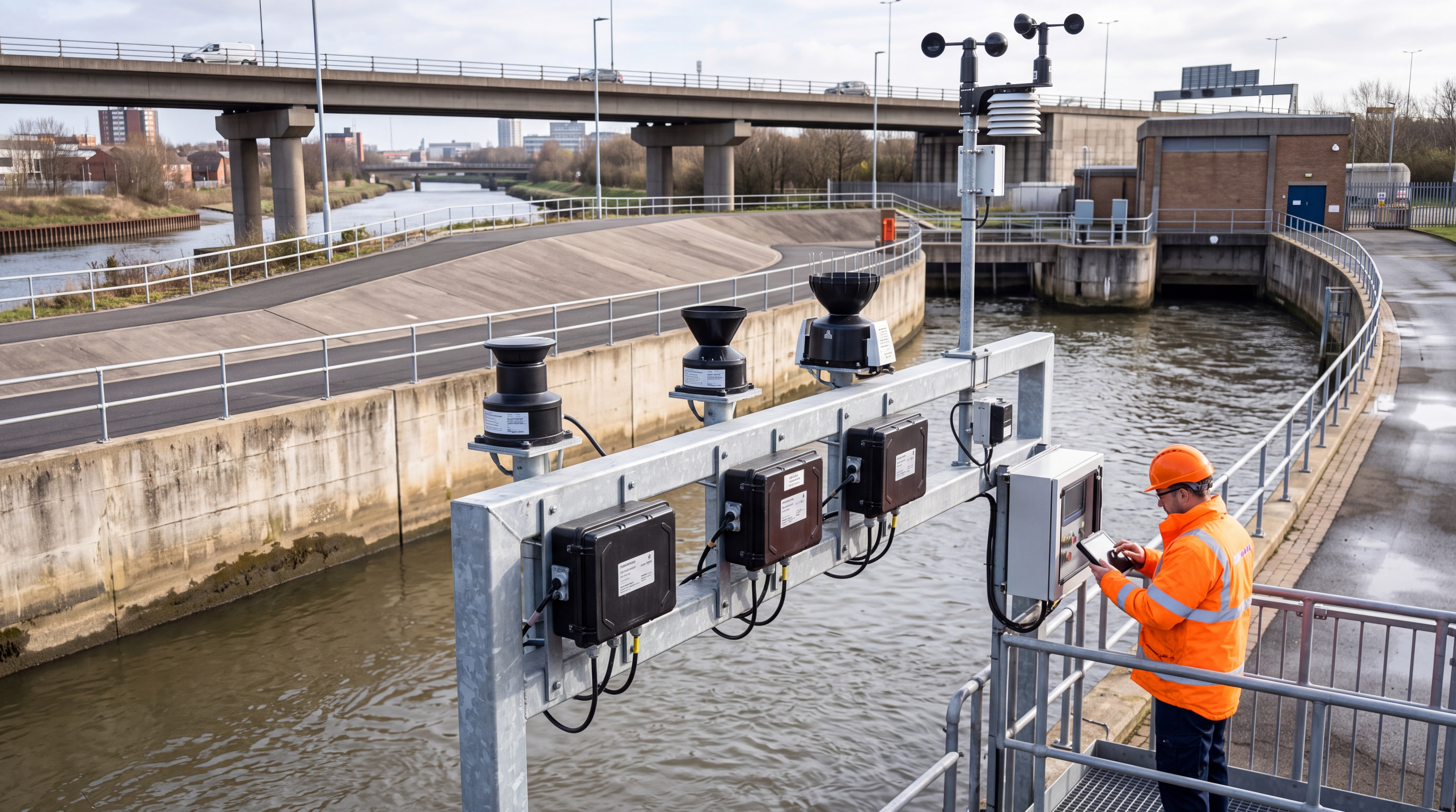
Introduction: Amid Frequent Extreme Rainfall, Urban Waterlogging Early Warning Shifts from "Detecting Ponding" to "Proactive Forecasting"
In recent years, the frequent occurrence of intense short-duration rainfall, typhoon rainstorms, and localized severe convective weather has made urban waterlogging a high-risk scenario affecting public safety, traffic operations, and the stability of municipal infrastructure. Compared to traditional floods, urban waterlogging is characterized by strong suddenness, small spatial scale, rapid disaster formation, and significant local variations. A heavy rainfall event lasting just tens of minutes can cause rapid ponding in low-lying road sections, underpasses, tunnel entrances, older residential communities, and underground spaces. Industry experience shows that when road ponding depth reaches 5 cm, pedestrian and non-motorized vehicle traffic begins to be affected; at 10 cm to 15 cm, the risk for small vehicles increases significantly; and at 25 cm to 30 cm, the probability of vehicle stalling, traffic disruption, and secondary accidents rises sharply. If the water further inundates underground garages, subway stations, power distribution rooms, and underground malls, the risk will escalate from a traffic issue to a threat to the city's lifeline systems.
Against this backdrop, urban waterlogging early warning is no longer just about "installing a few water level sensors" or "issuing a rainstorm alert." It has become a systematic engineering endeavor involving ponding perception, rainfall monitoring, radar forecasting, drainage modeling, risk assessment, warning dissemination, and coordinated flood control. Water affairs, emergency management, transportation, and meteorological departments across various regions are driving a shift from passive emergency response to proactive defense, with the core goal of improving the lead time, accuracy, and executability of warnings. Centered around keywords such as ponding, early warning, radar, and flood control, the market has developed multiple technical routes: some focus primarily on on-site ponding monitoring, others on radar rainfall forecasting, some emphasize hydrological and hydrodynamic model simulation, and others attempt to use AI for rapid risk identification. These different routes do not simply replace one another; rather, they are suited to different urban infrastructure conditions, risk scenarios, and budget levels. This article will compare mainstream technical routes from an industry perspective, analyzing their pros and cons, applicable scenarios, and selection recommendations.
Full Spectrum of Technical Routes: Perception, Forecasting, Modeling, and Response Jointly Determine Warning Quality
From a system architecture perspective, urban waterlogging early warning typically comprises four layers. The first is the perception layer, responsible for acquiring on-site data, including ponding depth, road ponding extent, manhole liquid levels, drainage network flow, river water levels, rainfall, and video imagery. The second is the forecasting layer, which primarily answers "where will it rain, how much, and for how long." Common methods include automatic rain gauges, weather radar, X-band gap-filling radar, satellite cloud imagery, and nowcasting algorithms. The third is the modeling layer, used to translate rainfall into ponding and waterlogging risk, encompassing traditional hydrological and hydrodynamic models, pipe network drainage models, surface inundation models, and data-driven AI models. The fourth is the response layer, which includes warning classification, information dissemination, traffic control, pump station dispatch, gate control, and rescue team deployment—forming a closed-loop flood control action.
Evaluating the maturity of a waterlogging early warning technical route requires looking beyond single hardware metrics to focus on multiple comprehensive parameters: Can ponding monitoring error be controlled within ±1 cm to ±2 cm? Are key risk points monitored 24/7? Can rainfall forecasting provide a 10- to 60-minute lead time? Can the model complete risk calculations at the minute level? Can warning information reach frontline responders? Can the system still operate under extreme conditions such as high temperatures, rainstorms, lightning, network outages, and power failures? Many projects in their initial construction phase easily fall into the trap of "valuing equipment over data" and "valuing visualization over closed-loop execution," resulting in numerous sensors but limited effective data for actual flood control decision-making.
Therefore, selecting a technical route must first clarify the objective: Is it to solve the problem of "visibility" at key ponding points, the problem of "advance knowledge" of heavy rainfall, or the problem of "accurate calculation" of pipe network drainage capacity? Different objectives require different technical combinations. Ponding monitoring is suited to answer "where is already ponding," radar and nowcasting are suited to answer "where might it rain," models are suited to answer "how deep and how long the ponding might be," and coordinated flood control determines whether warnings can be translated into actual response outcomes. Only by integrating these four capabilities into a unified framework can a truly functional urban waterlogging early warning system be formed.
Comparison of Ponding Point Monitoring Technologies: Radar Level Gauges, Ultrasonic, Pressure-Type, and Video AI Each Have Their Boundaries
Ponding point monitoring is the most fundamental and intuitive aspect of urban waterlogging early warning. Common technologies include pressure-type level gauges, electronic staff gauges, ultrasonic level gauges, millimeter-wave radar level gauges, video AI recognition, and auxiliary sensing methods such as manhole cover displacement and manhole overflow. Pressure-type and submersible level gauges feature mature technology and relatively low costs, with common ranges of 0 to 5 meters and accuracy reaching about ±0.5% of the full scale. They are suitable for relatively enclosed or controllable environments such as drainage pipes, storage tanks, and pump station forebays. However, these contact-type devices are susceptible to silt, debris, oil, and corrosion. If long-term desilting and calibration are neglected, measurement drift will affect warning accuracy.
Electronic staff gauges typically have a resolution of 1 cm and are suitable for installation on the side walls of underpass bridges, tunnel entrances, and the edges of low-lying roads. They provide an intuitive display of ponding depth, facilitating on-site verification and manual comparison. Their advantages are simple structure, intuitive reading, and a low maintenance threshold, but their installation locations are restricted, and they can only reflect water levels at local points, making it difficult to automatically identify changes in ponding area. Ultrasonic level gauges belong to non-contact measurement, with common ranges of 0.25 m to 10 m and blind zones mostly between 0.2 m and 0.3 m. Accuracy can reach about ±1 cm, making them suitable for bridges, rivers, and some low-lying road sections. However, ultrasonic sensors are easily affected by temperature changes, strong winds, rain, fog, foam, and installation angles, requiring temperature compensation and filtering in rainstorm environments.
Millimeter-wave radar level gauges have seen increased application in urban ponding monitoring in recent years. Common frequency bands include 24 GHz and 77 GHz, with ranges covering 0.3 m to 15 m. Some products achieve measurement accuracy of ±2 mm to ±1 cm, response times of less than 1 second, and protection ratings of IP67 or IP68. Since radar waves are less affected by rain, fog, dust, and lighting, they are suitable for complex environments such as underpass intersections, tunnels, culverts, rivers, and covered channels. Their drawback is that costs are usually higher than ultrasonic and pressure-type solutions, and on-site metal guardrails, walls, and vehicles may cause multipath reflections, requiring optimization through installation height, beam angle, and on-site calibration. For critical points with high flood control requirements, radar level gauges are often used as primary sensors, supplemented by video verification.
The value of video AI recognition lies not only in determining "whether there is water" but also in restoring the on-site situation, including ponding extent, vehicle obstruction, and personnel stranding. Through visible light cameras, infrared cameras, or edge computing boxes, the system can identify ponding boundaries, estimate ponding area, and infer ponding depth under calibrated conditions. However, video solutions also have clear limitations: night rainstorms, lens contamination, backlighting, and obstructions will affect recognition accuracy; depth estimation usually relies on reference objects or historical samples, with common errors ranging from 3 cm to 10 cm, making it more suitable as auxiliary verification rather than the sole basis. Overall, there is no single optimal solution for ponding point monitoring. For high-risk traffic nodes, it is recommended to use radar level gauges combined with video verification; for general road ponding points, ultrasonic sensors, electronic staff gauges, or low-cost combination solutions can be adopted; for pipe network overflow risk points, manhole liquid level and flow monitoring should be added to form a complete perception chain from the surface to the pipe network.
Comparison of Radar and Rainfall Forecasting Technologies: Value and Limitations of Weather Radar, X-Band Gap-Filling, and Nowcasting Extrapolation
If ponding monitoring answers "where is currently ponding," radar and rainfall forecasting answer "where might ponding occur next." In urban flood control, rainfall monitoring and forecasting are key to increasing warning lead time. The most basic equipment is the automatic rain gauge. Common tipping-bucket rain gauges have a resolution of 0.1 mm or 0.2 mm, with a catchment diameter typically of 200 mm, providing minute-level rainfall data. The advantage of rain gauges is accurate data, mature standards, and ease of calibration, but their point representativeness is limited. During severe convective weather, rainfall amounts on different streets may vary by several times; relying solely on rain gauges makes it difficult to depict fine-scale rainfall distribution. Therefore, the industry typically adopts a grid of rain gauges integrated with radar to enhance rainfall perception capabilities.
Weather radar is an important tool for regional rainfall monitoring. S-band and C-band weather radars have large coverage ranges and are commonly used for large-scale precipitation monitoring and basin flood control, with spatial resolutions mostly at the hundreds-of-meters to kilometers level and temporal resolutions commonly around 6 minutes. For urban waterlogging early warning, X-band radar and phased array gap-filling radars receive more attention because they are better suited for fine-grained monitoring at the urban scale. Some X-band radars can achieve 1-minute volumetric scans, with spatial resolutions reaching tens to hundreds of meters, and detection radii covering 30 km to 60 km for key urban areas. Such parameters are highly valuable for identifying localized short-duration heavy rainfall, thunderstorm cells, and localized rainstorms caused by the urban heat island effect.
Quantitative precipitation estimation and nowcasting based on radar data are among the core technologies in waterlogging early warning. Through methods such as optical flow extrapolation, echo tracking, and deep learning, the system can predict rainfall location and intensity for the next 10 to 60 minutes, buying advance response time for high-risk areas such as underpass bridges, tunnels, subway stations, and low-lying communities. For example, when the radar identifies that a certain area may experience short-duration heavy rainfall exceeding 30 mm per hour in the next 30 minutes, the system can push risk alerts in advance to local flood control personnel and coordinate traffic guidance screens, pump station pre-discharge, and rescue team standby. However, radar forecasting also has limitations: severe convective systems evolve rapidly, and extrapolation algorithms may increase errors in the case of sudden single cells, abrupt wind shifts, and complex vertical structures; urban high-rises, mountains, and bridges may cause clutter and blockage; and X-band radar may also be affected by attenuation during heavy rainfall.
Therefore, a mature radar rainfall route is usually not "single-radar decision-making," but rather the construction of a multi-source fusion system integrating rain gauges, radar, satellites, and manual reporting. Rain gauges are used for calibration and verification, radar for spatial extension, satellites for macro background, and manual reporting to supplement extreme on-site conditions. For cities with better financial conditions and high rainstorm risks, priority should be given to deploying X-band gap-filling radars in key urban areas, transportation hubs, and weak drainage areas. For cities with limited budgets, they can first increase rain gauge density, utilize shared radar data from neighboring areas and meteorological forecasting products, and gradually build nowcasting risk assessment capabilities. Radar is not a panacea, but without fine-grained radar support, it is difficult for urban waterlogging early warning to truly move from "post-event confirmation" to "pre-event forecasting."
Comparison of Modeling Routes: Balancing Accuracy, Cost, and Interpretability Between Hydrological-Hydrodynamic Models and AI Models
After obtaining rainfall and ponding data, how to judge future risk is the core algorithmic issue of the waterlogging early warning system. The traditional mainstream approach is the hydrological and hydrodynamic model, such as the coupling of urban drainage pipe network models with 2D surface inundation models. Such models are typically constructed based on DEM digital elevation, pipe network census data, manholes, stormwater inlets, pump stations, gates, storage tanks, and river boundary conditions. Spatial grids can range from 1 m to 5 m, and time steps can be set from 1 s to 10 s. The model can simulate pipe network load, overflow locations, ponding depth, and recession time under different return period rainfalls, providing a basis for flood control plan formulation, engineering renovation evaluation, and emergency dispatch.
The greatest advantage of physical models is their clear mechanism and strong interpretability, capable of answering questions like "why does water accumulate here," "what happens if rainfall reaches 50 mm," and "how much risk can be reduced by pump station pre-discharge." They are also suitable for digital twin platforms, plan drills, and engineering scheme comparison. However, physical models have very high data quality requirements. If underground pipe network data is missing, pipe invert elevations are inaccurate, stormwater inlet blockage is unknown, or surface elevation accuracy is insufficient, the model results may deviate significantly from reality. Additionally, high-precision 2D models require substantial computational power. To achieve real-time rolling calculations during rainstorms, strong computing support is needed, or optimization methods such as pre-calculation, reduced-order models, and parallel computing must be adopted.
Data-driven AI models provide an alternative path. Through historical rainfall, historical ponding, pipe network topology, terrain elevation, land use, and real-time monitoring data, AI models can quickly learn risk correlation relationships and achieve second-level or minute-level risk ranking. Their advantages are fast computation and flexible deployment, making them suitable for initial risk screening of a large number of points. For example, before heavy rainfall, an AI model can prioritize alerts for road sections most likely to experience ponding exceeding 15 cm based on radar forecasted rainfall and historical ponding data. However, the shortcomings of AI models are also obvious: limited generalization ability for extreme events and historically rare scenarios; potential underestimation of risk if training samples are insufficient; and weaker interpretability of model outputs compared to physical models, requiring cautious use in major flood control decisions.
From an industry trend perspective, relying solely on physical models or solely on AI models cannot meet complex urban needs. A more feasible direction is "physical models as the foundation, AI models for speedup, and real-time data for correction." Specifically, physical models can be used to establish a basic risk library and typical scenario library, completing multi-scenario pre-drills before rainstorms; during real-time operation, AI models combined with radar nowcasting can be used for rapid correction; and then closed-loop correction is performed through on-site ponding sensors, video recognition, and manual reporting. This hybrid route retains the interpretability of mechanistic models while improving warning timeliness, aligning better with the urban flood control decision-making requirement of "better to prepare ten times for nine empty alerts than to fail to prepare for one critical event."
Typical Scenarios and Case Reviews: Different Combinations for Underpass Intersections, Old Towns, New Districts, and Mountain Cities
The waterlogging risk structures vary significantly across different cities, and technical route selection must be combined with specific scenarios. Taking a coastal city in South China as an example, the city experiences frequent typhoons and short-duration heavy rainfall, making underpass intersections and tunnels the focus of flood control. The local authorities have deployed millimeter-wave radar level gauges, video AI recognition, and edge alert devices at major traffic nodes, and established a risk warning mechanism combined with X-band radar nowcasting. The system is set to prompt attention when ponding depth reaches 5 cm, remind on-site patrols at 10 cm, suggest traffic control at 15 cm, and initiate road closure plans at 25 cm. During a heavy rainfall event on the periphery of a typhoon, the radar nowcasting provided an approximately 20-minute advance warning of heavy rainfall in an underpass bridge area. Subsequently, about 18 cm of ponding occurred on-site. The management department closed the lanes in advance and guided vehicles to detour, avoiding the risk of vehicles being trapped.
The case of an old town in a megacity in East China highlights the importance of pipe network data and modeling. The old town's drainage pipe network was built early, and some pipes suffer from siltation, misconnections, and insufficient flow capacity. The local area has deployed level gauges and flow meters at key trunk pipes, pump station forebays, and waterlogging-prone areas, and established a drainage model combined with pipe network census data. Through model analysis, the system can identify which pipe sections will first reach full flow during rainfall and which manholes may experience surcharge overflow. Compared to relying solely on surface ponding alarms, this approach can identify drainage system bottlenecks earlier, providing a basis for desilting, renovation, and dispatch. After the project's operation, the rate of missed warnings at some historical ponding points has significantly decreased, and pre-flood inspections have shifted from "relying on experience" to "looking at data."
A new district in North China places more emphasis on the synergy between sponge city facilities and waterlogging monitoring. The area has deployed rainfall, soil moisture, liquid level, and ponding monitoring equipment around permeable road pavements, rain gardens, storage tanks, and ecological wetlands, forming a monitoring range of over ten square kilometers. The system not only focuses on whether roads are ponding but also evaluates whether sponge facilities are playing a peak-shaving role. For example, when the liquid level in a storage tank reaches the designed operating range, the system can prompt the initiation of pre-discharge; when abnormal surface runoff occurs in permeable areas, it can prompt facility blockage or overload. The value of such projects lies in expanding waterlogging warning from single-point safety to the overall performance evaluation of the urban drainage system.
The case of a mountain city in Southwest China illustrates that waterlogging warning cannot focus solely on road ponding but must also be linked with flash flood, river water level, and geological disaster risks. The low-lying areas of this city are close to rivers. During heavy rainfall, there may be a superposition of outer river water level surcharge, rapid confluence in flash flood gullies, and poor urban drainage. The local area adopts grid monitoring of rain gauges, radar nowcasting, river water level gauges, and key slope displacement monitoring to establish a multi-hazard coupled warning mechanism. When the estimated rainfall for the next hour exceeds the threshold and the river water level rises rapidly, the system will simultaneously issue risk alerts to sub-districts and flood control personnel, reminding them to evacuate personnel in low-lying areas. In such scenarios, a single ponding sensor is insufficient to support decision-making; radar, water level, terrain, and personnel evacuation plans must be integrated into a unified platform.
Selection Recommendations: Engineering Trade-offs Based on Risk Level, Data Foundation, O&M Capability, and Budget
For urban managers and technical units, the selection of a waterlogging early warning system should not pursue the "most expensive" or "most comprehensive," but should adhere to the principles of risk priority, data usability, sustainable O&M, and closed-loop warnings. Risk classification should first be conducted, listing underpass intersections, tunnels, subway stations, underground garages, areas around hospitals and schools, low-lying old residential communities, historical ponding points, and important traffic arteries as high-risk objects. For such points, monitoring redundancy and communication reliability should be prioritized. It is recommended to use millimeter-wave radar level gauges as primary sensors, supplemented by video AI verification. Ponding alert thresholds can be set at four levels: 5 cm, 10 cm, 15 cm, and 25 cm. On-site response time should be controlled within 30 seconds, equipped with backup power and multi-link communication to avoid data loss due to power and network outages during rainstorms.
For general low-lying road sections, if the budget is limited, ultrasonic level gauges, electronic staff gauges, or low-cost radar modules can be used for monitoring, combined with nearby rain gauges and shared video for comprehensive judgment. For drainage pipe networks, the focus is not on blindly adding sensors, but on prioritizing coverage of trunk pipes, bottleneck pipe sections, pump station forebays, storage tanks, and overflow-prone manholes. Pipe network liquid level and flow data can reflect the internal operating status of the system, holding long-term value for model calibration and dispatch decisions. For rainfall monitoring, it is recommended to first improve the layout of automatic rain gauges, with the spacing between rain gauges in key areas controlled within 3 km to 5 km. In areas with frequent heavy rainfall and strong demand for fine-grained urban-scale governance, X-band radar or integration with meteorological radar data can be further introduced.
In terms of platform construction, isolated hardware systems should be avoided. Monitoring equipment should be uniformly integrated into the urban flood control platform, adopting standard coordinates, unified device coding, clear data protocols, and traceable alert rules. Warning rules should not only set a single depth threshold but also make comprehensive judgments combining rainfall intensity, ponding rise rate, duration, traffic impact, and historical events. For example, if the ponding depth at a certain point reaches 10 cm and rises by more than 5 cm within 10 minutes, an early warning should be triggered even if the high threshold is not reached; when the ponding depth drops but still exceeds 5 cm, it can be transferred to a continuous observation state to avoid prematurely lifting control measures. Warning information should be simultaneously pushed to water affairs, emergency management, transportation, sub-district, and on-site maintenance personnel, and reach the public through channels such as SMS, apps, broadcasts, variable message signs, and navigation platforms.
O&M capability is equally critical for selection. Urban waterlogging monitoring equipment is exposed outdoors for long periods, facing issues such as lightning strikes, water immersion, vehicle collisions, construction damage, communication interruptions, and battery degradation. Equipment selection should focus on protection ratings, wind resistance, lightning protection design, low and high-temperature adaptability, battery life, and remote diagnostic capabilities. For manhole sensors powered by batteries, it should be clarified whether the battery life can reach 3 to 5 years, and a low-battery alert mechanism should be established. For critical points, regular calibration, pre-flood inspections, and post-flood reviews should be institutionalized. Industry experience shows that the long-term effectiveness of a waterlogging early warning system is 30% construction and 70% O&M. Without continuous maintenance, even the most advanced radar and sensors may fail at critical moments during heavy rainstorms.
Concluding Outlook: Digital Twins and Resilient Cities Will Drive Waterlogging Warning Towards Computability, Drillability, and Closed-Loop Execution
In the future, urban waterlogging early warning will no longer be an isolated monitoring and alert system but will become an important component of urban digital twins and resilient governance. With the development of high-precision terrain mapping, pipe network census, fine-grained radar observation, IoT sensing, and AI algorithms, urban managers are expected to simulate the ponding process, traffic impact, and drainage facility load under different rainfall scenarios in advance within virtual space. The early warning system will also further evolve from "prompting risks" to "providing solutions," such as automatically recommending pump station pre-discharge timing, gate dispatch strategies, traffic control road sections, and rescue force deployment routes.
From the perspective of industry development, ponding monitoring, radar forecasting, model simulation, and flood control coordination will accelerate their integration. Radar level gauges, video AI, X-band rainfall radar, hydrological and hydrodynamic models, and large model technologies will not replace each other but will form complements at different levels. The perception end pursues greater stability, lower power consumption, and higher accuracy; the forecasting end pursues finer spatiotemporal resolution and more reliable nowcasting capabilities; the modeling end pursues faster computation and stronger interpretability; and the application end pursues a clearer response closed loop. For urban builders, what truly matters is not piling up technical parameters, but ensuring that every warning can be verified, reviewed, and optimized, ultimately translating into the ability to reduce ponding, minimize losses, and enhance public safety.
Overall, urban waterlogging early warning is advancing from single-point equipment construction to systematic governance. Facing the normalization challenge of extreme weather, only by integrating ponding perception, radar monitoring, rainfall forecasting, drainage modeling, and flood control response into a unified framework, and making scientific selections based on urban risk characteristics, can a safer, more resilient, and more sustainable urban water security defense line be built. Yicai Technology believes that the focus of future industry competition will no longer be single hardware metrics, but the long-term comprehensive capabilities in data quality, algorithmic power, O&M systems, and practical effectiveness.

