80G Radar Water Level Gauge: Complete Installation, Commissioning & Maintenance Guide
As the industry standard for hydrological resource management and urban waterlogging prevention, the 80G radar water level gauge delivers precise, non-contact measurement critical for flood control and drought relief. Unlike traditional contact sensors prone to vegetation entanglement, this advanced technology utilizes high transmission frequencies and narrow beam angles to ensure stability in complex environments. This comprehensive guide details the standardized operational practices for deploying 80G radar systems, from site selection to troubleshooting common faults.

Site Selection and Installation Procedures for 80G Radar Water Level Gauges
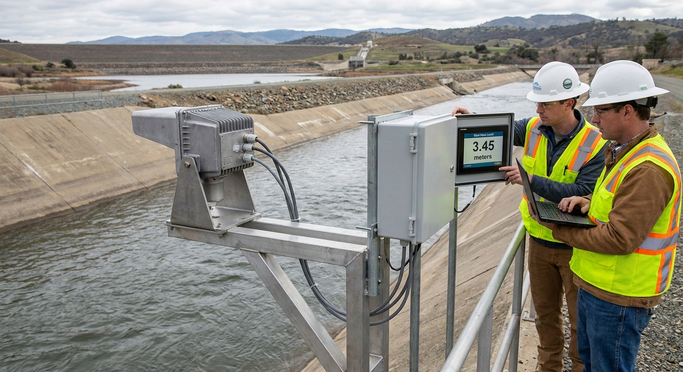
Scientific installation is the prerequisite for achieving high-precision measurements with your 80G radar water level gauge. Prior to deployment, a thorough survey of the site environment is mandatory to avoid false echoes caused by bridge piers or protruding embankments. The microwave propagation path must remain unobstructed to ensure the narrow beam angle (typically 3-8 degrees) targets only the water surface.
Proper fixation and alignment are critical; the device must be mounted vertically pointing directly downward. If the unit tilts, microwaves undergo specular reflection, preventing the antenna from capturing a strong signal. Installers must also account for the top dead zone, ensuring the distance from the antenna to the historical highest water level exceeds the specified blind zone distance.
On-Site Commissioning Methods for Accurate 80G Radar Data
Following physical installation, systematic commissioning activates the full performance potential of the 80G radar water level gauge. Technicians must accurately input the "air gap" and "range" parameters via dedicated software to establish the foundation for internal algorithms. These settings allow the system to calculate the actual water level relative to the riverbed or zero-water level.
Echo curve analysis is essential for high-precision commissioning. A single, sharp main peak indicates normal conditions, while secondary peaks suggest fixed obstacles requiring "False Echo Learning." Operators can also set dynamic filtering and damping time (e.g., 10-30 seconds) to smooth out data jitter caused by wind waves, ensuring stable average values for real-time monitoring.
Routine Operation and Maintenance Standards for Long-Term Reliability
Although the 80G radar water level gauge offers non-contact advantages, regular maintenance is indispensable for long-term lifecycle management. Site visits should occur at least quarterly to check for bracket deformation due to settlement and to inspect the antenna surface for spider webs or insect nests that could attenuate signal strength.
Data validation should involve manual comparative measurements using staff gauges during seasonal transitions. If systematic deviations are detected, offset compensation must be applied promptly via backend software. Additionally, regularly verify the power supply system, including solar panels or AC modules, and check communication module signal strength to ensure continuous data upload.
Common Fault Troubleshooting for 80G Radar Systems
Fault 1: Data Output Freezes
Cause: Radar locked onto a strong false echo.
Solution: Retrieve the echo curve to identify obstructions like moored vessels. Clear the obstacle or re-execute false echo suppression functions.
Fault 2: Sudden Data Fluctuations
Cause: High winds, rough waves, or heavy rainfall affecting reflectivity.
Solution: Increase the damping filter coefficient to mitigate jitter. If a water film forms, data typically recovers automatically after rain subsides.
Fault 3: Device Offline / No Upload
Principle: Hardware first, then software.
Measure voltage at terminals (ensure DC 12V-24V). Check RS485/4-20mA cables for damage and verify DTU 4G/5G signal status if power is normal.
As a precision instrument in modern hydrological monitoring, the full realization of the 80G radar water level gauge's high precision depends on rigorous installation and meticulous operations. Ecolor Technology urges practitioners to strictly adhere to these guidelines to fortify the data foundation essential for water conservancy and urban safety.