From Technical Challenges to Successful Implementation: A Case Study on the Implementation of a Municipal Pipeline Network Project
In recent years, the frequent occurrence of extreme short-duration heavy rainfall has led to a continuous rise in risks such as urban road ponding, submersion of underpasses, and water ingress into underground spaces. For urban managers, the key to waterlogging management is no longer just "post-rain emergency rescue," but rather the ability to complete risk identification, issue warnings, and pre-position resources before rainfall occurs and ponding forms.
While tracking urban water safety and smart flood control projects, Ecolor Technology has noted that a number of cities are beginning to transition waterlogging early warning from empirical judgment to engineered, data-driven, and scenario-based operations through the construction of weather radar, ponding monitoring, pipe network hydrodynamic models, and multi-department coordination mechanisms.
Introduction: Urban Waterlogging Early Warning Shifts from "Passive Response" to "Proactive Defense"
This article takes the Smart Urban Waterlogging Early Warning and Flood Control Coordination Project in Binjiang District, a coastal city in East China, as an example to review the complete process of the project from risk survey, equipment construction, model calibration, to actual flood season operations. The project covers approximately 137 square kilometers of the built-up area in Binjiang District, serving a permanent population of about 1.86 million, with a focus on 23 depressed intersections, 3 urban tunnels, 12 large underground commercial spaces, and 186 historical ponding hotspots.
Key Achievement:
The system was put into trial operation before the 2024 flood season and generated complete operational data after experiencing 11 heavy rainfall events and the peripheral impacts of 2 typhoons from July to September of that year.
From the operational results, the project has reduced the average ponding detection time from the previous 38 minutes to less than 3 minutes, achieved an average lead time of 47 minutes for ponding warnings on key road sections, and controlled the mean absolute error of ponding depth predictions to 3.8 centimeters. During a heavy rainfall event on July 15, 2024, with a maximum hourly rainfall intensity of 91.3 mm, the system predicted in advance that 23 road sections might experience ponding depths exceeding 20 centimeters, and coordinated with traffic police, drainage, sub-district, and underground space management units to complete road closures, pre-drainage, and defense deployments.
No casualties occurred, and the traffic recovery time was significantly shortened compared to similar rainfall events in previous years. This case demonstrates that urban waterlogging early warning is becoming a critical infrastructure connecting meteorology, water affairs, transportation, and grassroots governance within the flood control system.
Project Background: Convergence of High-Density Urban Areas, Limited Drainage Capacity, and Extreme Rainfall
Binjiang District is located in the eastern coastal area of the city and is a typical high-density built-up area. The region features a mix of commercial complexes, industrial parks, and residential areas, with an impervious surface ratio of approximately 68.4%, which is higher than the citywide average. The total length of the drainage pipe network in the district is about 2,180 kilometers, including approximately 1,260 kilometers of stormwater pipes, 420 kilometers of combined sewer pipes, and 500 kilometers of sewage pipes.
The design return period for drainage facilities in most old urban areas is 1 to 3 years, and 3 to 5 years for some newly built areas. However, affected by factors such as pipe network aging, localized misconnections, and backwater effects from river water levels, the actual drainage capacity significantly attenuates under heavy rainfall conditions.
- Terrain Challenges: Flat terrain with many localized low-lying areas, particularly depressed intersections, tunnel entrances/exits, and underground garage entrances.
- Historical Data: In July 2021, a short-duration heavy rainfall (82mm/hour) resulted in 47 significant ponding spots, stranding 32 vehicles and causing water ingress in 6 underground spaces.
- Complex Scenarios: Affected by coastal storm surges, plum rain seasons, and summer severe convective weather.
Against this backdrop, Binjiang District launched the Smart Urban Waterlogging Early Warning and Flood Control Coordination Project in September 2023. The project's goal was not simply to build a visualization platform, but to form a closed-loop capability encompassing "monitoring—forecasting—warning—dispatch—response—evaluation." Led by the water affairs department, the project involved the joint participation of meteorology, transportation, urban management, housing and urban-rural development, emergency management, and local sub-districts, with Ecolor Technology participating as one of the technical support units for data governance, model integration, and warning rule design.
Technical Challenges: Slow Detection and Data Fusion
During the preliminary research, the project team identified four main technical challenges that needed to be overcome to ensure effective flood control:
1. Slow Ponding Detection
Previous reliance on patrol personnel and citizen hotlines resulted in an average detection time of 38 minutes. In high-risk points like tunnels, ponding depth can rise from 10 cm to 30 cm in just 10-15 minutes, making delayed detection dangerous.
2. Coarse Warning Granularity
Traditional rain gauges had an average spacing of 2.8 sq km, insufficient for capturing "point-like, sudden" convective rainfall. Relying solely on administrative division warnings cannot support road-section-level precision.
3. Multi-Source Data Fusion
Data from meteorology, water affairs, and transportation departments had inconsistent standards and misaligned coordinates. Incomplete pipe network records directly affected hydrodynamic model accuracy.
4. Disconnect Between Warning & Response
Past warnings lacked graded thresholds and specific response actions. Without knowing "where," "how deep," or "what to do," warnings failed to translate into effective flood control actions.
Solutions: Closed Loop of Radar, Sensing, and Simulation
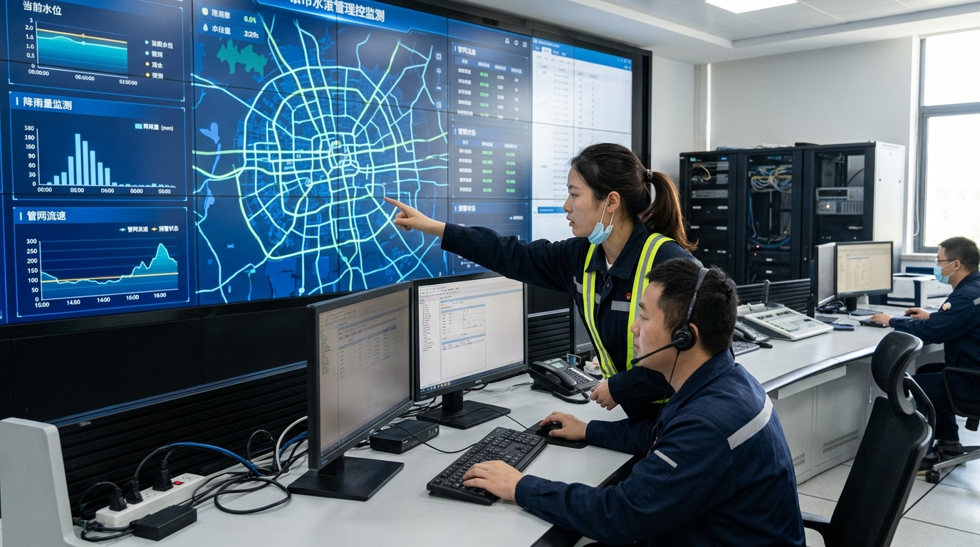
To address these challenges, the project adopted an overall architecture of "radar rainfall measurement + IoT sensing + model simulation + graded warning + coordinated response."
1. Enhanced Monitoring Layer
- Radar Network: Integrated 1 X-band dual-polarization weather radar and 3 micro blind-spot-filling radars. Achieved 100-meter spatial resolution and 3-minute volume scan cycles, enabling 0-to-120-minute nowcasting.
- Ponding Sensing: Deployed 642 ponding monitoring devices (radar level gauges/electronic water staff gauges) at depressed intersections and tunnels. Measurement accuracy controlled within ±5mm to ±10mm.
- Comprehensive Coverage: Added 875 pipe network level monitoring points, 28 river water level stations, and 412 video surveillance feeds.
2. Data Governance & Model Calibration
The project team conducted unified governance of 1:500 terrain data and 2,180 kilometers of drainage pipe network data. Key achievements included correcting 12,000 node coordinate deviations and calibrating over 4,300 combined sewer misconnection records. This increased model input data completeness from 71% to over 94%.
The model layer adopted a coupled calculation method integrating rainfall forecasting, runoff generation, pipe network hydrodynamics (1D), and surface overflow (2D). With a grid size of 5m×5m for key areas, the system performs rolling calculations every 5 minutes, completing a 2-hour future prediction in under 90 seconds.
3. Graded Warning & Coordinated Response
The system established a rule system graded by level and scenario:
| Risk Level | Ponding Depth | Response Action |
|---|---|---|
| Attention | < 10 cm | Monitor status |
| Yellow Warning | 10 - 20 cm | Strengthen patrols; Sanitation/Drainage prepare |
| Orange Warning | 20 - 30 cm | Traffic guidance; Pre-position rescue forces |
| Red Warning | > 30 cm | Temporary closure; Detours; Evacuation |
For coordinated response, the system generates "one point, one policy" action cards. When a risk is predicted, it automatically pushes suggestions like "pre-start associated pump stations" or "notify traffic police to place cones," forming a human-machine collaborative decision-making process.
Implementation Process: From Survey to Operation
The project implementation followed a rigorous four-phase approach:
- Risk Survey & Design (Sep-Dec 2023): Identified 186 key risk points and divided the district into 42 drainage zones based on historical work orders and traffic incidents.
- Equipment Installation (Jan-Mar 2024): Completed installation of 642 ponding monitors, 875 pipe network sensors, and upgraded 28 river stations. Ensured power supply via municipal backup batteries and 4G/5G communication.
- Model Calibration (Mar-May 2024): Calibrated using 18 typical rainfall events. Nash-Sutcliffe efficiency improved from 0.62 to 0.83; Mean Absolute Error (MAE) for ponding depth decreased from 9.6cm to 3.8cm.
- Trial Operation & Drills (May-Jun 2024): Conducted 3 cross-departmental drills simulating severe rainfall, intersection flooding, and underground space ingress. Rectified 17 issues including SMS template lengths and video recognition errors.
Final Results: Quantifiable Improvements
During the 2024 flood season, the system demonstrated significant effectiveness in reducing risks and improving response efficiency:
Case Study: July 15, 2024 Heavy Rainfall
During a severe convective weather event with 91.3 mm/hour rainfall, the system issued an orange warning 8 minutes after the onset, predicting ponding >20cm on 23 road sections. The command center initiated a Level III emergency response. Departments pre-positioned 18 mobile pump trucks and 210 rescue personnel. By the time ponding reached 26cm at Jiangwan underpass, traffic signals were already adjusted for detours. Result: No stranded vehicles or casualties, and traffic recovery time was shortened by approximately 64% compared to similar past events.
Furthermore, the system achieved zero underground space water ingress events during the 2024 flood season, a significant improvement from the 2021-2023 average of 4.7 events per year. Rescue team arrival times were cut from 31 minutes to 14 minutes due to proactive pre-positioning based on predictive analytics.
Industry Outlook
The Binjiang District case illustrates that urban waterlogging early warning is evolving towards greater precision, speed, and coordination. Future trends include:
- Faster Updates: Focus on 0-30 minute nowcasting with minute-level updates during convective weather.
- Finer Spatial Resolution: Refining warnings from district level to individual road sections and building entrances (5m resolution).
- Broader Coordination: Integrating warnings with traffic signal control, metro flood control, and public navigation apps.
Despite challenges in data quality, equipment maintenance, and model uncertainty, the shift from "passive response" to "proactive defense" through digital twins and IoT sensing provides a stable technical foundation for urban resilience. As systems become more integrated, they will play an increasingly vital role in mitigating the impacts of extreme rainfall on modern cities.

