How a Water Services Group Achieves Cost Reduction and Efficiency Improvement Through Urban Waterlogging Early Warning
A Case Study on Shifting from "Post-Rain Reporting" to "Pre-Rain Dispatching" in City J
Introduction: The Paradigm Shift in Flood Control
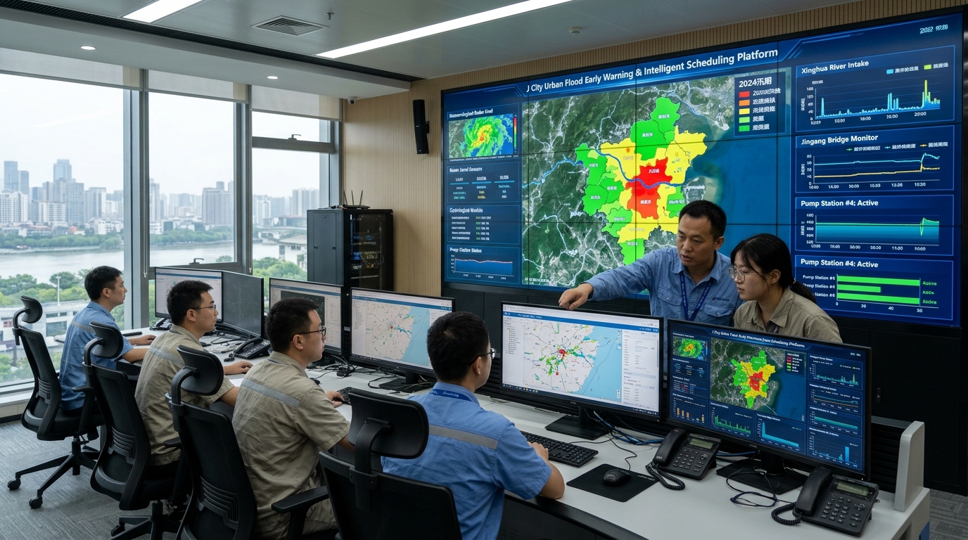
Yicai Technology learned from the acceptance materials of the integrated urban waterlogging intelligent early-warning and flood-control dispatch project in City J that the project, centered on meteorological radar, ponding monitoring, urban hydrological models, and flood-control linkage algorithms, completed Phase I launch during the 2024 flood season. It covers 340 km² of the central urban area, 127 historically flood-prone sites, and 22 underpasses, increasing the average lead time of ponding warnings to 28 minutes and compressing response time at key sites from about 42 minutes to 16 minutes.
Unlike the traditional approach of “watching videos after rain and manually reporting ponding,” the project embeds radar nowcasting, pipe-network–surface runoff calculations, and threshold warnings into the flood-control command process, outputting ponding locations, depths, and dispatch recommendations for the next 30 to 60 minutes.
After the system became operational, water affairs, transport, and emergency response departments could complete pump station pre-drawdown, mobile pump truck deployment, and underpass pre-control before rainfall peaks. This provides a replicable case for flood-control dispatch under conditions of insufficient drainage capacity in old urban districts. The acceptance requirements specified a warning lead time of no less than 20 minutes for key sites and a ponding peak prediction error of less than 5 cm; actual tests all met the Phase I targets.
Project Background: Mismatch Between Extreme Rainfall and Drainage Capacity
City J has a built-up area of about 680 km², a total drainage pipe network length of about 9,800 km, and a combined sewer network share of about 31%. The central area was developed at an early stage, underground space is complex, some low-lying road sections have drainage standards of only 10- to 20-year return periods, and the frequency of short-duration heavy rainfall has increased.
Critical Incident: July 2021 Torrential Rain
- Rainfall: 6-hour cumulative rainfall of 150 mm; max 1-hour rainfall of 68 mm.
- Impact: Road ponding exceeded 50 cm at 38 sites; 22 underpasses were closed.
- Disruption: Cumulative traffic interruption lasted 4.6 hours.
- Losses: Direct economic losses amounted to approximately RMB 210 million.
The review showed that the contradiction lay not only in rainfall exceeding drainage standards but also in the overly long warning chain. After meteorological warnings were issued, departments had to rely on manual patrols, video review, and citizen reports to determine ponding locations. Often, pump stations and tunnel closures started only after ponding formed. For urban flood control, the key is not “ponding has already occurred,” but “when, where, and to what depth ponding will occur.”
In October 2023, water affairs, emergency management, meteorology, and transport departments in City J jointly launched the project, with a total investment of about RMB 136 million. Yicai Technology participated in system integration and algorithm implementation. Phase I focused on the central urban area and high-risk underpasses, aiming to form a “radar-ponding-model-dispatch” closed loop before the 2024 flood season.
Technical Difficulties: Real-Time Fusion Challenges
1. Rainfall Forecasting
Short-duration heavy precipitation has small spatial scales. Traditional S-band radar struggles with 1-3km convective cells due to urban terrain blockage. X-band phased-array radar improves minute-scale scanning but suffers from clutter and limited coverage radius.
2. Ponding Monitoring
Road ponding is affected by vehicles, debris, and gradients. Video recognition fails at night or in heavy rain. Level gauges only reflect point depth. The system must fuse rainfall, pipe levels, and structural data on the same time axis.
3. Model Speed & Data Quality
Full 2D hydraulic simulation takes too long for rolling warnings. Simplified models miss complexity. Data gaps and jumps require balancing accuracy, speed, and robustness to update forecasts every 5 minutes.
Additionally, inconsistent understanding of warning terminology across departments can cause command conflicts. Therefore, the project established a unified data dictionary and tiered response rules.
Solution: Linking X-Band Radar Nowcasting with Urban Modeling
Implementation: From Survey to Flood-Season Drills
- Nov 2023 (Site Survey): Rechecked elevations of 127 flood-prone sites. Adjusted level gauge positions to reduce vehicle disturbance false alarms.
- Jan-Mar 2024 (Model Training): Used 11 historical heavy rain events. Tuning reduced mean absolute error of 30-min ponding depth from 7.9 cm to 3.8 cm.
- Apr 2024 (Linkage Drill): Simulated 120 mm rainfall. System predicted ponding 41 mins in advance. Response time dropped from 35 mins (traditional) to 12 mins. Developed 12 automatic linkage rules for tunnel broadcasts.
- Jun 2024 (Trial Operation): Connected 8 data types. Daily new data volume ~18 GB. Updated forecasts every 5 minutes. Triggered 47 warnings (9 red, 18 orange, 20 yellow).
Final Results: Improved Lead Time and Response Efficiency
Key Performance Indicators
- Average Warning Lead Time: 28 minutes (Max: 43 minutes).
- Hit Rate (≥20mm/hr): 71%.
- False Alarm Rate: 18%.
- Ponding >30cm Miss Rate: Decreased from 23% to 11%.
Operational Impact vs. 2021
- Road Interruption Duration: Decreased by 45%.
- Underpass Vehicle Entrapment: Decreased by 67%.
- Emergency Evacuation/Guidance: ~3,200 person-times supported efficiently.
- Response Time: Compressed from ~42 mins to 16 mins.
During the 2024 main flood season, City J experienced 11 heavy rainfall events. The system issued effective warnings for all 6 torrential rain events. Of the 127 key sites, 119 did not exceed the orange threshold, and the 8 that reached the red threshold completed drainage within 30 minutes after the predicted peak.
Case Highlight: July 18, 2024 Night Event
Radar detected a strong convective cell producing 28.6 mm rain in 10 minutes. The system predicted peak ponding of 34 cm at the Changjiang Road underpass 37 minutes in advance. The underpass was closed at 22:14. Actual maximum ponding was 28 cm—below the threshold—with no vehicles trapped. Under traditional methods, closure would likely have been delayed by 15-20 minutes.
Closing Outlook: From Ponding Warning to Urban Resilience
The City J project demonstrates that the key to urban waterlogging early warning is not the number of single-point devices, but whether radar, ponding monitoring, hydrological models, and flood-control dispatch can form a low-latency closed loop. Phase I validated the feasibility of “pre-rain forecasting, in-rain dispatching, and post-rain after-action review.”
Phase II plans to extend X-band radar coverage to 120 km in the periphery, add 60 ponding monitoring devices, and incorporate communities, underground garages, and power facilities into risk layers. Future urban flood control will rely more on data-driven risk management, connecting traffic guidance, emergency management, and citizen service platforms. As climate uncertainty increases, cities need to complement drainage projects with “warning-dispatch-recovery” capabilities, ensuring extreme rainfall risks are seen earlier, handled more quickly, and less likely to evolve into disasters.

