Digital Transformation of Urban Pipe Networks: Data Silos and IoT Platforms
Urban Pipe Network Industry Insights: How Waterlogging, Early Warning, Radar and Flood Control Are Reshaping Resilient Infrastructure
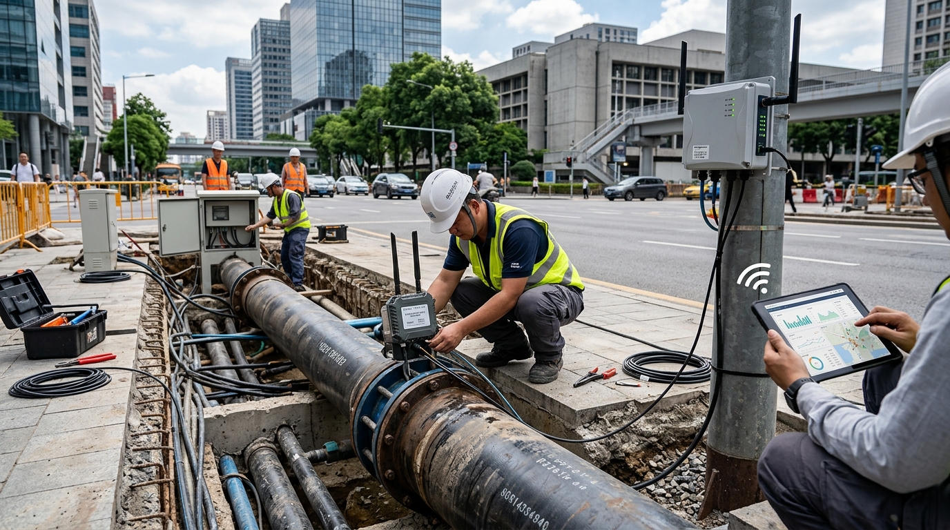
Urban pipe networks have long been hidden beneath roads, buildings and green spaces, making them one of the least visible infrastructure systems in city operations. In the past, the core goal of pipe network construction was often “able to drain, no surcharging, and less backflow,” and its value was reflected mainly in project acceptance and periodic performance assessments. As extreme rainfall, urban expansion, traffic congestion and underground space utilization intensity increase simultaneously, urban waterlogging risk is evolving from a single drainage issue into a comprehensive safety governance challenge. Keywords such as waterlogging, early warning, radar and flood control are increasingly frequent in industry discussions, indicating that urban pipe networks are transitioning from traditional municipal engineering to urban safety infrastructure that is perceivable, computable, schedulable and reviewable.
I. From “Drainage Compliance” to “Flood Control Resilience”: A New Stage of Risk Governance
China’s urban population and asset density continue to rise, significantly increasing pressure on pipe network safety. Public data show that by 2023, China’s permanent resident urbanization rate was about 66.2%, and the built-up area of cities and the scale of underground pipelines expanded in tandem. Statistics on urban construction published by the Ministry of Housing and Urban-Rural Development indicate that the total length of urban drainage pipelines nationwide has exceeded 1 million kilometers. At the same time, many cities have drainage pipe networks built at an early date, with differences in pipe diameter standards, design return periods, construction quality and operation and maintenance capabilities. Some old urban areas still have combined sewer systems or mixed rainwater-sewage connections; although drainage standards in newly developed areas have improved, sensitive scenarios such as underground spaces, underpasses, subways and underground parking garages introduce additional waterlogging risks.
"Building pipe networks solely according to traditional drainage standards cannot fully cope with above-standard rainfall."
Extreme rainfall events are changing industry understanding of pipe network safety boundaries. In July 2021, Zhengzhou experienced an extreme rainstorm, with a maximum hourly rainfall intensity of 201.9 mm and a three-day event rainfall close to 600 mm. From late July to early August 2023, Beijing and surrounding areas encountered heavy rainfall, with some monitoring stations recording event rainfall close to 1,000 mm. Such events expose a reality: building pipe networks solely according to traditional drainage standards cannot fully cope with above-standard rainfall. Urban flood control is no longer only a matter of pump stations, sluice gates and emergency rescue teams; it is a systems engineering challenge involving meteorology, pipe networks, roads, transportation, communities, electricity and telecommunications. Industry focus has shifted from “whether design standards are met” to “whether early warning, loss reduction and rapid recovery are possible under above-standard rainfall.”
II. Market Trends: Three Main Lines Driving Growth
From a market structure perspective, the urban pipe network industry is shifting from a focus primarily on new construction to a stage where new construction and renovation, existing network operation and maintenance, and digital services run in parallel. In recent years, urban renewal, aging underground pipe network renewal and renovation, drainage and waterlogging prevention facility construction, and sponge city projects have continued to receive funding support from central budget investment, local government special bonds, ultra-long-term special government bonds and other channels. Public information shows that investment demand for urban underground pipe network renovation and drainage and waterlogging prevention facilities has remained at a relatively high level during the 14th Five-Year Plan period. Some provinces and cities have included pipe network inventories, GIS database construction, monitoring systems and dispatching platforms in annual construction plans. This means that competition in the pipe network market is no longer only about construction capacity; it also includes comprehensive capabilities such as inspection and assessment, data governance, operation and maintenance, and emergency dispatching.
Existing network O&M is becoming an important growth point. A large number of drainage pipelines have entered their inspection and maintenance cycles, and traditional manual patrols can no longer meet the needs for high frequency, full coverage and rapid response. Demand is increasing for services such as pipeline inspection, trenchless rehabilitation, dredging and desilting, structural health monitoring, and water quality and flow monitoring. At the same time, digital services are moving from “display-oriented platforms” to “business-oriented platforms.” Local water affairs, urban management and emergency management authorities need not merely a visualization dashboard, but a closed-loop system that can connect waterlogging spots, pump stations, sluice gates, rain gauges, underpasses and emergency response forces. Market procurement logic has also shifted from “building a system” to “whether it can reduce waterlogging incidents, shorten response times and improve flood-control decision-making efficiency.”
III. Technology Direction: Forming a Closed Loop
At the technical level, the urban pipe network flood control system is forming a closed loop of “sensing—simulation—early warning—dispatching—review.” Radar is an important upstream sensing entry point. Weather radar can provide regional rainfall distribution, rain cell movement direction and short-term rainfall trends. New devices such as X-band phased-array radar can compress temporal resolution to 3 to 6 minutes and achieve spatial resolution of 500 meters to 1 kilometer, providing more refined rainfall input for urban waterlogging early warning. However, radar rainfall estimation is still affected by terrain blockage, attenuation, strong convective structures and underlying surface differences, with typical estimation errors potentially ranging from 10% to 30%. Therefore, the industry’s technological trend is not to rely solely on radar, but to integrate radar, satellite remote sensing, ground rain gauges, urban video and pipe network sensors to form a multi-source data correction mechanism.
Waterlogging monitoring is the key link connecting rainfall and urban risk. Electronic water gauges, radar level sensors, pressure level sensors, video recognition and AI image analysis are widely used in underpasses, low-lying roads, pump station forebays, detention basins and flood-prone locations. In typical threshold settings, 10 cm of waterlogging may trigger patrol reminders, 20 cm may affect vehicle passage, and 30 cm or more may trigger traffic control or closure measures. Pipe network models link rainfall, runoff, drainage capacity, pump and gate dispatching, and surface runoff. Model tools such as SWMM and InfoWorks ICM can perform coupled 1D pipe network and 2D surface simulations and conduct risk scenario analysis for rainfall events with return periods of 5 years, 10 years, 20 years, 50 years and even 100 years. AI and machine learning are used to complement traditional hydraulic models, accelerating short-term waterlogging forecasts and shifting early warning lead time from “post-event alarm” to “15 to 60 minutes in advance.”
IV. Early Warning System: Zoned, Tiered, and Credible
The core of an early warning system is not to connect more sensors to a platform, but to establish actionable risk classification. Traditional waterlogging early warning often focuses only on whether water depth at a point exceeds a threshold, easily resulting in “point-based alarms and area-wide passivity.” The new generation of early warning systems places greater emphasis on spatial, temporal and impact dimensions: whether a road segment will become waterlogged in the next 30 minutes, how deep the waterlogging may become, which underpasses, metro stations, hospitals, schools, underground parking garages and transportation hubs may be affected, and whether pump station start/stop restrictions or road closures are involved. Early warning recipients have also expanded from a single management department to traffic police, emergency management authorities, subdistrict offices, property managers, bus operators, metro operators and public service channels.
In flood-control operations, the credibility of early warnings is more important than their quantity. Too many false alarms can cause fatigue in frontline response, while too many missed warnings may cause dispatching windows to be missed. In industry practice, some cities jointly validate meteorological nowcasting, radar rainfall estimates, measured data from ground rain gauges and pipe network model results to produce early warning information with different confidence levels. For example, in some demonstration projects, the system can control the predicted onset time of waterlogging on key road segments within an error of 30 minutes to 1 hour, with water depth simulation error around 20%, dynamically corrected using radar rainfall trends, measured water levels and video recognition. More mature early warning systems also introduce “tiered response”: yellow warnings trigger patrols and pre-positioning of resources; orange warnings activate pump station pre-lowering and sluice gate dispatching; red warnings trigger traffic control, personnel evacuation and emergency rescue coordination.
V. Policy Impact: Shaping Industry Boundaries
Policy is an important driver of urban pipe network industry upgrading. The Implementation Opinions on Strengthening Urban Waterlogging Governance issued by the General Office of the State Council in 2021 proposed that by 2025, cities should basically establish an urban drainage and waterlogging prevention engineering system characterized by “source reduction, pipe network drainage, combined storage and drainage, and emergency response to above-standard rainfall,” and that by 2030, urban waterlogging under rainfall conditions within prevention standards should be generally eliminated. This objective elevates pipe network governance from “filling gaps in drainage facilities” to the level of “building urban safety resilience.” Policy instruments such as sponge cities, drainage and waterlogging prevention, urban renewal and underground pipe network aging renovation are overlapping, expanding industry demand from single projects to full-lifecycle services covering planning, construction, monitoring, operation and maintenance, emergency response and assessment.
Data governance is also reshaping industry boundaries. Pipe network GIS data, drainage facility inventories, pump and gate operation data, meteorological radar data, video imagery data, waterlogging monitoring data and emergency command data are becoming key components of the digital foundation for urban flood control. However, pipe network data has spatial sensitivity and infrastructure security attributes, involving compliance requirements related to surveying and mapping data, urban security data and personal video information. Future projects must address not only whether data exists, but also whether data is accurate, shareable, traceable, and compliant with cybersecurity and data classification and grading requirements. Policy direction is driving the industry from equipment procurement to standards development, from system commissioning to long-term operations, and from departmental silos to cross-domain coordination.
VI. Case Observations: Typical Scenarios and Pathways
Old Urban Areas
High pipe network density and complex misconnections make simple diameter increases difficult. Practice involves identifying risks through CCTV and GIS, then combining low-impact development and detention basins for tiered treatment. One northern city modeled 1,200 km of pipes, identifying 80+ high-risk spots to optimize resource allocation.
New Development Zones
Facilities are concentrated, allowing flexible dispatching. Systems link “rainfall—pipe level—pump status—risk.” When radar predicts heavy rain, the system proactively lowers water levels and adjusts gates. Southern cities use electronic gauges and video AI to shift from post-discovery response to pre-rainfall lowering.
Underground Spaces
Subways and parking garages require rapid response due to fast-expanding losses. Strategies include external interception and internal drainage. Unified risk maps display entrances and passages. Key success factors are generating executable instructions (closing entrances, stopping vehicles) within minutes via sensor integration.
VII. Outlook: From “Concealed Works” to “Computable Assets”
Looking ahead over the next five years, the urban pipe network industry will undergo four notable changes. First, pipe networks will transform from concealed works into computable assets. In the past, the value of pipe networks was reflected mainly in completion acceptance and annual maintenance budgets. In the future, their risk status, drainage capacity, waterlogging probability, rehabilitation priority and operating cost will all be quantified. Second, radar, satellites, ground sensors and pipe network models will be further integrated. Single rainfall forecasts or single waterlogging alarms are insufficient to support complex flood-control decision-making; multi-source sensing and model-based scenario analysis will become foundational capabilities of urban drainage and waterlogging prevention systems. Third, early warning systems will move from “alarm” to “credible decision support.” The future competitive focus will not be the number of alarms, but lead time, spatial localization accuracy, impact-area assessment and the quality of response recommendations. Fourth, flood control will gradually shift from emergency incident management to risk pricing and insurance governance. Waterlogging risk, pipe network asset condition, insurance claims and emergency capability assessment will form a tighter data closed loop.
The real challenge for the urban pipe network industry is not only upgrading technical equipment, but also updating organizational mechanisms and operating models. Meteorological departments provide rainfall trends, water affairs departments manage pipe networks and pump station operations, urban management departments patrol road waterlogging, emergency departments coordinate rescue, transportation departments implement road control, and subdistrict offices and communities are responsible for last-mile evacuation and notification. If data, workflows and responsibility boundaries are not connected, even advanced radar, sensors and models may remain at the display level. A common characteristic of future industry-leading cities may be the ability to connect waterlogging monitoring, radar early warning, pipe network models, pump and gate dispatching, and emergency command into a low-latency closed loop, continuously review events after the flood season, and turn every rainfall event into a basis for updating risk maps, maintenance plans and dispatching rules.
Overall, urban pipe networks are entering a new resilience-oriented cycle. Waterlogging governance is no longer merely a drainage issue, but a comprehensive challenge involving urban safety, public governance and digital infrastructure. Radar provides the entry point for rainfall sensing, early warning determines the action window, and flood control tests system resilience. The industry is shifting from engineering construction to long-term operations, from point-based monitoring to system simulation, and from post-event rescue to pre-event assessment. In the future, the measure of urban pipe network capability may no longer be “how long the pipe network is,” but “before heavy rainfall arrives, can the city see risks earlier, dispatch resources faster and restore operations more steadily?” This trend will continue to drive pipe network inventories, sensors, pipe network models, digital twins, data governance and emergency coordination services into deeper market stages.

