How to Choose the Right Urban Waterlogging Early Warning System? Accuracy and Stability Are Key
Shifting urban waterlogging early warning from post-disaster response to pre-disaster assessment through advanced sensing, modeling, and digital twin technologies.
In recent years, the superposition of short-duration heavy rainfall, typhoons, and storm surges has made urban waterlogging a high-frequency issue in flood prevention. Practices in various regions show that when 1-hour rainfall exceeds 50 mm or 3-hour cumulative rainfall exceeds 100 mm, obvious ponding is prone to occur in underpasses, low-lying communities, subway entrances, and areas with aging pipeline networks.
Traditional manual inspections and post-disaster rescue operations struggle to cope with the characteristics of concentrated rain peaks, rapid flow concentration, and fast disaster formation. Consequently, urban waterlogging early warning has become a critical infrastructure for resilient cities.
From the perspective of technological evolution, waterlogging early warning has developed from a simple rainfall alarm into a comprehensive system integrating radar rainfall monitoring, floodwater sensing, pipeline and river channel operating conditions, digital twin models, and emergency dispatch. The industry's focus has also shifted from whether there is data to whether early warning can be issued in advance, risks can be located, and dispatch can be supported.
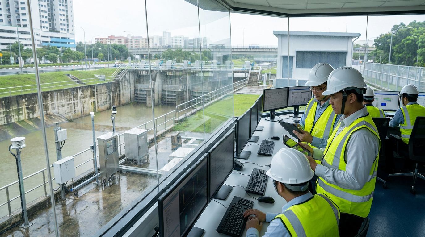
Overview of Technical Routes: Four-Tier Capabilities
Urban waterlogging early warning systems typically consist of four layers:
- Sensing Layer: Collects rainfall, water level, ponding depth, video, and pump station operation data.
- Forecasting Layer: Utilizes radar, meteorological grid forecasts, and nowcasting to determine rainfall trends.
- Modeling Layer: Calculates the ponding range through runoff generation and concentration and hydraulic models.
- Application Layer: Completes tiered early warning, work order dispatch, traffic control, and emergency rescue scheduling.
Current mainstream routes can be summarized into four categories:
1. Macro-Level Forecasting
Centered on radar and meteorological forecasting, emphasizing coverage and lead time.
2. Ponding Monitoring
Centered on electronic staff gauges, level gauges, and video AI, emphasizing point accuracy.
3. Drainage Capacity
Centered on pipeline, river channel, and pump station monitoring, emphasizing bottleneck diagnosis.
4. Risk Deduction
Centered on digital twins and hydraulic models, emphasizing the prediction of unmonitored areas.
An ideal configuration would be: ponding depth identification error at key flood-prone points no greater than ±5 cm, nowcasting rainfall early warning lead time reaching 15 to 45 minutes, platform data latency below 30 seconds, and red alerts pushed to streets, traffic police, and rescue teams within 5 minutes.
Radar and Meteorological Nowcasting: Gaining Lead Time
The core value of the radar route is to identify heavy rainfall areas before ponding forms. Conventional weather radars can provide large-scale precipitation monitoring, with a typical spatiotemporal resolution of about 1 km and 6 minutes; in refined urban scenarios, X-band phased array radars or gap-filling radars can improve spatial resolution to 30 to 120 meters and shorten the update cycle to 1 to 3 minutes.
At the algorithm level, radar is often combined with QPE (Quantitative Precipitation Estimation), QPF (Quantitative Precipitation Forecast), optical flow extrapolation, and deep learning models to form 0- to 2-hour nowcasts. The system can output rainfall intensity distributions for the next 15, 30, and 60 minutes, and overlay low-lying terrain, drainage zones, and historical ponding points.
Case Study: Coastal City Deployment
After deploying X-band gap-filling radars, a coastal city increased its advance identification time for heavy precipitation from 10 minutes to 35 minutes, gaining a window for pump station pre-discharge and channel closure.
The limitations lie in the bias of radar-estimated rainfall, occlusion caused by complex urban environments, and potential underestimation of sudden convection by nowcasting extrapolation. In practice, the deviation between radar rainfall estimation and ground rain gauges is often between 10% and 30%, requiring correction through rain gauge networks and manual verification.
Ground Sensing and Video AI: Enhancing Point Accuracy
The ground sensing route focuses on ponding that has already occurred or is about to occur. Common equipment includes electronic staff gauges, radar level gauges, ultrasonic level gauges, pressure-type level gauges, and video AI. Electronic staff gauges are often deployed at underpasses, tunnel entrances, and low-lying road sections, with a measuring range generally from 0 to 2 meters or 0 to 3 meters, and an accuracy of up to ±1 cm.
Video AI utilizes existing or newly added cameras to identify ponding area, water level scales, and vehicle passage risks. In scenarios with good lighting and visible scales, the ponding depth identification error can be controlled within ±2 cm to ±5 cm. The results of this route are intuitive and easy to verify, and can be directly linked to audio-visual alarm screens, boom gates, and traffic signals.
Efficiency Improvement
A provincial capital city deployed video AI and electronic staff gauges at 120 flood-prone points. After operation, the ponding discovery time was shortened from about 45 minutes for manual inspection to within 3 minutes, and the on-site response time was reduced from about 40 minutes to 18 minutes.
Its drawback is limited coverage; it belongs to point sensing rather than areal prediction. Equipment exposed outdoors for long periods is affected by silt, garbage, power supply, and communications, resulting in high O&M requirements.
Pipeline Monitoring & Digital Twins: From Bottlenecks to Prediction
Pipeline, River Channel, and Pump Station Monitoring
Urban waterlogging depends not only on rainfall but also on pipeline drainage capacity, river channel water level backwater effects, tidal level changes, and pump station gate dispatch. Many old urban areas experience ponding under 30 mm/h rainfall not because the rainfall is too heavy, but because of insufficient pipe diameter, severe siltation, or excessively high downstream water levels leading to poor drainage.
Common equipment includes submersible level gauges, radar level gauges, Doppler flow meters, electromagnetic flow meters, and pump station condition sensors. For DN300 to DN2000 stormwater pipelines, level gauge accuracy can typically reach ±0.5% FS, and flow monitoring error can be controlled within ±1% to ±2%.
Digital Twins and Hydraulic Models
The digital twin route simulates the process of rainfall—runoff generation—flow concentration—pipeline drainage—surface inundation through 1D pipeline models, 2D surface models, and 1D-2D coupled models. Model inputs include DEM elevation, pipeline census data, land use, river channel water levels, pump station capacity, and historical rainfall.
The greatest value of this route lies in predicting areas without deployed sensors. By simulating 10-year, 50-year, and 100-year return period rainfall scenarios, the system can identify in advance roads, underground garages, and traffic nodes that may be inundated, providing ponding depth, inundation extent, and recession time.
New District Success
A new district constructed a 5-meter grid coupled model, identifying 27 high-risk points, increasing the early warning lead time from 10 minutes to over 30 minutes, and shortening the generation time for dispatch plans from about 2 hours manually to within 10 minutes.
Platform Integration and Selection Recommendations
The early warning platform needs to integrate radar, rain gauges, water level gauges, video, pump stations, gates, and emergency resources, and make comprehensive judgments through rule engines and model engines. Common tiering can be set as blue, yellow, orange, and red:
- Blue Alerts: Focus on rainfall trends.
- Yellow Alerts: Require inspection of key points.
- Orange Alerts: Suggest traffic control and pre-positioning of rescue forces.
- Red Alerts: Initiate closure, evacuation, and emergency drainage.
To avoid false alarms, multi-source confirmation using radar forecasts, actual rainfall measurements, and level video should be adopted. Cities should not aim for a one-step solution but should build according to risk priorities.
Specific Selection Recommendations
- High-Risk Points: Prioritize deployment of electronic staff gauges, radar level gauges, video AI, and audio-visual warning screens at underpasses, tunnels, and subway entrances, controlling ponding depth error within ±5 cm and alarm latency below 30 seconds.
- City-Level Flood Prevention: First improve the rain gauge network and radar nowcasting; key urban areas can be densified with no less than 1 automatic rain gauge per square kilometer.
- Old Urban Areas: Increase pipeline level, flow, and pump station monitoring, combining tidal levels and river channel water levels to assess drainage capacity.
- New Cities/Key Areas: Build digital twin models starting with calibration in 1 to 3 drainage zones before gradually expanding.
Concluding Outlook
Future urban waterlogging early warning will exhibit three trends: first, finer sensing, where radar, rain gauges, video, and IoT devices form multi-source complementarity; second, smarter deduction, combining AI rainfall forecasting with hydraulic models to enhance nowcasting and inundation analysis capabilities; and third, more closed-loop response, where early warning information is directly linked to plans, materials, vehicles, and responsible personnel, moving from visible to dispatchable.
For urban managers, waterlogging early warning is not a one-time project but a continuous operational process. Only by establishing mechanisms for data governance, model calibration, plan drills, and cross-departmental collaboration can early warning be transformed into real flood prevention capabilities during the flood season. With the improvement of standards, the enhancement of computing power, and the maturation of scenario-based applications, urban waterlogging early warning will evolve from broad-brush alarming to minute-level, block-level, and executable risk governance.

