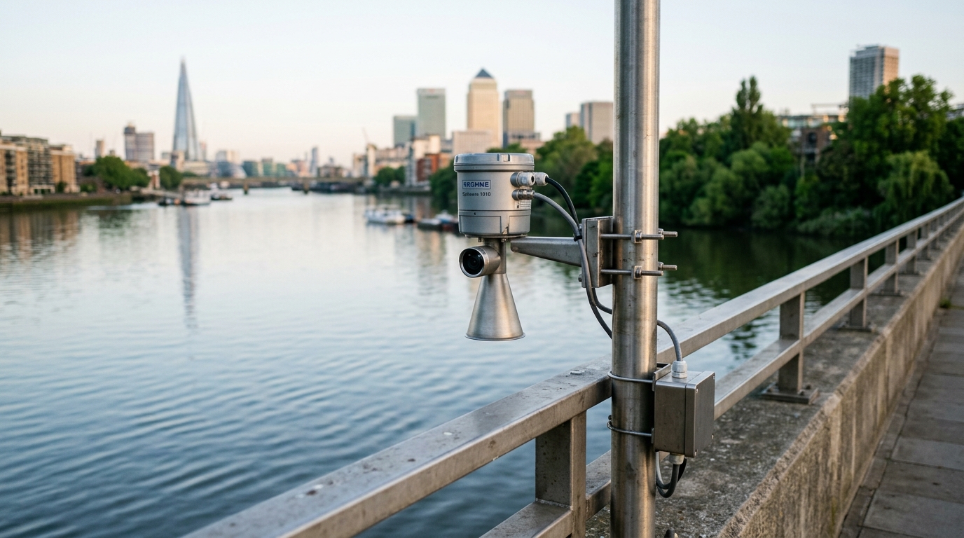
Visual Fusion Radar Water Level Gauge Solution for Urban River Ecological Replenishment Level Monitoring
Addressing distorted level data, unverifiable field conditions and the lack of quantitative effectiveness assessment in urban river ecological replenishment, this solution deploys visual fusion radar water level gauges with non-contact 80 GHz radar measurement plus integrated visual imaging as the core sensing units. Together with Doppler radar flow meters and hydrological RTUs it builds an integrated level-flow-image monitoring network, achieving ±3 mm level accuracy, automatic image evidence with every reading, continuous calculation of replenishment volume and water exchange cycles, and interlocked gate and pump scheduling — providing reliable and verifiable data for replenishment effectiveness assessment and operation control.
Overview
Summary
Addressing distorted level data, unverifiable field conditions and the lack of quantitative effectiveness assessment in urban river ecological replenishment, this solution deploys visual fusion radar water level gauges with non-contact 80 GHz radar measurement plus integrated visual imaging as the core sensing units. Together with Doppler radar flow meters and hydrological RTUs it builds an integrated level-flow-image monitoring network, achieving ±3 mm level accuracy, automatic image evidence with every reading, continuous calculation of replenishment volume and water exchange cycles, and interlocked gate and pump scheduling — providing reliable and verifiable data for replenishment effectiveness assessment and operation control.
Key Advantages
Challenges
- Contact-type level sensors such as submersible and ultrasonic devices drift and produce false readings in urban rivers with large level fluctuations and abundant floating debris, distorting monitoring data
- Pure radar level measurement lacks visual verification, making it difficult to remotely distinguish equipment failures and debris-induced interference from real water level changes
- Intermittent replenishment with large flow fluctuations and the lack of continuous level-flow data prevent quantitative accounting of replenishment volume and river water exchange cycles
- Replenishment reaches are numerous and dispersed; manual inspection cannot meet real-time scheduling needs, and gate and pump operations rely mainly on operator experience
- Most monitoring sites lack mains power and wired communications, making conventional systems expensive to deploy while outdoor unmanned sites face theft and lightning risks
Results
- Non-contact radar-plus-vision dual verification achieves ±3 mm level accuracy and reduces false readings by more than 90% versus conventional methods
- Every reading automatically captures a scene image for remote verification of water surface state, debris and icing, forming a complete data evidence chain
- Continuous level-flow data at key cross-sections enables quantitative calculation of replenishment volume and water exchange cycles for effectiveness assessment
- Gate and pump operations interlocked with replenishment plans raise water utilization efficiency by over 20% and cut manual scheduling effort
- Solar-plus-lithium low-power supply with 4G/NB-IoT reporting keeps device availability above 98% and reduces overall O&M costs by more than 50%
Solution Details
Visual Fusion Radar Water Level Gauge Solution for Urban River Ecological Replenishment Level Monitoring
Ecological water replenishment of urban rivers is a key measure for maintaining ecological base flow, improving water environment quality and building healthy rivers. As water ecology governance advances, cities increasingly implement river replenishment projects through water diversion and reclaimed water reuse. Replenishment operates intermittently with large flow fluctuations along long conveyance routes, and water level monitoring is the core link for effectiveness assessment, safety assurance and scheduling. Conventional monitoring has clear shortcomings in urban river scenarios: contact-type level sensors such as submersible and ultrasonic devices drift and produce false readings under large level swings and abundant floating debris; pure radar gauging lacks visual verification, so operators cannot remotely tell whether an anomalous reading is equipment failure, debris interference or a real level change; and most monitoring cross-sections lack mains power and communication infrastructure, making deployment and O&M expensive.
This solution uses the visual fusion radar water level gauge as the core sensing unit, with an innovative dual-verification architecture combining non-contact radar measurement and integrated visual imaging: an 80 GHz FMCW radar delivers millimeter-level accuracy while a built-in HD camera automatically captures a scene image with every reading, making water surface state, floating debris and icing visible remotely and eliminating false readings at the source. Doppler radar flow meters installed at replenishment inlets and key cross-sections measure level and surface velocity simultaneously, enabling continuous inflow and cumulative volume accounting. All instruments connect through hydrological RTU telemetry terminals and report over 4G/NB-IoT to the monitoring platform, supporting stage-discharge rating management, replenishment effectiveness assessment and interlocked gate and pump scheduling, providing continuous, reliable and verifiable data for urban river ecological replenishment.
Core Advantages of the Visual Fusion Radar Water Level Gauge Solution
- Visual fusion radar water level gauge: 80 GHz FMCW non-contact measurement with ±3 mm accuracy and integrated HD camera for radar-plus-vision dual verification, immune to floating debris, sediment and water quality
- Automatic image evidence: scene images archived with every level reading, with time-lapse playback for remote confirmation of water surface conditions and anomaly screening
- Doppler radar flow meter: simultaneous level and surface velocity measurement for cross-section discharge, fully non-contact to avoid debris entanglement under intermittent, highly variable replenishment flows
- Hydrological RTU telemetry terminal: 4G/NB-IoT/Ethernet reporting with store-and-forward, more than 7 days of local data storage, low-power design with solar and lithium battery supply
- Replenishment effectiveness assessment: continuous calculation of replenishment volume, water exchange cycles and level guarantee rates from stage-discharge ratings, with automatic period reports
- Interlocked gate and pump scheduling: automatic execution of replenishment plans by level and flow thresholds along scheduling curves, linking gate openings and pump starts and stops
Key Technical Specifications
80 GHz
FMCW Radar Frequency
±3 mm
Level Measurement Accuracy
4G / NB-IoT
Telemetry Connectivity
>7 Days
Local Data Storage
Solar + Lithium
Low-Power Supply
Dual Verification
Radar + Visual Imaging
Application Scenarios for Urban River Replenishment Monitoring
The visual fusion radar water level gauge solution is purpose-built for urban river ecological replenishment projects, where intermittent flows, long conveyance routes and debris-laden water challenge conventional monitoring. By combining non-contact radar measurement with integrated visual imaging, it delivers continuous, reliable and verifiable data for effectiveness assessment, safety assurance and scheduling of replenishment operations.
References
- Product specification: Visual Fusion Radar Water Level Gauge Solution for Urban River Ecological Replenishment Level Monitoring
Approach
How we implement intelligence into your infrastructure step by step.
Reach survey and monitoring point layout
Map replenishment water sources, conveyance routes and control cross-sections; combine river GIS and hydraulic models to select level and flow monitoring points, prioritizing replenishment inlets, river confluences and reaches upstream and downstream of gates, with site visits to confirm installation conditions and line-of-sight obstructions.
Instrument installation and system integration
Mount visual fusion radar water level gauges on bridgesides or poles at key cross-sections (2.5-3 m mounting height, clear of piers and trees) and Doppler radar flow meters at replenishment inlets; complete solar power, lightning protection grounding and anti-theft measures, and connect level, flow and image signals to hydrological RTUs for unified acquisition and reporting.
Platform deployment and model configuration
Integrate monitoring data into the hydrological platform, configure stage-discharge rating curves, alarm thresholds and assessment indicators; build replenishment volume and water exchange cycle models and deploy interlocked gate and pump scheduling strategies.
Commissioning, verification and trial operation
Verify radar level accuracy against manual gauge readings and calibrate rating curves with measured discharge; run a trial assessment through a replenishment period to prove the image evidence chain and alarm interlock mechanisms.
Long-term operation and continuous optimization
Establish device inspection and data quality routines, periodically clean radar antennas and camera lenses, and refine replenishment scheduling with seasonal water demand and river ecology targets to keep improving utilization efficiency.
Recommended Hardware
Essential components for this solution.
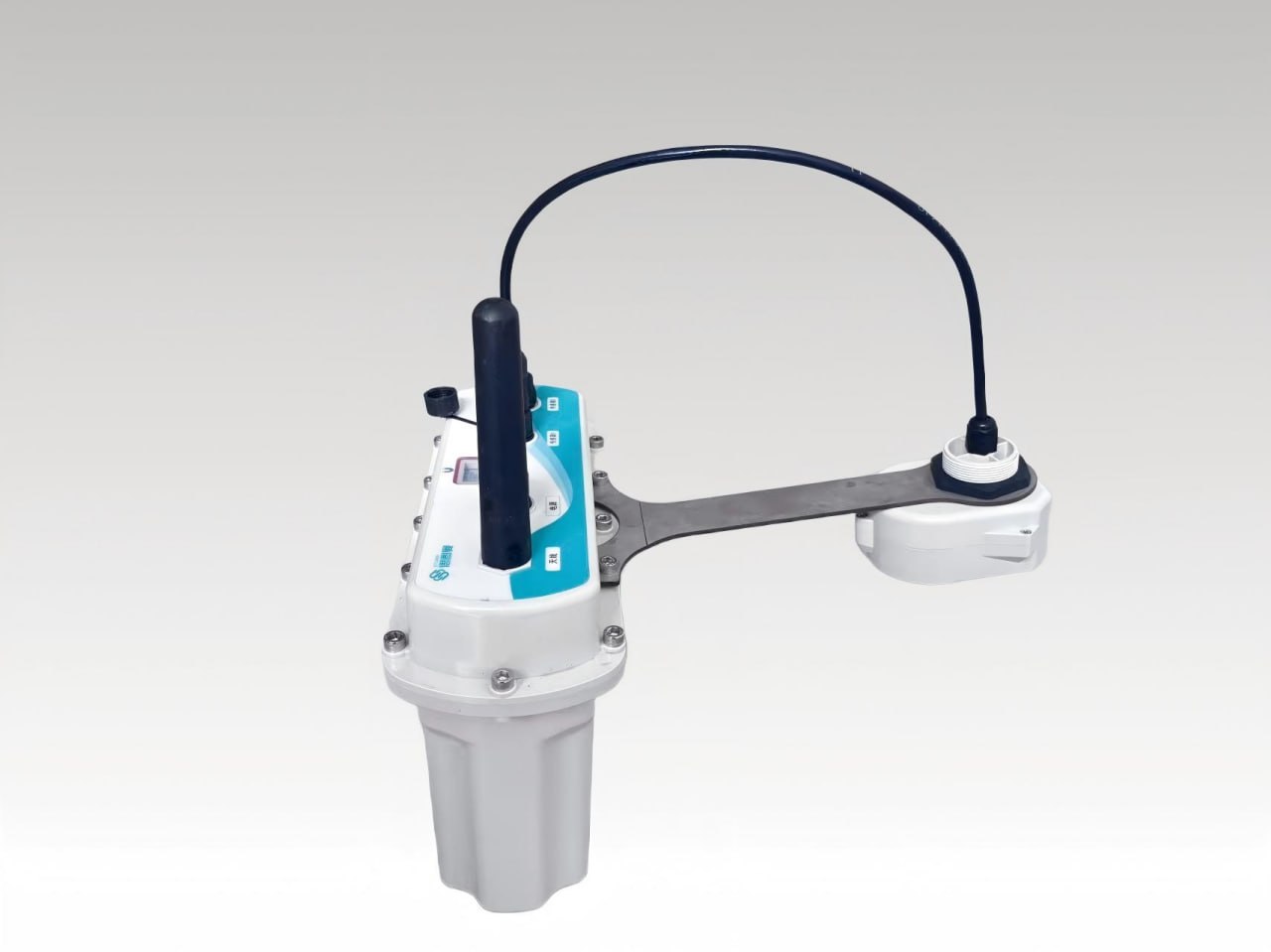
Visual Fusion Radar Water Level Gauge
The Visual Fusion Radar Water Level Gauge series is independently innovated and developed by Ecolor....
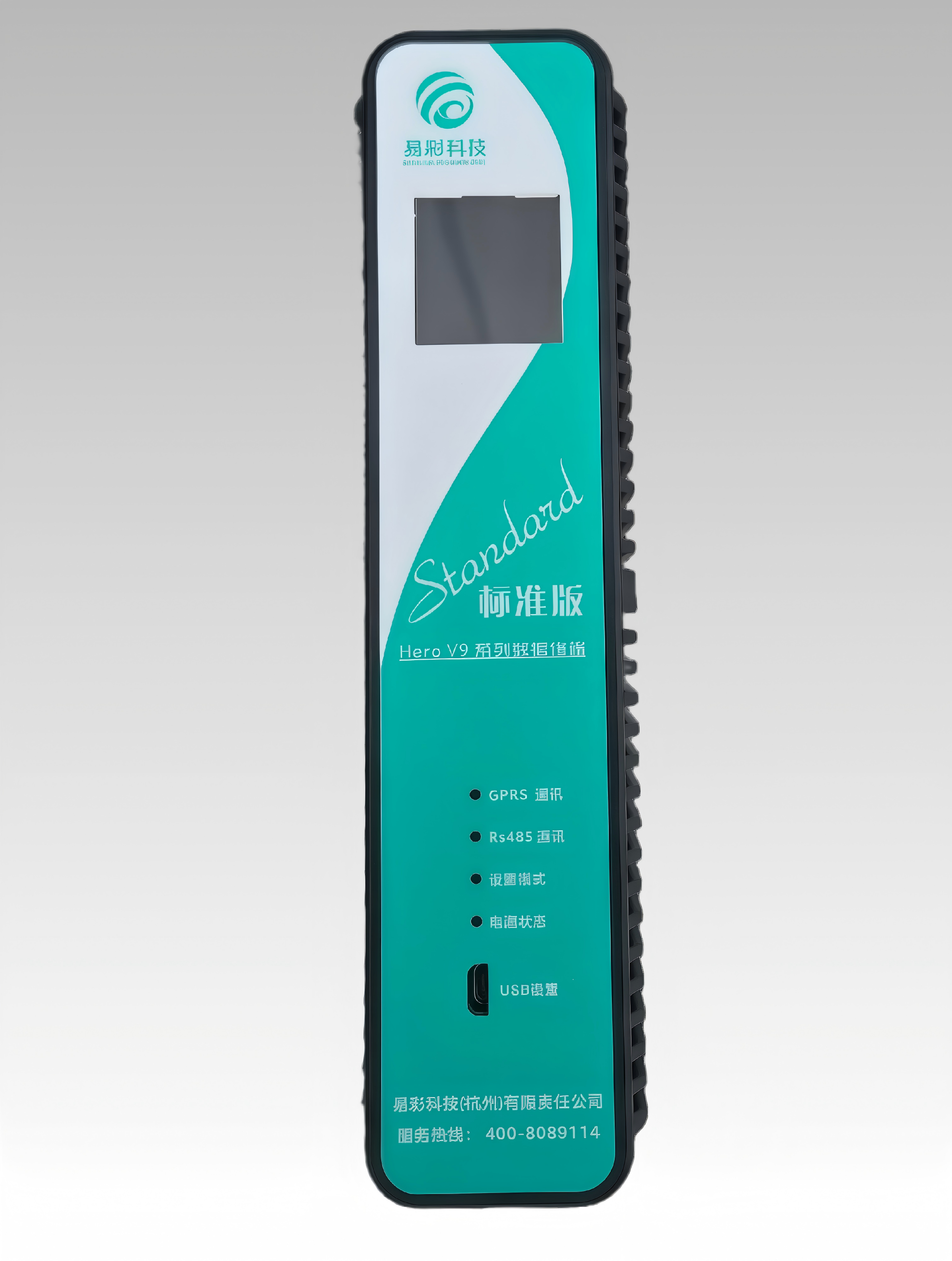
HERO V9-EC32 Hydrology RTU | Remote Terminal Unit
This product has the functions of remote data collection, control and communication. It can receive ...
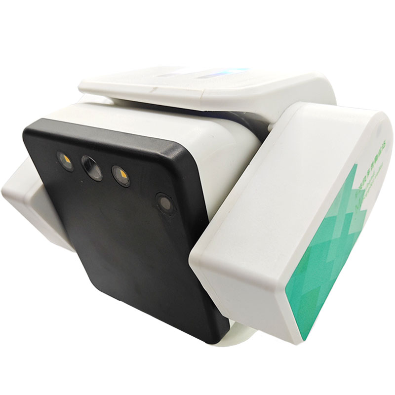
Visual Fusion Multi-band Doppler Radar Flow Meter
The Multi-band Doppler Radar Flowmeter is an independently developed and innovated non-contact fluid...
❓ Related FAQs
Related Solutions
Water Resource Tax Intake Metering & Online Monitoring Solution
Doppler Radar Flowmeter Downhole Non-Contact Flow Monitoring Standard Solution
Precision Drip Irrigation Intelligent Control System for Cotton & Wheat

Ready to Optimize Your Business?
Contact us, and our professional team will provide customized solutions to help your business achieve digital transformation.
Get In Touch