Development Opportunities for Urban Pipeline Networks in 2026 under the Dual Carbon Goals
Urban pipeline networks are shifting from underground facilities that are “invisible, poorly understood, and incompletely managed” into a perceptible, predictable, and dispatchable foundation for urban safety. This article explores how the industry is moving from single-project construction to a stage emphasizing existing-network renewal, digital governance, and operations services.
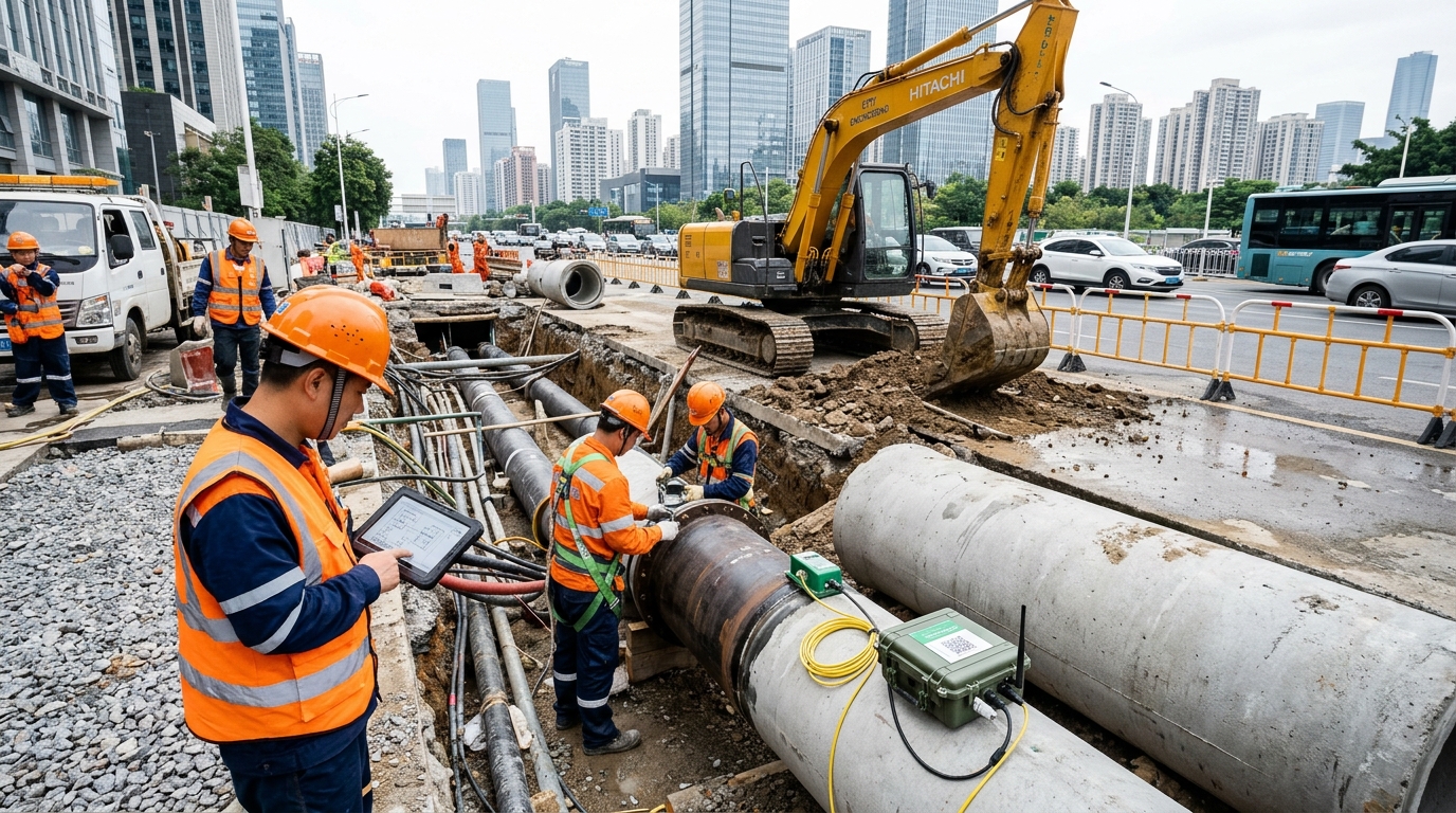
From “Post-event Drainage” to “Process Control”: Entering a Risk-Governance Cycle
For a long time, urban drainage pipeline-network construction focused on physical capacity—pipe diameters and pump station sufficiency. However, with China’s urban drainage pipeline network exceeding 900,000 km, the complexity of underground records and operational boundaries has increased significantly. While conventional stormwater pipe networks are designed for return periods of 1 to 3 years, modern urban safety requires coping with extreme rainfall scenarios up to once-in-30-year events.
Industry experience shows that 15 cm of standing water affects e-bikes; 30 cm increases vehicle stalling risk; above 50 cm, passage becomes difficult; around 80 cm may trigger high-risk events such as vehicle floating.
The core shift is moving from "post-rain drainage" to a closed loop: pre-rain prevention, in-rain dispatching, and post-rain review. Future competitiveness lies not just in facility capacity, but in risk-identification speed, prediction accuracy, and disposal efficiency.
Market Trends: Renewal, Digital Foundation, and O&M Services
1. Existing-Network Renewal
Investment is flowing toward renovation, rainwater-sewage separation, and remediation of waterlogging-prone points. Supported by special-purpose bonds and central fiscal funds, this sector addresses shortcomings in urban drainage capacity. In 2023 alone, RMB 1 trillion in government bonds was issued for disaster recovery and infrastructure safety.
2. Digitalization: From Devices to Data
Projects now prioritize whether data enters operational systems. Key metrics include device online rate, data completeness, warning lead time, and false-alarm rates. The goal is integrating sensors into GIS base maps to form single waterlogging-risk maps that trigger coordinated actions.
3. Operations & Maintenance as a Service
Pipeline monitoring is dynamic, requiring continuous parameter tuning and emergency standby. Market opportunities extend from hardware sales to monitoring services, data governance, model updates, and flood-control decision support.
4. Converging Industry Boundaries
Governance now intersects meteorology, water conservancy, transportation, and emergency management. Those who can transform multi-source data (rainfall, river levels, traffic) into executable actions will create significant market stickiness.
Policy Impact: Standards Upgrades and Data Elements
The policy framework is expanding from simple drainage construction to "urban safety and resilience governance." By 2030, overall goals for urban waterlogging governance should be basically completed. Evaluation criteria are shifting from engineering completion to risk reduction, warning effectiveness, and closed-loop dispatching.
- Standards System: New regulations require cities to establish drainage facility ledgers, waterlogging risk-point lists, and remediation plans. Technology products must evolve from single-point devices to systematic solutions compatible with multi-source data.
- Data Element Policies: Pipeline network data is high-value but sensitive. Projects must meet requirements for data classification, privacy protection, cybersecurity, and critical information infrastructure protection. Compliance capability is becoming as important as technical capability.
Technology Directions: Radar Sensing Moves from “Seeing” to “Accurate Calculation”
Radar technology is becoming the key sensor type in urban flood-control systems, covering rainfall monitoring, level measurement, and underground defect detection.
Provides rainfall echoes with 5-6 minute temporal resolution and 250m-1km spatial resolution, enabling pre-positioning of resources before rainfall arrives.
Millimeter-wave radar level gauges offer non-contact measurement with ±1-2 cm accuracy, stable under fog, dust, and sediment conditions. Ideal for complex environments like sewage and closed conduits.
Used for pre-flood-season surveys to detect voids, leakage, and loose soil beneath roads (0.5-3 meters depth), preventing road surface collapse.
Combines level data with visual recognition to identify waterlogging boundaries, vehicle contours, and pedestrian stranding states, outputting structured events via edge computing.
Waterlogging Early Warning: From Alarming to Decision-Making
Effective early warning requires scenario-specific thresholds. For general roads, 10 cm might be an advisory threshold, while 30 cm triggers closure. For metro entrances or underpasses, stricter thresholds apply (e.g., 5 cm triggers warning, 15 cm closes passage).
Modeling is key. Traditional alarms lag behind reality. Advanced systems build a chain: "Rainfall Input → Surface Runoff → Pipeline Network Runoff → Waterlogging Prediction → Risk Grading → Disposal Recommendations." AI improves nowcasting speed, while hydrologic models explain physical processes.
Case Study: After the July 20, 2021 Zhengzhou extreme rainfall (201.9 mm/hour), many cities strengthened "one point, one strategy" protocols, reducing alarm delays from minutes to seconds through integrated radar-video-IoT systems.
Implementation Challenges
- Incomplete basic data: Missing as-built records and mixed connections.
- Unstable sensor quality: Device drift, communication interruptions, and sediment blockage.
- Localization needs: Generic algorithms fail without local parameter tuning.
- Procedural gaps: Accurate predictions cannot act without clear authority and responsibility links.
Reconstructing Flood-Control Scenarios: Multi-System Coordination
Urban flood control is no longer a single-line battle. It requires joint dispatching among pipeline networks, river channels, pump stations, transportation, and communities. External river water levels can cause backwater effects, reducing drainage capacity if pump stations do not pre-discharge in time.
Community & Underground Spaces
Low-lying compounds and underground garages are weak links. Systems now link water levels, video, access control, and broadcasting. When garage entrance levels exceed thresholds, alarms trigger automatically, restricting access and notifying property management.
Transportation Integration
Road waterlogging must be linked with traffic guidance signs, metro service suspension, and tunnel closures. Mobile pump trucks are pre-positioned based on predictive models rather than reactive calls.
Industry Landscape: Changing Logic of Competition
Participants are stratifying: sensing-device companies, platform providers, model specialists, and operations service firms. Procurement is shifting from project-based buying to long-term "construction + operation + performance assessment" models.
| Metric | Traditional Focus | Future Focus |
|---|---|---|
| Device Status | Quantity Installed | Online Rate > 95% |
| Data Quality | Network Coverage | Completeness Rate ~ 98% |
| Response Time | Minute-level Delay | Second-level Alert |
| Evaluation | Engineering Completion | Risk Reduction & Closed Loop |
Key Risks
- Construction over Operation: Systems become "screens without brains" due to lack of maintenance and model updates.
- Data Silos: Inconsistent standards across departments hinder cross-coordination.
- Device Reliability: Harsh underground environments (wetness, corrosion, weak signals) affect longevity.
- Safety Responsibility: False alarms or missed alarms carry legal and operational risks; systems must be explainable and traceable.
Outlook: Resilient Pipe Networks and AI-Native Operations
Facing climate change, the industry is moving from fixed design return periods to dynamic verification and scenario simulation. Design standards must remain flexible, adjustable according to real-time meteorological conditions and urban needs.
AI-Native Operations will embed data acquisition, model computation, warning generation, and dispatch recommendations into a single process. Future systems will automatically distinguish between sensor failure and actual waterlogging, generate risk briefings, and consolidate lessons learned into knowledge bases.
The fusion of radar, video, IoT, and digital twins will lower application barriers. An integrated "sky-air-ground-manhole" sensing network will emerge, utilizing drones, robots, and satellites alongside ground-based sensors.
Conclusion
Urban pipeline networks are upgrading from "underground engineering" to "urban safety infrastructure." Truly competitive solutions must ensure that risks can be seen, trends accurately calculated, and the field effectively managed. The ultimate goal is not building more systems, but making the city less passive and more composed before the next heavy rainfall arrives.

