How a Water Utility Group Achieves Cost Reduction and Efficiency Improvement Using Doppler Flow Meters
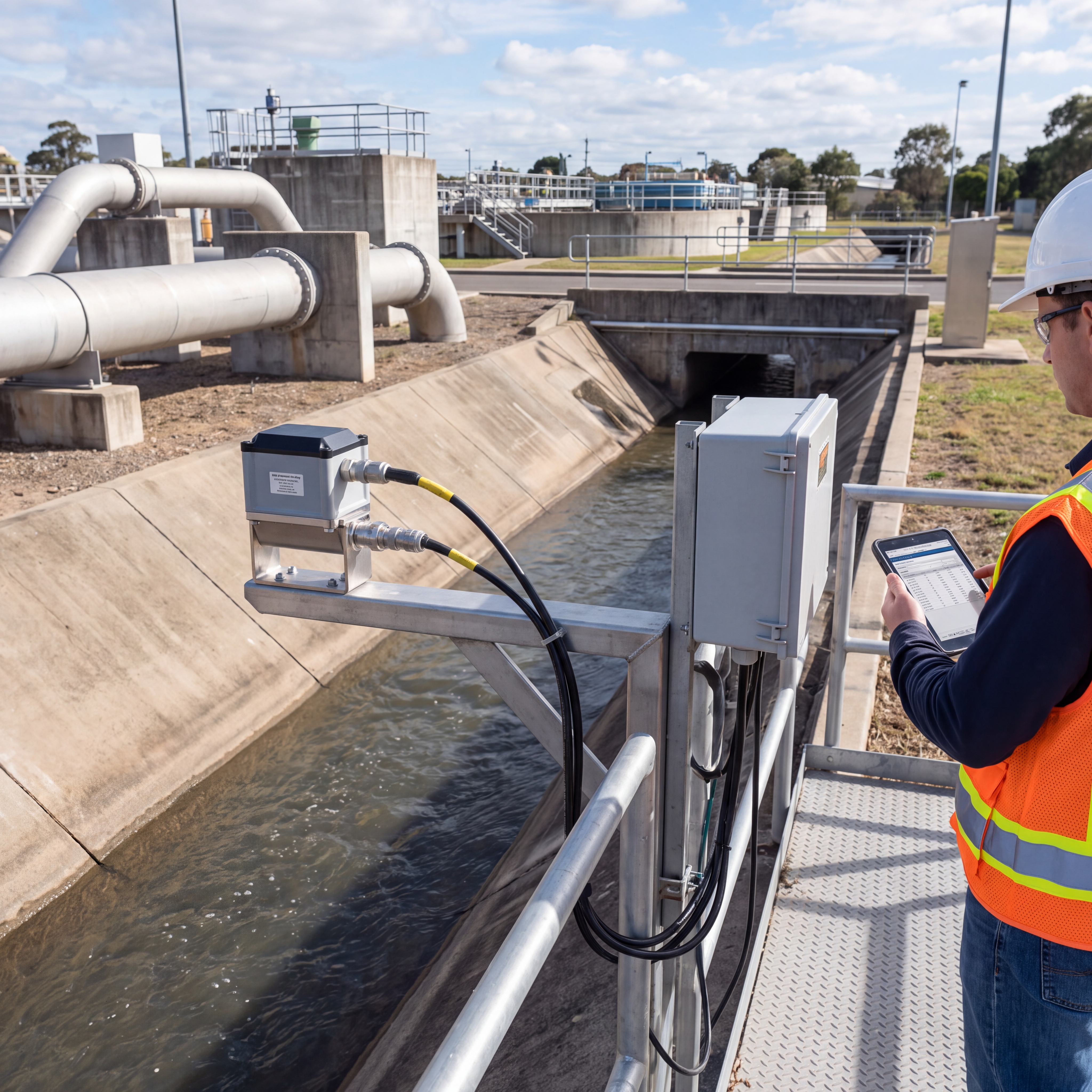
From March to November 2025, an application case of non-contact Doppler flowmeters for urban combined drainage main canals was deployed and validated during the flood season in a prefecture-level city in East China. Yicai Technology participated as the technical provider, cooperating with the local drainage management department to upgrade flow monitoring for 18.6 kilometers of drainage main canals, forebays of 3 rainwater pump stations, and 6 combined sewer overflow outfalls.
Project Background: Challenges in Old Urban Areas
The city where the project is located is a typical plain river network city with an average annual rainfall of about 1,180 millimeters. The urban drainage system was built early, with main canals mostly consisting of rectangular or trapezoidal open channels. Due to the presence of combined sewer pipe sections, catering streets, and construction sites upstream, the canals suffer from long-term silt deposition, grease adhesion, and floating debris.
"Before the upgrade, contact sensors were easily affected by siltation, entanglement, and scouring. In 2023, abnormal data caused by probes covered by debris accounted for over 45%."
To address these issues, the local drainage management department required a solution that minimizes maintenance pressure, simultaneously acquires flow velocity and water level data, and integrates seamlessly into the existing dispatch platform. This led to the selection of a non-contact Doppler surface velocity measurement solution.
Technical Challenges & Solution Architecture
Urban drainage open channels differ significantly from standard laboratory flumes. Non-contact Doppler flowmeters needed to overcome complex challenges including low flow velocity recognition (as low as 0.05 m/s), complex water surface interference (rain, foam, debris), and irregular cross-sections due to siltation.
Microwave Doppler Velocity
24GHz continuous wave radar measuring surface velocity from 0.03 to 15 m/s with ±0.01 m/s accuracy.
Radar Water Level Gauge
26GHz radar with 1mm resolution, installed on the same pole to ensure synchronized data collection.
Integrated Camera
5MP starlight camera for visual verification of water levels, debris, and equipment status via edge AI.
Edge Computing Gateway
Handles flow calculation, anomaly filtering, and encrypted transmission via 4G/5G to the dispatch platform.
Implementation: Calibration is Key
The implementation process involved rigorous site surveys, precise installation, and crucial joint calibration. Since surface flow velocity does not equal cross-section average velocity, the team conducted 18 synchronous comparative measurements using ADCP and propeller meters.
- Ks Value Determination: Regression analysis revealed Ks values between 0.80 and 0.87 depending on channel geometry.
- Three-Level Data Review: Edge anomaly elimination → Threshold/Trend verification → Video review.
- Visual Verification: The integrated camera confirmed water level staff gauge readings with 96.8% accuracy.
Operational Effects: Cost Reduction & Efficiency
As of November 30, 2025, the system had operated continuously for 217 days with a data completeness rate of 99.2%. The non-contact approach significantly reduced O&M workload.
Key Performance Indicators
- ✓ O&M Workload Reduced by ~41%: Inspection frequency dropped from twice daily to once weekly.
- ✓ Warning Timeliness: System identified water level rises 8-14 minutes earlier than manual patrols.
- ✓ Flow Error Control: Comprehensive flow error controlled within ±5.6% after Ks correction.
- ✓ Siltation Management: Video recognition helped identify a 6.5% decrease in flow capacity at Cross-section 4, prompting timely dredging.
Conclusion: Towards Digital Twins
This case demonstrates that non-contact Doppler flowmeters, when integrated with radar water level gauges and video recognition, provide a robust solution for complex urban drainage scenarios. By moving from single-instrument data to multi-source fusion, the utility group has achieved significant cost reductions and operational efficiency improvements.
Looking forward, the integration of this data with digital twin platforms will further enhance real-time dispatch capabilities, allowing for more precise simulation of canal loads and overflow risks under various rainfall scenarios.

