Digital Twin Reshapes the Agricultural Artery: A Chronicle of the Modernization Upgrade of the Qingyuan Irrigation District
Introduction: In the vast wheat fields of the North China Plain, flowing canal water is now nourishing the thirsty soil with unprecedented precision. The wave of national digital agriculture and smart water conservancy construction has swept into the fields, and the modernization upgrade of large and medium-sized irrigation districts is directly related to the baseline of national food security and the ultimate utilization efficiency of water resources. Recently, the highly anticipated "Qingyuan Modern Irrigation District Informatization Upgrade Project" officially passed the completion acceptance inspection. This article will delve into the front lines of the project to analyze how cutting-edge technologies such as IoT, edge computing, and digital twins have taken root in this ancient land, providing a detailed practical sample for the digital transformation of traditional water conservancy projects.
I. Historical Burden: The Transformation Pains Faced by Traditional Irrigation Districts
The Qingyuan Irrigation District spans the major grain-producing areas in northern China, with a designed irrigation area of up to 350,000 mu. As the absolute lifeline of local agricultural production, this "water artery" has carried the hopes for a bountiful harvest for generations. However, after more than 40 years of high-intensity operation, this large-scale water conservancy hub built in the 1970s and 1980s is now facing undeniable aging and fatigue.
The physical aging of infrastructure is merely the surface; the lag in management methods is the core pain point restricting development. For many years, the irrigation district has continued to rely on the extensive "flood irrigation" model. Before the upgrade, the effective utilization coefficient of agricultural water in the Qingyuan Irrigation District was only 0.46. This means that over half of the precious water resources were wasted through evaporation or seepage into the groundwater during long-distance earthen canal transport and unrestrained flood irrigation. In the increasingly water-scarce northern regions, this extensive model has become an unbearable burden.
The daily operation and maintenance of grassroots water management units are equally arduous. Canal inspection and gate operation rely almost entirely on manual labor. During peak irrigation periods, canal inspectors need to ride motorcycles along rugged canal banks, estimating water levels with the naked eye and manually turning heavy cast-iron handwheels to open and close gates. This working method not only consumes enormous manpower and material resources but also yields extremely low efficiency. More critically, due to the lack of scientific and real-time flow data support, water resource allocation often relies on the "empiricism" of older-generation water conservancy workers. Excessive water release upstream leads to the risk of embankment breaches, while insufficient water downstream causes crop yield reductions, and water disputes between upstream and downstream areas occur from time to time. Comprehensively promoting the informatization of the irrigation district and achieving the leap from "experience-based water management" to "data-driven water management" has become the only way out for the Qingyuan Irrigation District to break through its development bottleneck.
II. Breaking the Dilemma: Data Collection and System Integration in Complex Environments
Although the blueprint is excellent, implementation is extremely difficult. During the initial on-site survey and scheme design phase of the project, the engineering team immediately realized how tough this "hard bone" was to crack. Water conservancy projects are located in the wild with harsh environments, and technology implementation faces three insurmountable mountains.
The First Mountain: Blind Spots in Communication Networks
The Qingyuan Irrigation District has significant terrain fluctuations, with some branch and lateral canals buried deep in remote mountainous areas and gullies. In these areas, conventional public network signals from carriers are extremely weak, and there are even large-scale signal blind spots. For IoT systems that rely on real-time data backhaul, without stable communication links, even the most advanced sensors are merely information islands.
The Second Mountain: Guarantee of Water Measurement Accuracy
"Inaccurate measurement" is a recognized chronic problem in agricultural water conservancy. Traditional open-channel flow measurement mostly uses propeller-type current meters or Doppler velocimeters. However, the water quality in the Qingyuan Irrigation District is complex, with lush aquatic weeds in the canals during summer and heavy sediment loads during the flood season. Mechanical propellers are highly susceptible to being tangled by weeds, causing them to stop rotating, while Doppler ultrasonic signals suffer severe attenuation when facing water bodies with high sediment concentrations. It is difficult for flow meters to maintain long-term stability under harsh water conditions, making data distortion the norm.
The Third Mountain: Data Silos and System Integration
The Qingyuan Irrigation District is not entirely without an informatization foundation. Over the past decade, the district has sporadically purchased a small amount of rainfall and water level monitoring equipment. These legacy devices from "various brands" come from different manufacturers and use different underlying protocols such as Modbus and RS485, with a wide variety of data interfaces. How to uniformly integrate these heterogeneous data into a brand-new informatization platform, break down information barriers, and achieve seamless integration of old and new equipment extremely tests the underlying development capabilities of the integrator.
III. Core Architecture: Building a "Cloud-Edge-Device" Integrated Smart System
Faced with numerous challenges, the project team abandoned the traditional single-point transformation mindset and tailored a comprehensive solution based on the industrial IoT "Cloud-Edge-Device" architecture. This solution completely maps the physical irrigation district into the digital space, forming a closed-loop system with the capabilities of perception, thinking, and execution.
- At the "Device" end, reshaping the perception nerves: To address the challenge of water measurement, the engineering team introduced industry-leading integrated measurement and control gates. This equipment adopts multi-path transit-time ultrasonic flow measurement technology. Its principle is to calculate the flow velocity through the time difference of ultrasonic waves propagating with and against the flow. This non-contact measurement method completely avoids the risk of weed entanglement. Meanwhile, the system has built-in powerful signal filtering algorithms to effectively filter out the clutter interference caused by sediment. The gate opening and closing control and high-precision flow metering are integrated, truly achieving "knowing exactly how much water has flowed."
- At the "Edge" end, unblocking the communication arteries: To solve the problem of network disconnection in remote areas, the project team deployed industrial-grade edge computing gateways at key nodes of the canals. These gateways possess powerful local data processing capabilities. In areas without public network signals, the system innovatively adopted LoRa mesh networking technology to connect scattered sensor nodes into a local area network, aggregating the data at nodes with higher elevation and signal coverage for centralized upload. For extremely remote dead zones, the BeiDou satellite short message service was introduced as the ultimate backup. Public networks, LoRa, and BeiDou complement each other, building an all-weather, dead-zone-free data transmission network.
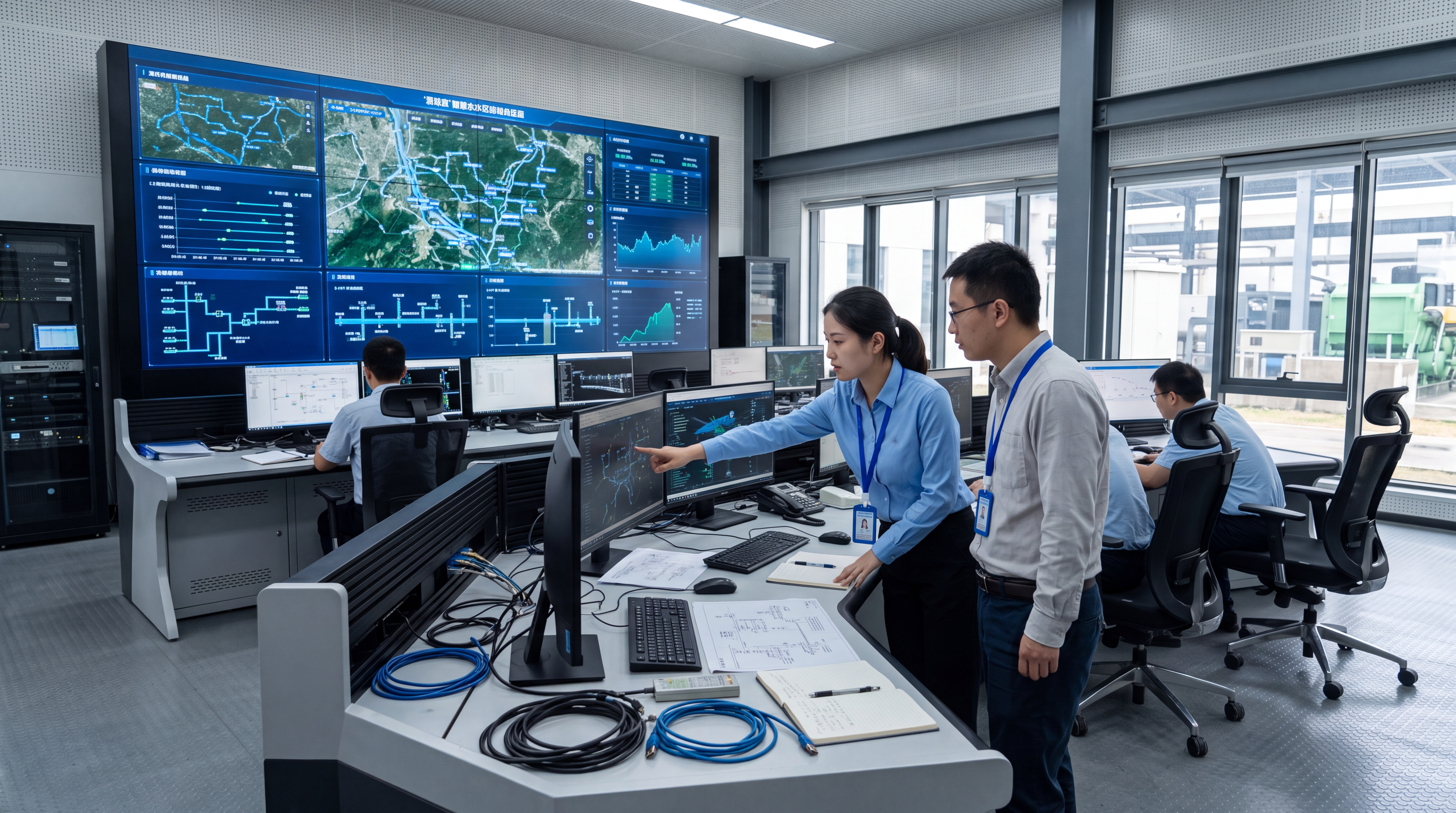
- At the "Cloud" end, creating a digital brain: The project team built an irrigation district informatization comprehensive management digital twin platform. This is far more than just a large screen for display; it is a decision-making hub with deep computing capabilities. The platform deeply integrates a high-precision GIS geographic information system, accurately restoring the 3D terrain and canal routing of the 350,000-mu irrigation district. More importantly, the system embeds complex hydrodynamic models (based on the Saint-Venant equations) and AI prediction algorithms. The brain can automatically calculate the optimal water distribution scheme based on real-time soil moisture, weather forecasts, and water demand requests from each branch canal, achieving on-demand water supply and precise scheduling.
IV. Overcoming Difficulties: A Phased and Steady Implementation Path
What you get from paper is shallow; to truly know something, you must practice it yourself. The entire project lasted 14 months, spanning severe cold and intense heat. To avoid affecting agricultural production, the project team precisely divided the construction cycle into three phases for orderly advancement.
Phase 1: Infrastructure Upgrade and Perception Network Construction
This was the most physically demanding part. The engineering team seized the window of the winter dry season to excavate foundation pits and pour concrete at key nodes of the main and branch canals. In just a few months, 120 integrated measurement and control gates were erected, 85 high-precision water level and flow monitoring stations were distributed along the canals, and 40 deep soil moisture monitors were buried deep in tens of thousands of mu of fertile farmland. A dense neural data network was quietly laid out across the Qingyuan land.
Phase 2: Communication Network Optimization and Platform Construction
The tough battle at the software level was immediately launched. The engineering team completed the deployment of the irrigation district's private network and set about establishing the data link between the underlying devices and the cloud platform. For the complex legacy equipment, the development team wrote dozens of protocol parsing scripts and formulated a unified data standard interface. After weeks of joint debugging, they finally achieved "plug and play" and unified management for all existing and incremental hardware devices, thoroughly eliminating data silos.
Phase 3: Model Training and System Joint Debugging
Hardware deployment is only the foundation; making the system "smart" is the key. The project team "fed" nearly ten years of historical hydrological data, rainfall records, and weather forecast data of the Qingyuan Irrigation District into the AI model for deep training. The algorithm continuously iterated on massive data to optimize the intelligent scheduling strategy. Subsequently, the system faced a practical test during a complete spring irrigation season. During the trial operation, the cloud platform issued precise commands, hundreds of gates responded automatically, and the full-line automated linkage control ran as smooth as silk, with all indicators meeting or even exceeding the design requirements.
V. Value Realization: Data Evidencing Substantial Leaps in Water Saving and Efficiency Enhancement
Today, the informatization project of the Qingyuan Irrigation District has been officially in operation for a full year. Behind the dry data are tangible economic benefits and ecological dividends.
- Stunning Water Saving Results: Thanks to the precise water measurement system and scientific water distribution scheduling, the irrigation district has completely bid farewell to the history of "flood irrigation." The effective utilization coefficient of agricultural water has surged from 0.46 before the upgrade to 0.58. This seemingly small numerical change means that the irrigation district saves about 12 million cubic meters of water annually. This is equivalent to the storage capacity of a medium-sized reservoir, or the water volume of nearly 10,000 standard swimming pools. The saved water resources are replenished back into the groundwater depression cone, injecting a source of living water into the local ecological restoration.
- Agricultural Efficiency Enhancement: Smart irrigation has demonstrated a powerful empowering effect. Based on the data transmitted by soil moisture sensors, the system keeps the soil moisture consistently within the golden range most suitable for crop growth. Bidding farewell to uneven droughts and waterlogging, crops are growing vigorously, with the average yield per mu increasing by 8.5% that year, directly increasing farmers' economic income.
- O&M Efficiency Transformation: Grassroots water management personnel have experienced a subversion in their working methods. Now, in the operation control room, staff only need to "click the mouse to open the gate." Remote automated control has reduced the workload of frontline inspection and management personnel by 60%, significantly cutting unit labor costs. More importantly, the accuracy of water measurement data has remained stable at over 95% in the long term. A clear and transparent "water account" has completely eliminated the neighborhood disputes caused by competing for water sources in the past. Transparent and precise data has also laid a solid foundation of trust for promoting agricultural water rights trading and comprehensive water pricing reform locally.
Conclusion
The informatization upgrade practice of the Qingyuan Irrigation District is a profound industry revelation. It objectively proves that through the deep integration of IoT, edge computing, and big data technologies, traditional water conservancy projects can completely break free from historical shackles and radiate strong new vitality. This transformation is far more than just the renewal of a few gates and sensors; at its core, it is a profound revolution in the concept of water resource management, shifting from extensive to refined, scientific, and law-based management. In the future, the Yicai Technology News Center will continue to take root at the front lines, closely following engineering practices in the fields of smart water conservancy and digital agriculture, recording and sharing more real imprints of using technological power to safeguard the national granary and empower high-quality development.
Learn More About Smart Water Solutions
Ready to upgrade your irrigation infrastructure? Visit www.cssoc.com or call our experts at 400-808-9114 for customized digital twin and IoT solutions.

