From Technical Challenges to Successful Implementation: A Case Study on a Smart Water Management Project
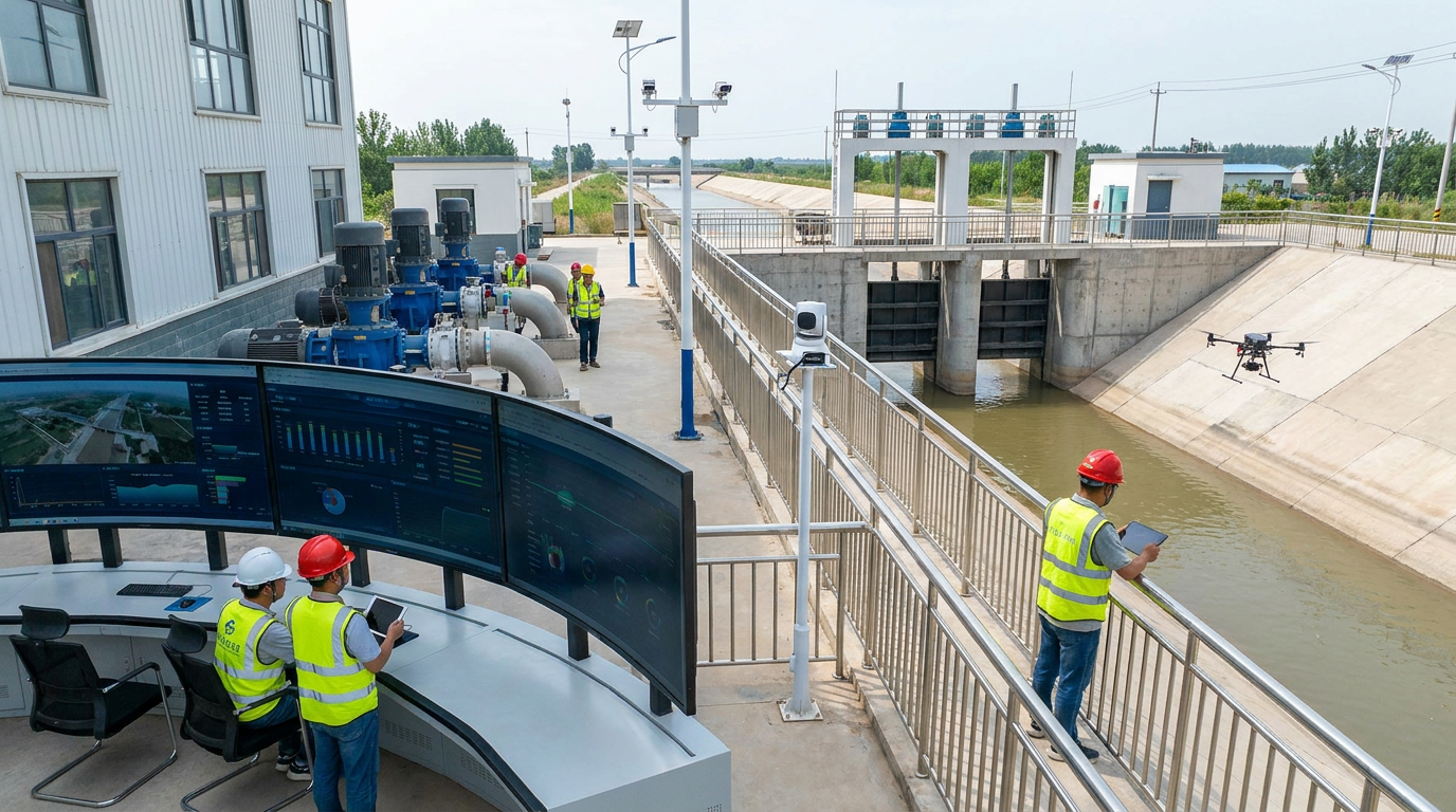
Introduction: Moving from "Visibility" to "Precision"
Against the backdrop of agricultural water consumption accounting for over 60% of total societal water use, irrigation districts are shifting from traditional canal management to a data-centric modern operational model. Taking the informatization upgrade project of a large Yellow River diversion irrigation district in the lower reaches as an example, this article presents a practical engineering case covering 865,000 mu of irrigated area.
Upon completion, the automatic measurement coverage rate of the main canals reached 100%, and the online measurement coverage rate of key branch canal turnouts reached 92.6%. The effective utilization coefficient of irrigation water increased from 0.532 to 0.611, reducing annual water transmission losses by approximately 43 million cubic meters. Data shows that digitalization is not merely about equipment upgrades, but a systemic transformation in water resource dispatch and grassroots management.
Project Background: Rigid Water Resource Constraints
Located in the alluvial plain of the lower Yellow River, this irrigation district serves as a major production area for local grains and vegetables. Prior to renovation, the district faced critical issues:
- Low Measurement Coverage: Only 11 manual staff gauge sections existed; most relied on empirical estimation.
- Inefficient Dispatch: Instructions were transmitted via telephone and paper, leading to significant deviations in water distribution.
- High Loss Rates: In the 2022 season, per-mu water consumption was 386 m³, with a main canal loss rate close to 14.6%.
Technical Challenges: From "Visible Canals" to "Clear Water Accounts"
The technical team faced five distinct hurdles during the implementation of the smart irrigation system:
Hydraulic Coupling Complexity
Slopes range from 1/8000 to 1/2500 with significant water level fluctuations (0.2–3.6m). Single-point sensors cannot reflect storage changes or support joint dispatch.
High-Sediment Flow Measurement
Sediment concentrations reach 8–12 kg/m³. Traditional mechanical meters fail easily, and irregular channel cross-sections make stable measurement difficult.
Infrastructure Deficits
Monitoring points are scattered up to 23km away. Many locations lack stable grid power, requiring robust solar and hybrid communication solutions (4G/LoRa).
Data Silos & Operational Habits
Previous systems used fragmented data formats. Additionally, grassroots managers needed training to trust automated remote control over manual operations.
Solutions: Integrated "Perception, Measurement, Dispatch, and Control"
With a total investment of 187 million RMB, the project adopted a comprehensive approach:
Perception Layer
Built 186 automatic measurement sections using ultrasonic transit-time flowmeters (main canals) and radar level gauges (branch canals). Added 48 soil moisture stations and 6 weather stations.
Network Layer
Deployed a hybrid mode: "4G/5G primary, LoRa supplementary, BeiDou emergency." Achieved 99.5% communication availability with <5s response time for dispatch instructions.
Control Layer
Automated 37 gates with PLC cabinets. Retained local manual modes for safety. Implemented hierarchical permissions and abnormal locking mechanisms.
Platform Layer
Integrated 5,620 monitoring points into a smart management platform featuring real-time monitoring, intelligent dispatch, and automated water fee settlement.
For high-sediment flows, the project adopted a multi-parameter fusion scheme. Main canal measurement error is controlled within ±2%, and branch canal turnout error within ±3%.
Implementation Process: Three Phases
Phase I: Foundation (Apr – Nov 2023)
Focus: Canal surveying and main/branch measurement installation. Completed 186 section measurements and corrected rating coefficients for 17 sections, reducing measurement error from ±12% to ±3%.
Phase II: Automation (Mar – Oct 2024)
Focus: Gate automation and joint dispatch. Conducted 12 rounds of joint debugging. On a 12.6km demonstration section, water level fluctuation was controlled within ±0.08m (down from ±0.25m).
Phase III: Intelligence (Mar – Sep 2025)
Focus: Platform deepening and mobile terminals. Established O&M mechanisms ("daily inspection, weekly consultation") and trained 216 personnel. Reduced average fault handling time to <4 hours.
Application Results: Efficiency & Conservation
The project achieved simultaneous improvements in conservation, measurement accuracy, and management efficiency. Per-mu irrigation water use dropped by 18.7% (from 386 to 314 m³). Water fee collection rates rose from 82% to 97% due to transparent, measurement-based billing. Operation times for single gate stations shortened from 45 minutes to just 3 minutes.
Experience and Future Outlook
This case demonstrates that irrigation district informatization must avoid "valuing hardware over data." Success required embedding technical systems into daily business processes, including rigorous calibration and institutional reform.
Looking ahead, the district plans to extend informatization to lateral and farm canals ("last mile") by 2027. Digital twin pilots will couple hydrodynamic models with crop water demand models to achieve unattended operation for key sections. Ultimately, this provides a replicable sample for building modern, smart, and efficient irrigation districts that prioritize water conservation.

