Smart Irrigation vs. Water Conservation: A Selection Guide for Smart Water Management Scenarios
Comparison of Irrigation District Informatization Technology Roadmaps: How to Select Water Metering, Smart Irrigation, and Water-Saving Closed-Loop Solutions
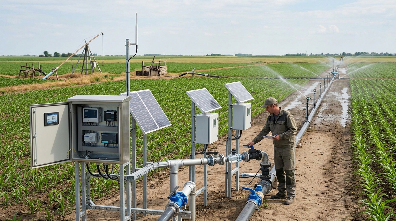
With the continued advancement of irrigation district rehabilitation, supporting facilities, and modernization, irrigation district informatization is shifting from single-point monitoring to a closed-loop system based on water metering, executed by smart irrigation, and targeting water-saving benefits. Water source conditions, channel system structures, crop types, and management capabilities vary widely across regions, so there is no single universal technology roadmap. This article compares common roadmaps from the perspectives of sensing and metering, communication transmission, platform control, algorithmic scheduling, and scenario selection, providing reference for irrigation district construction.
I. Technology Roadmap Panorama: Not Device Stacking but a Closed Loop
Irrigation district informatization typically consists of a sensing layer, network layer, platform layer, execution layer, and application layer. The sensing layer addresses “where the water comes from, how much is used, and whether the soil lacks water”; the network layer addresses whether data can be reliably returned; the platform layer addresses scheduling commands, statistical reports, and warning analysis; the execution layer addresses automatic control of sluice gates, pump stations, valves, and water-fertilizer equipment; and the application layer targets water-use management, water-saving irrigation, water rights trading, flood control, and drought relief. The core of technology roadmap selection is to match each layer with the actual needs of the irrigation district.
From engineering practice, some projects have problems such as “building the platform first and supplementing data later,” “emphasizing display while neglecting metering,” and “emphasizing intelligence while neglecting operation and maintenance.” If water metering data are unreliable, smart irrigation easily becomes empirical control; if communication links are unstable, remote control is difficult to implement.
Therefore, roadmap comparison should be conducted across five dimensions: accuracy, cost, reliability, scalability, and operation and maintenance difficulty.
II. Sensing and Water Metering Roadmaps
Open-channel irrigation districts most commonly use the “water level + weir/flume” method for indirect flow measurement. Parshall flumes, triangular weirs, rectangular weirs, and broad-crested weirs have mature structures and are suitable for canal heads, diversion points, and turnouts. Radar water level gauges typically achieve accuracy of ±1 to ±3 mm, are less affected by temperature and water mist, and are suitable for sediment-laden flow. Ultrasonic water level gauges have lower cost and accuracy of about ±3 to ±5 mm, but are susceptible to water vapor and dust. Pressure-type water level gauges have simple structures and low prices, are suitable for well water or short-distance monitoring, but are prone to clogging.
Direct Flow Measurement
- Ultrasonic Doppler: Suitable for open channels/pipes, error ±3% to ±8%.
- Electromagnetic Flowmeters: For full-pipe pressurized flow, accuracy ±0.5% to ±2%. Requires specific conductivity; affected by empty pipes/power outages.
Soil & Video Monitoring
- Soil Moisture: FDR/TDR sensors (error ±3% to ±5%), installed at 20cm, 40cm, 60cm depths.
- Video: 2-4 MP cameras for gate recognition and debris warning, though they increase bandwidth/storage pressure.
For example, in a medium-sized irrigation district (~120,000 mu), using broad-crested weirs and radar gauges increased metering coverage from 40% to 85%, with annual water savings of ~1.8 million cubic meters. Another pipeline district (<50,000 mu) using DN200-DN400 electromagnetic flowmeters achieved ±1% accuracy under full-pipe conditions, reducing leakage rates from 18% to 9%. These cases show that water metering roadmaps depend on measurement point location, flow regime, and O&M capability, not just cost.
III. Communication Roadmaps: NB-IoT, LoRa, 4G, 5G, Fiber Optic, and BeiDou
The communication roadmap determines data return frequency and control latency.
| Technology | Best Use Case | Pros & Cons |
|---|---|---|
| NB-IoT | Low-frequency acquisition (level, moisture) | + Low power (5-10y battery) - High latency, unsuitable for video/control |
| LoRa | Self-built networks in hilly/mountainous areas | + Controllable cost, long range - Limited bandwidth, interference risks |
| 4G / 5G | Gate stations, pumps, video, remote control | + Mature deployment (4G) + Low latency/high bandwidth (5G) - Coverage/tariff constraints |
| Fiber/Ethernet | Fixed nodes (canal head, dispatch center) | + Stable, high bandwidth (>100Mbps) - High investment, long construction |
| BeiDou SMS | Emergency monitoring in remote areas | + Works without public network - Low frequency (2-4 times/day) |
In actual selection, hybrid communication is commonly used: main canals use fiber optic or 4G/5G; field metering uses NB-IoT or LoRa; remote nodes use BeiDou as fallback. For critical control systems, it is recommended to use 4G/5G together with local PLC dual channels, ensuring execution even when the network is down.
IV. Platform and Control Roadmaps
Platform roadmaps can be divided into centralized, edge-based, and cloud-based approaches. SCADA and PLC are suitable for pump/gate stations requiring high real-time performance. Edge gateways perform protocol conversion and local logic, reducing cloud dependence. Cloud platforms suit multi-district aggregation and mobile inspection but require attention to data sovereignty and outage risks.
Digital twins are valuable for large districts but demand high data quality. If metering error exceeds ±10%, model results may deviate from reality. At the execution layer, safety must include opening limits, pressure protection, and manual override capabilities.
Case Study: An irrigation district adopting “cloud + edge gateway + PLC” connected 120 gate stations and 800+ metering points. Average command latency was <3 seconds, local operation lasted 72 hours during outages, and patrol frequency decreased by 40%.
V. Algorithm and Scheduling Roadmaps
Algorithms generally fall into four categories:
- Rule-Based: Simple thresholds (e.g., irrigate if soil moisture <30%). Transparent and easy to maintain, but poor adaptability to sudden weather changes.
- Mechanistic Models: Calculate crop water requirements (ETc) using ET0 and Kc. Suitable for large districts but require continuous meteorological/soil data.
- Data-Driven/AI: Used for prediction and anomaly detection. Requires 1-3 years of stable historical data to avoid overfitting.
- Hybrid Models: Combine mechanistic boundaries with AI corrections. Most realistic for complex irrigation systems.
Fertigation is a high-value scenario. Closed-loop control of EC, pH, and flow can save water and fertilizer, but must include salinity warnings to prevent soil damage. A vegetable base using linked control saw a 35% decrease in water use and 20% decrease in fertilizer use after one year.
VI. Typical Scenario Selection
Large Canal Districts (>200k mu)
Goal: Allocation fairness, dispatch safety.
Tech: High-precision metering (radar/weirs), Fiber/4G/5G comms, Private/Hybrid Cloud + SCADA. Phased implementation recommended.
Medium Districts (50k-200k mu)
Goal: Improve coverage & efficiency.
Tech: NB-IoT/LoRa hybrid, Weirs/Ultrasonic flowmeters, Edge gateways, Lightweight cloud.
Hilly Small Districts
Goal: Cost reduction, ease of O&M.
Tech: Electromagnetic/Clamp-on ultrasonic, LoRa/4G, Solar power, Rule-based control.
Greenhouses & Facility Ag
Goal: Precise fertigation, stability.
Tech: Soil moisture/EC/pH sensors, Solenoid valves, 5G/Wired networks for low latency.
Investment structures generally allocate 30-40% to sensing/metering, 10-20% to communication, 20-30% to platform/software, and 15-25% to control execution. Neglecting metering while investing only in platforms makes water-saving benefits unquantifiable.
VII. Selection Recommendations and Outlook
Selection should adhere to four principles:
- Define objectives before defining the roadmap. Prioritize hardware based on whether the goal is billing, saving water, or dispatch safety.
- Ensure data availability before pursuing algorithmic intelligence. Target data completeness ≥95% and online rate ≥98%.
- Communication and control must have redundancy. Retain local manual operation and edge control capabilities.
- Operation and maintenance must be front-loaded. Include calibration, dredging, and upgrades in annual budgets.
Future developments will focus on low-cost sensing, satellite remote sensing, BeiDou positioning, and digital twin dispatch. However, the core of the water-saving closed loop remains unchanged: accurate metering, stable transmission, reliable execution, and implemented management processes. The final conclusion is not to select a single device type, but to form a buildable, operable, and assessable system tailored to local terrain, crops, and management capabilities.

