1. Background: Why Reservoir Level Monitoring Differs
Reservoir water level serves three masters at once: flood control, water supply dispatch and dam safety assessment. Unlike rivers and sewers, reservoir stations face a unique combination of conditions — a large open fetch that can generate wind-driven waves of 0.3–0.8 m, a working range that frequently spans 20–50 m of drawdown, and fixed measurement points at the dam face, intake or spillway where construction windows are narrow. Stilling-well float gauges demand significant civil works, while submersible pressure transmitters suffer from siltation and annual maintenance. Non-contact radar level transmitters have therefore become the de facto standard for reservoir telemetry and automated dam-face measurement.
2. Technical Analysis: Range, Frequency and Interference Handling
- Range and accuracy grading: Select the range as "maximum historical drawdown + 20% margin"; mainstream devices offer 30–70 m. Accuracy should follow the use case — dam safety monitoring typically requires ±3 mm or better (referencing SL 551 and GB/T 50138), while supply metering can accept ±5–10 mm to avoid over-specification.
- Frequency selection: 80 GHz FMCW radars provide a beam width of about 3°, which rejects nearby reflections from dam faces and gate piers and delivers the highest accuracy — the preferred choice for dam-face installation. 26 GHz units penetrate rain and fog more effectively and suit long-range mountain sites, but their 8°–10° beam calls for careful placement away from spillway piers and hoist platforms.
- Wave and false-echo handling: On open reservoirs, multi-echo tracking and median filtering are mandatory to stabilise the reading under wind waves. Gate movements and floating debris generate transient echoes, so the transmitter should expose a signal-confidence (echo quality) value that the RTU uses for data validation and outlier rejection.
3. Engineering Recommendations: Installation, Commissioning and O&M
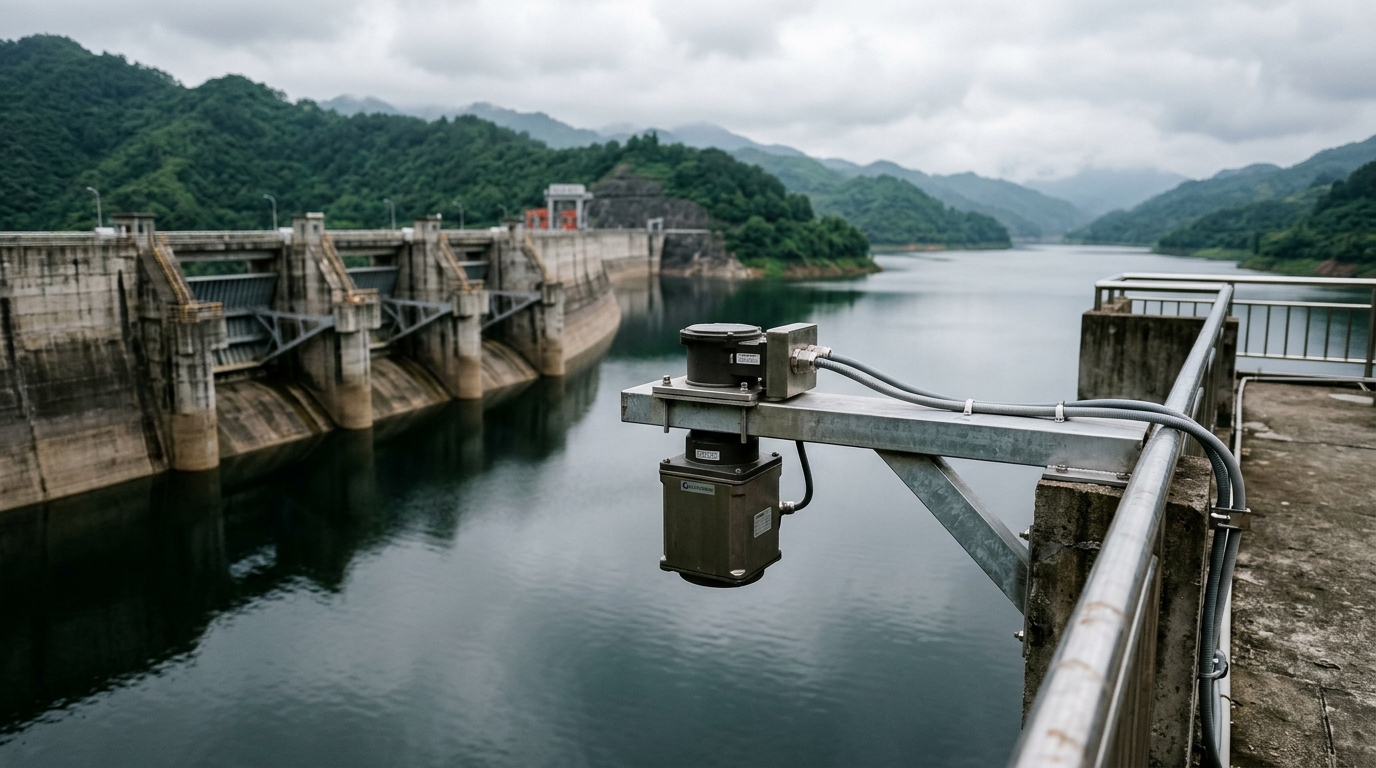
- Mounting: Install on an upstream-face cantilever bracket or a stilling-well observation tower with the antenna plane vertical, clear of gate operation zones, spillway turbulence and intake vortices. The mounting elevation should sit at least 0.5 m above the check flood level.
- Lightning protection and power: Dam-crest stations are high-exposure lightning targets. Fit surge protection devices on both power and signal lines and provide a dedicated earth (≤4 Ω). Power the IoT RTU from solar plus battery sized for 7 consecutive overcast days; report every 5 minutes during floods and 30 minutes in normal operation, with rate-of-change triggered escalation.
- Commissioning and redundancy: Perform empty-tank calibration and false-echo mapping before service; accept the installation only when the deviation against a staff gauge is ≤2 cm. Pair the radar with an in-dam pressure transducer as a redundant channel with automatic cross-comparison to flag drift.
- Maintenance: Inspect the antenna for condensation and icing quarterly (heated antennas are recommended for cold regions), check bracket corrosion and anchorage before each flood season, and perform an annual on-site verification against a reference standard.
4. Conclusion
Reliable reservoir level measurement is ultimately about sustained credibility under open-water, wide-range and lightning-prone conditions. An 80 GHz narrow-beam radar, disciplined installation geometry, proper surge protection, echo-quality-based data QC and dual-channel redundancy together deliver ±3 mm-class accuracy and data availability above 99% — a dependable foundation for flood dispatch, supply metering and dam safety assessment.