Smart Water Management Trend Outlook: 80 GHz Radar Reshaping Smart Water Management
"Smart water management is advancing from 'digital recording' to 'intelligent governance.' High-precision non-contact monitoring will become a crucial support for flood safety, water resource management, and urban resilience."
In recent years, the frequent occurrence of extreme rainfall, basin-wide floods, flash floods, and urban waterlogging has shifted the focus of water management from engineering expansion to risk identification, real-time monitoring, and intelligent dispatch. Public data shows that there are over 98,000 reservoirs and more than 120,000 hydrological monitoring stations nationwide, yet significant sensing blind spots remain in small and medium-sized rivers, irrigation canals, pump and gate clusters, and urban low-lying areas. The value of smart water management now lies not merely in making water conditions "visible," but in achieving "accurate measurement, fast transmission, clear calculation, and effective prevention" under complex weather conditions.
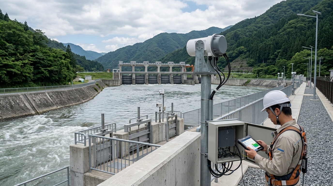
In this process, the upgrading of sensing terminals has become a focal point for the industry. Traditional contact-based equipment is prone to damage or signal distortion in environments with floods, high sediment loads, and abundant floating debris, prompting the faster deployment of non-contact radar monitoring. High-precision sensing technologies represented by 80 GHz mmWave radar are expanding from single-point water level measurement to real-time monitoring of multiple parameters, including water level, flow velocity, discharge, gate position, and ponding depth, providing a more reliable data foundation for digital twin river basins and the "Four Forecasts" system.
Market Trends: From Standalone Devices to Sensing Networks
The smart water management market is transitioning from project-based construction to systematic operation. In the past, industry procurement primarily focused on standalone devices such as hydrological stations, water level gauges, rain gauges, and video surveillance. In recent years, local water authorities have paid more attention to basin-scale sensing networks, data aggregation platforms, model computation, and O&M services. Multiple industry research institutions predict that investments in water informatization and smart water management will maintain double-digit growth over the next five years, with the proportion of sensing terminals, edge computing, data governance, and model platforms continuing to rise.
Reservoir Safety
Focuses on forebay water levels, seepage, displacement, and spillway status.
Urban Drainage
Focuses on ponding depth at overpasses, tunnels, underground spaces, and flood-prone areas.
Flash Flood Prevention
Focuses on rainfall, channel water levels, and critical warning thresholds.
Irrigation Modernization
Focuses on canal water levels, gate openings, and water distribution efficiency.
From the perspective of terminal form factors, the market favors low-power, miniaturized devices that require little to no calibration or maintenance. Solar power, 4G/5G, NB-IoT, and BeiDou short message communication have become standard configurations. For rivers, mountain valley outlets, and remote reservoirs that are difficult to access during flood seasons, the ability of equipment to operate continuously under conditions of network outages, power failures, and severe weather has become a crucial metric in bidding evaluations. Due to its non-contact nature, low maintenance requirements, and adaptability to complex water surface environments, 80G radar is gradually becoming a preferred option for water level and surface flow velocity monitoring.
Policy Impact: Digital Twins and "Four Forecasts"
Policy is the core driving force behind the development of smart water management. In recent years, the Ministry of Water Resources has successively proposed directions such as advancing smart water management, building digital twin river basins, and developing new water infrastructure, forming a series of technical requirements around data foundations, model platforms, visualization, and cybersecurity. According to relevant plans, significant progress will be made in digital twin river basin construction by 2025, and by 2035, water management business and digital mapping and intelligent simulation will achieve deeper integration. Policy objectives are pushing water monitoring from "data collection" to "decision support."
"If front-end monitoring accuracy is insufficient, the missing data rate is high, or timestamps are inconsistent, even the most advanced subsequent models will struggle to produce reliable conclusions."
The "Four Forecasts" system—encompassing forecasting, early warning, rehearsal, and contingency planning—imposes higher requirements on sensing data. Forecasting requires continuous, stable, and traceable sequences of rainfall and water conditions; early warning requires second- or minute-level updates; rehearsal requires the linkage of basic data such as terrain, cross-sections, gates, pumps, and reservoir capacity with real-time water conditions; and contingency planning requires translating model results into dispatch instructions. At the funding level, channels such as central budget investments, local government special bonds, ultra-long-term special treasury bonds, and water conservancy construction funds are increasingly shifting towards flood safety, water resource allocation, irrigation district renovation, and digital twin projects.
Technological Direction: 80G Radar Advantages
In traditional water level monitoring, float-type water level gauges are susceptible to interference from floating debris, aquatic weeds, and wellhead siltation; pressure-type gauges require contact with water, posing risks of temperature drift, silt burial, and corrosion; and ultrasonic gauges are prone to signal jumps in environments with strong winds, foam, water vapor, and temperature gradients. In contrast, 80G mmWave radar employs a non-contact measurement method. Installed above the water surface, it calculates distance by transmitting high-frequency electromagnetic waves and receiving echoes from the water surface. It does not rely on water contact, making it suitable for environments with floods, high sediment loads, sewage, and corrosive water bodies.
- High Precision: Static water level accuracy reaching ±2 mm to ±5 mm with a resolution of 1 mm.
- Narrow Beam Angle: Typical beam angles controllable between 3° and 6°, avoiding clutter interference from bridge piers and slope protection.
- Real-Time Capability: Data output at 1 Hz to 20 Hz supports local filtering and anomaly rejection.
- Low Power Consumption: Average power consumption below the watt level, suitable for solar-powered remote scenarios.
80G radar typically operates in the 76 GHz to 81 GHz frequency band using an FMCW architecture. The high frequency band provides shorter wavelengths and narrower beam angles. Real-time monitoring capability is another advantage. When the water level rises beyond a set threshold within one minute, or when flow velocity and discharge fluctuate suddenly, the terminal can directly report the alarm, reducing platform polling latency. Combined with solar power and low-power design, this deployment method significantly reduces construction and O&M difficulties for flash flood channels and irrigation districts.
Application Scenarios: Closed-Loop Practices
Small & Medium Rivers / Flash Floods
Deployed on bridges or shore-based poles, 80G radar ensures continuous operation during floods, reducing personnel risk. Industry cases show linking radar with rain gauges increased data update frequency from 10 minutes to 1 minute, capturing flood rising processes more completely.
Reservoirs & Pump-Gate Projects
Monitors forebay water levels, spillway status, and gate openings. Radar terminals collect data every 5 minutes (increasing to 1 minute during floods), automatically pushing alerts when water levels approach control limits to assist in dispatch decisions.
Irrigation Districts
Shortens collection cycles from 15 minutes to 1 minute. After cross-sectional calibration, discharge estimation errors have been reduced from ~15% to 5%-8%, supporting on-demand water supply and coordinated dispatch.
Urban Drainage
Measures ponding depths (0-3m) with millimeter resolution at high-risk points like underpasses. Reporting delay during heavy rain is controlled within 30 seconds, linking with pump stations to reduce information lag.
Industry Challenges & Future Outlook
Despite the obvious advantages of 80G radar, non-contact measurement is not without its boundaries. Wind waves, heavy rain, surface foam, and installation bracket vibrations can affect echo quality. Discharge measurement requires particular caution; radar measures surface flow velocity which cannot be directly equated to cross-sectional discharge without combining topography and roughness coefficients. O&M and standards remain practical challenges, requiring clearer data quality assessment mechanisms and life-cycle budgeting for maintenance. Cybersecurity is equally critical, demanding identity authentication and encrypted transmission for distributed terminals.
Over the next five to ten years, smart water management will exhibit a trend toward "integrated space-air-ground-water" sensing. Satellite remote sensing will handle large-scale identification, while UAVs acquire terrain data. Fixed radar terminals will provide high-frequency continuous observation at key nodes. Digital twins and AI will further enhance data value, shifting flood routing and water quantity dispatch from offline computation to real-time deduction.
Conclusion
Overall, smart water management is advancing from "digital recording" to "intelligent governance." Against the backdrop of normalized extreme weather and national water network construction, high-precision non-contact monitoring will become a crucial support for flood safety and urban resilience. The industry needs to promote the scaling of advanced sensing technologies like 80G radar through more open interfaces, unified standards, and sustainable O&M mechanisms.

