Development Opportunities for Smart Water Management in 2026 Against the Backdrop of the Dual Carbon Goals
In recent years, the intertwined occurrences of extreme rainfall, basin-wide floods, urban waterlogging, droughts, and rigid constraints on water resources have placed immense pressure on traditional water management approaches. These legacy systems, relying primarily on manual inspections, experience-based dispatching, and periodic censuses, are no longer sufficient. An industry consensus is emerging: smart water conservancy is not merely about moving information such as water levels, rainfall, and video feeds onto screens. Instead, it requires high-frequency, continuous, and reliable sensing data to support the closed loop of forecasting, early warning, rehearsal, and contingency planning. This is especially critical in scenarios involving small and medium-sized rivers, flash flood gullies, irrigation canals, reservoir spillways, and urban waterlogging-prone areas.
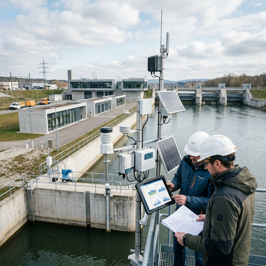
"Smart water conservancy is transitioning from 'seeing water conditions' to 'foreseeing risks.' The key lies in high-frequency, continuous, and reliable sensing data."
In these complex environments, monitoring targets are dispersed, conditions are harsh, and maintenance is limited. Traditional contact sensors are highly susceptible to silt, floating debris, corrosion, and sedimentation, making non-contact sensing a key developmental direction.
Introduction: From "Seeing Water Conditions" to "Foreseeing Risks"
Against this backdrop, keywords such as 80G radar, non-contact measurement, high-precision water level and flow velocity identification, and real-time monitoring frequently appear in tender documents and technical proposals for smart water conservancy projects across various regions. Compared to early configurations dominated by 24GHz radar, ultrasonic, and pressure-type water level gauges, the 80GHz millimeter-wave radar, with its narrower beamwidth, stronger anti-interference capability, and smaller blind zone, is transitioning from a "high-end option" to a "high-reliability option."
It meets the water conservancy industry's demand for all-weather, round-the-clock data, while also satisfying the expectations of digital twin watersheds, digital twin water networks, and digital twin engineering projects for high-quality underlying data. In the coming years, the upgrading of the perception layer will determine whether smart water conservancy systems can evolve from display-oriented platforms to decision-oriented platforms.
Market Trends: Investment Focus Shifts from "Building Systems" to "Ensuring Safety, Enhancing Efficiency, and Achieving Operability"
In terms of market size, the growth foundation of smart water conservancy stems from the sustained high level of investment in water conservancy infrastructure. Public data shows that national water conservancy construction investment has remained above one trillion yuan for several consecutive years, exceeding 1.19 trillion yuan in 2023 and maintaining a high level in 2024. Unlike past civil engineering investments focused primarily on dams, embankments, and water diversion projects, this new round of investment places greater emphasis on engineering safety monitoring, digitalization of operation and management, intelligent basin dispatching, and refined allocation of water resources. Smart water conservancy is evolving from a supplementary facility into a crucial component of project initiation.
The Three Tiers of Market Space
- Tier 1: Basic Sensing Expansion. Construction of stations for rainfall, water level, flow, flow velocity, waterlogging depth, and video imagery.
- Tier 2: Networks and Edge Computing. Encompassing 4G/5G, BeiDou short message service, LoRa, NB-IoT, satellite IoT, and edge gateways.
- Tier 3: Models and Business Applications. Including flood forecasting, hydrodynamic simulation, water resource dispatching, irrigation water measurement, river and lake supervision, and engineering safety diagnosis.
The demand structure is also changing. Early projects often focused on visual display, with main deliverables being "a large screen, a platform, and several cameras." In recent years, purchasers have paid closer attention to whether data can be stably integrated, whether early warnings can be verified, whether models can be implemented, and whether operation and maintenance have clear metrics. Quantitative requirements such as data completeness rate, online rate, false alarm rate, response time, equipment protection rating, power supply endurance, and communication backup have begun to appear in tender documents in many regions.
Consequently, the market space presents three tiers (as detailed above). As sensing density increases, industry value is shifting from single-point equipment sales to comprehensive competition in "data quality + O&M services + business closed-loop." Monitoring blind spots in small and medium-sized rivers, flash flood gullies, rural rivers, and irrigation lateral and tertiary canals will become significant incremental markets for 80G radar water level gauges, radar flow velocity meters, and integrated monitoring stations.
Technical Directions: 80G Radar Drives Non-Contact, High-Precision, Real-Time Monitoring
The technological evolution of smart water conservancy centers on enhancing data credibility and decision-making timeliness. Traditional contact measurement still holds value in stable environments, but water conservancy sites often face challenges such as high sediment load, floating debris, large water level fluctuations, riverbed scouring and silting, and construction disturbances. Non-contact radar measurement emits millimeter waves toward the water surface and receives the echoes, utilizing FMCW or Doppler principles to calculate distance, velocity, and water surface changes. This avoids direct contact between the sensor and the water body, reducing the risks of siltation, corrosion, entanglement, and destruction by floods.
Why 80GHz?
The focus on 80G radar is closely related to its physical characteristics. The millimeter waves in the 76GHz to 81GHz frequency band have a wavelength of approximately 3.8 millimeters, making it easier to achieve a narrow beamwidth compared to lower-frequency solutions like 24GHz. The antenna beamwidth of a typical 80G radar water level gauge can be controlled at around 3 degrees, and some integrated devices can narrow it further. This means that in environments with limited installation space, such as bridges, gates, canal side walls, and spillways, the signal is less susceptible to interference from riverside weeds, guardrails, rocks, and wave clutter. For wide and shallow rivers, compound cross-sections, and narrow urban waterlogging-prone areas, the narrow beamwidth can improve echo quality and reduce multipath interference.
Measurement Range & Accuracy
- Range: 20–80m (expandable to >100m)
- Blind Zone: 0.1–0.3m
- Water Level Accuracy: ±2mm to ±10mm
- Resolution: Up to 1mm
Flow Velocity Performance
- Principle: Doppler-based
- Accuracy: ~±0.01 m/s
- Cycle: < 1 second
- Output: Instantaneous flow estimates
Real-Time Capabilities and Edge Intelligence
The enhancement of real-time monitoring capabilities is equally critical. In the past, automatic hydrological reporting typically adopted 5-minute, 15-minute, or 1-hour intervals, which sufficed for daily monitoring but left a very limited time window when facing sudden flash floods, short-duration heavy rainfall, and urban waterlogging. When paired with edge computing gateways, 80G radar devices can perform local echo filtering, anomaly elimination, threshold judgment, and data compression, uploading data via 4G/5G, BeiDou, fiber optics, or private networks.
In key flood control scenarios, the data reporting cycle can be compressed from minutes to seconds; in emergency monitoring scenarios, combined with solar power and low-power design, equipment can operate continuously for days to weeks without mains power. Meanwhile, 80G radar can be integrated with video AI, rain gauges, GNSS displacement monitoring, InSAR remote sensing, and UAV aerial surveying to form a combination of "radar for water level, video for water surface, models for flow calculation, and satellites for comprehensive domain observation," driving equipment from single sensors to edge nodes with data governance capabilities.
Application Scenarios: From River and Lake Flood Control to Irrigation District Metering
River and Lake Flood Control
Mountain rivers are characterized by rapid rises and falls. Non-contact radars installed on bridges, revetments, monitoring poles, or cliff walls do not directly contact the water flow, enabling continuous water level monitoring during floods. In a pilot project in Southwest China, 80G radar stations increased update frequency to the second level, automatically pushing alerts to village-level officers when thresholds were exceeded, buying critical time for evacuation.
Irrigation Districts and Agricultural Water-Saving
Open channel water measurement faces challenges from irregular cross-sections and weed growth. 80G radar flow velocity meters measure surface velocity non-contactly. In a North China irrigation district, integrating radar data with remote gate control transitioned water allocation from a ten-day basis to a daily basis, with measurement deviations controlled within 5%, providing a credible foundation for water pricing reform.
Reservoir and Urban Waterlogging
In eastern city waterlogging renovations, radar monitoring was linked with traffic guidance and pump station operations: warnings at 15cm, underpass closures at 25cm, and emergency pumping at 35cm. This shifts response from "manual patrol discovery" to "data-triggered response." Similarly, for small reservoirs, radar integrates with rainfall and seepage sensors to form a comprehensive safety matrix, overcoming limitations of manual night observations.
Policy Impacts: Water Network Construction, Digital Twins, and Assessment Mechanisms
Policy is a crucial driver for the smart water conservancy market. Documents such as the "Outline of the National Water Network Construction Plan" and the "14th Five-Year Plan for Smart Water Conservancy Construction" emphasize digitalization, networking, and intelligentization. The proposal of digital twin watersheds and networks has elevated the construction of the sensing system from a mere engineering appendage to a prerequisite for model computation, forecast dispatching, and decision support.
At the operational level, policies demand densified rainfall and water level capabilities for flash flood prevention, improved automation for small reservoirs, and strengthened metering for the strictest water resource management system. Collectively, these point to one outcome: water conservancy data must transition from merely "having it" to being "accurate, fast, comprehensive, and traceable." Furthermore, funding structures involving special-purpose bonds and ultra-long-term treasury bonds are increasingly leaning towards projects that demonstrate quantifiable performance in disaster early warning and efficiency enhancement.
Forward-Looking Outlook: From Single-Point Monitoring to a "Sensing-Model-Dispatching" Closed Loop
Looking ahead to the next three to five years, smart water conservancy will exhibit three trends:
- Multi-parameter Integration: 80G radar will integrate with flow velocity, rainfall, video, water quality, and displacement data to form standardized monitoring units.
- Edge Intelligence: Devices will handle more algorithmic processing locally (clutter suppression, false echo identification), reducing invalid data transmission and improving response speeds.
- Diversified Communication: 4G/5G, BeiDou, satellite IoT, and LPWAN will complement each other to solve data backhaul issues in weak-signal areas.
Deeper changes stem from AI models and digital twins. As historical hydrological data accumulates, large water conservancy models will play a role in flood routing and joint reservoir dispatching. The high-precision real-time monitoring data provided by 80G radar will serve as crucial input for model calibration. Future systems will answer questions like "Will the water level exceed the warning threshold in the next hour?" rather than just displaying current levels.
Overall, smart water conservancy is transitioning from informatization to a stage driven by data and intelligent decision-making. For industry participants, the true opportunity lies not in piling up concepts, but in combining reliable data, standard interfaces, O&M services, and business models. As the sensing foundation is consolidated, smart water conservancy will advance from "seeing water conditions" to "foreseeing risks, precise dispatching, and proactive governance."

