Digital Transformation in Smart Water Management: Data Silos and IoT Platforms
In recent years, water conservancy construction has shifted from a primary focus on engineering investment to a new phase that equally emphasizes engineering safety, digital governance, and operational dispatch. Public data shows that national water conservancy construction investment has remained above one trillion yuan for several consecutive years, reaching 1,199.6 billion yuan in 2023 and further increasing to 1,352.9 billion yuan in 2024. Behind this continuous expansion in investment scale is the higher demand for digital capabilities in flood control and drainage, water resource allocation, water ecological protection, modernization of irrigation districts, and safe operation of water projects.
Smart water management is no longer just a showcase platform or an isolated information system; it is becoming the fundamental support for basin management, regional dispatch, and grassroots emergency response. In this process, the sensing system has become the first and most critical breakthrough. Traditional manual observation and contact sensors generally suffer from easy damage, difficult maintenance, and data gaps during flood periods, in high-sediment waters, in river sections with dense floating debris, in remote mountainous areas, and in urban waterlogging-prone spots. Non-contact sensing technology, represented by 80G radar, is moving from pilot applications to large-scale deployment, thanks to its high precision, real-time monitoring, low power consumption, and adaptability to complex environments.
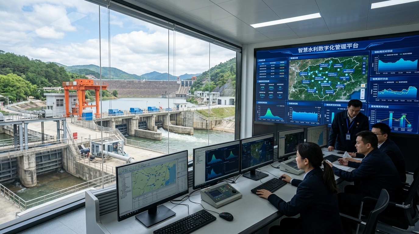
Market and Policy: Shifting from Point-Based Construction to Full-Element Sensing
The first main thread of the smart water management market is the shift from fragmented informatization projects to a full-element, whole-basin sensing network. In the past, data on water levels, rainfall, flow rates, video feeds, gates, and pump stations were often scattered across different systems, and construction entities were dispersed across departments such as water resources, housing and urban-rural development, emergency management, agriculture and rural affairs, and ecology and environment. With the continuous advancement of digital twin basins, digital twin water networks, and digital twin water projects, the industry now requires unified coordinate systems, unified time-series standards, and unified data interfaces to form a comprehensive sensing system covering the sky, ground, water bodies, and project entities.
"The 'Guiding Opinions on Vigorously Promoting the Construction of Smart Water Conservancy' proposes accelerating the construction of a digital twin business application system focusing on basin flood control, water resource management, and water project safety."
From the perspective of demand structure, flood control and drainage remain the primary driver, but the objects of monitoring are rapidly expanding. There are currently about 98,000 reservoirs nationwide, many of which are small reservoirs, mountain ponds, and mountain flood channels located in remote areas where traditional monitoring methods struggle to meet the high-frequency updating requirements during the flood season. Meanwhile, the treatment of small and medium-sized rivers, urban waterlogging prevention, modernization of irrigation districts, supervision of ecological flow in rivers and lakes, groundwater overdraft governance, and water abstraction metering are generating new incremental demand.
Technological Direction: Why 80G Radar Has Become the Key Route
At the sensing layer of smart water management, the choice of technological route depends on accuracy, reliability, installation conditions, and O&M costs. Traditional pressure-type water level gauges require contact with the water body and are susceptible to sediment deposition, aquatic weed entanglement, and flood impact; float-type water level gauges usually require the construction of a stilling well, imposing high demands on installation conditions; ultrasonic devices are prone to interference from temperature gradients, water vapor, and wind and waves; and low-frequency radar has certain limitations in long-range measurement, narrow beam width, and complex echo processing.
Traditional Sensors Challenges
- Contact Gauges: Susceptible to sediment, weeds, and flood damage.
- Float Gauges: Require complex stilling wells and precise installation.
- Ultrasonic: Prone to interference from temperature and humidity.
80G Radar Advantages
- Non-Contact: Immune to water quality and debris.
- High Precision: Millimeter-level resolution (±1-2mm).
- Robustness: IP68 rated, works in extreme weather.
Due to its higher frequency and shorter wavelength, the 80G radar device can achieve a beam width of approximately ±3 degrees or even smaller, which helps avoid interference from targets such as bridges, gates, slopes, and trees, focusing the beam on the water surface. The measuring range of mainstream 80G radar water level gauges in the industry typically covers several meters to hundreds of meters, with common ranges being 70, 80, or 120 meters; the distance resolution can reach the millimeter level. Under static or slow-flow conditions, some devices can achieve a measurement accuracy of ±1 mm to ±2 mm.
Application Scenarios: Implementation Paths from Flood Early Warning to Precision Dispatch
The value of smart water management must ultimately be realized in specific scenarios. The combination of 80G radar, non-contact measurement, and high-precision real-time monitoring is first reflected in the field of flood control and drainage. A mountainous county in southwest China has deployed 80G radar water level gauges, automatic rain gauges, and audio-visual warning devices across 150 key mountain flood channels. Project review shows that the average time from data triggering to warning issuance has been compressed to the minute level, significantly improving response efficiency compared to manual patrols and telephone reporting.
Urban waterlogging governance also relies on high-precision real-time monitoring. A prefecture-level city in central China has deployed non-contact radar water level gauges at 32 underpasses, 18 waterlogging-prone roads, and 6 pump station forebays. After switching to 80G radar, the system cross-validates water level change rates, rainfall intensity, and video recognition, reducing the false alarm rate for waterlogging by about 40%. During the local flood season, the advance warning time for key waterlogging points increased from about 15 minutes to 35 minutes.
The modernization of irrigation districts and the safe operation of water projects constitute another category of high-value scenarios. An irrigation district in the Yellow River basin has deployed 80G radar water level gauges, Doppler flow meters, gate control terminals, and video monitoring equipment along its main and branch canals, covering approximately 260 kilometers of channels. After project implementation, the water level fluctuation at key cross-sections of the main canal was controlled within ±2 cm, water dispatch error dropped from about 8% to below 5%, and the irrigation water utilization coefficient increased from 0.54 to 0.57.
Data Platforms and Industry Governance: Moving from Data Acquisition to Trusted Closed-Loops
Front-end sensing is merely the entry point for smart water management; the true watershed lies in whether data can be transformed into forecasting, early warning, and dispatch capabilities. With the large-scale deployment of devices like 80G radar, data volume is growing rapidly, and the industry's focus is shifting from "whether there is data" to "whether the data is trustworthy, fusible, and capable of driving models." Platforms need to possess capabilities for access, cleaning, quality control, storage, analysis, and visualization, and must be deeply coupled with professional water conservancy models.
Model computation is the key to smart water management's transition from "monitoring" to "forecasting." The goal of the digital twin platform is to input real-time monitoring data into models to generate scenario simulations for the next few hours to days. For example, when upstream rain gauges and radar water level gauges show a rapid rise in water levels, the system can calculate the time to exceed warning levels, the affected area, and the risk level at downstream control cross-sections. Machine learning can be used for short-term precipitation nowcasting, water level trend prediction, anomaly detection, and video recognition, but decisions involving public safety must still be based on mechanistic models and expert judgment.
Forward-Looking Outlook: From "Seeing Water Levels" to "Calculating Water Risks"
Over the next 3 to 5 years, the smart water management sensing system will exhibit three changes. First, device forms will evolve from single-point sensors to multi-source fusion. 80G radar will collaborate with Doppler flow measurement, video AI, rain gauges, GNSS displacement monitoring, InSAR, drones, and satellite remote sensing to form an integrated space-air-ground-water sensing network. Second, monitoring indicators will expand from basic elements like water level and rainfall to composite indicators such as flow velocity, flow rate, ice conditions, floating debris, canal siltation, gate status, and engineering deformation. Third, system capabilities will shift from post-event queries to real-time closed loops.
Conclusion
Looking at a longer cycle, the core goal of smart water management is not simply piling up equipment, but building a computable, simulatable, and governable water security system. Non-contact, high-precision, real-time monitoring technologies like 80G radar will serve as a crucial foundation for digital twin water conservancy; however, what truly determines the industry's height remains data quality, model capabilities, business understanding, and long-term operational mechanisms. As the construction of the national water network continues, smart water management will progress from "being able to see" to "being able to calculate clearly," providing more certain technical support for flood safety and water ecological protection.
Related Product: Visual Fusion Radar Water Level Gauge — Ecolor Visual Fusion Radar Water Level Gauge — non-contact water level monitoring for rivers, reservoirs and urban flood scenarios.

