Development Opportunities for Smart Water Conservancy in 2026 Under the Dual Carbon Goals
Smart water conservancy is moving from the stage of “installing devices” to the stage of “making data flow, usable, and manageable.” In the past, the industry focused mainly on single-point capabilities such as monitoring station construction, video upload, and platform visualization; currently, with the continued advancement of policies on digital twin river basins, refined water resources management, flood and drought disaster prevention, the river and lake chief system, and modernization of irrigation districts, data collection, remote transmission, edge computing, model analysis, and closed-loop business processes have become the new competitive focus.
The evolution of next-generation water data collection and remote transmission terminals such as the Hero V9 also reflects that industry demand is concentrating on low power consumption, multi-protocol support, strong adaptability, high reliability, and maintainability. For companies such as YiCai Technology that focus on digital infrastructure for water conservancy, what truly determines long-term value is not only hardware specifications, but whether they can form stable, trustworthy, tradeable, and reusable data capabilities in complex hydrological environments.
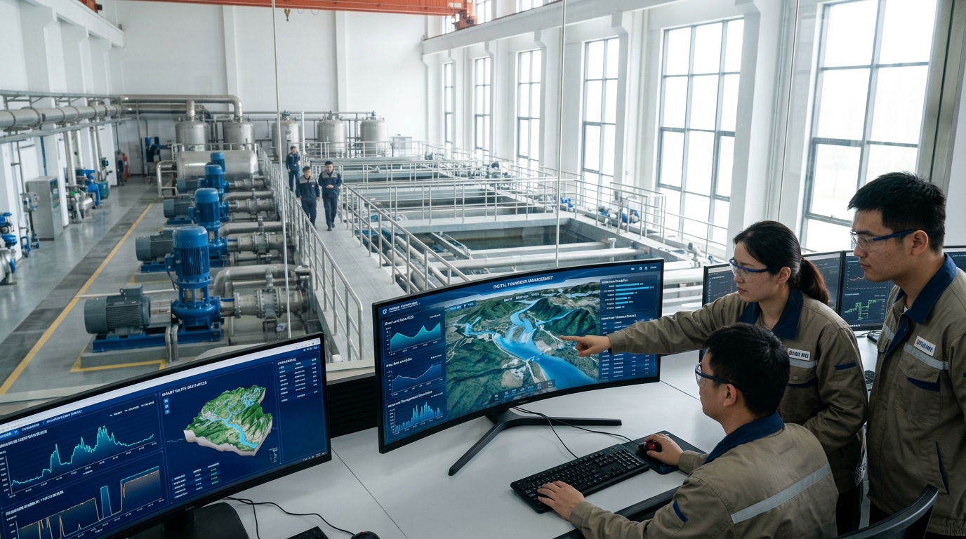
I. Market Trends: Smart Water Conservancy Moves from Pilot Demonstration to Systematic Construction
The expansion of the smart water conservancy market first comes from changes in water governance logic. Traditional water conservancy construction has focused on engineering safety, water quantity allocation, and flood control dispatching, with information systems often being supplementary configurations after project completion; however, under requirements such as digital twin water conservancy, rigid constraints on water resources, and modernization of flood and drought disaster prevention, data has become a basic factor of production for water conservancy operations. Industry observations show that over the past three years, water conservancy informatization projects have gradually shifted from “single-station construction and single-system construction” to systematic construction at “basin-level, regional-level, and project-cluster-level” scales. A project no longer procures only rain gauges, water level stations, or video surveillance, but also requires sensing networks, communication links, data governance, model platforms, warning dissemination, and operation and maintenance services to form an integrated solution.
From the perspective of investment structure, market hotspots are shifting from “visible platforms” to “invisible foundations.” Early smart water conservancy projects often delivered visualization dashboards, GIS maps, video dispatching, and data displays as the main content, with limited actual use after project acceptance. Currently, water conservancy authorities and project owners pay more attention to whether data can continuously feed into forecasting models, dispatching systems, inspection work orders, water fee settlement, and emergency command. In other words, the market is shifting from “presentation-oriented smart water conservancy” to “business-oriented smart water conservancy.” This places higher requirements on data collection and remote transmission: devices must not only upload data, but also ensure that data is complete, timely, accurate, and traceable, and operate stably in complex environments such as network outages, power failures, lightning strikes, high temperatures, humidity, and freezing.
Regional differences are also affecting market pace. Projects in eastern regions place greater emphasis on urban waterlogging, river and lake water environments, smart water utilities, water supply pipe networks, sponge cities, and digital twin river basins; central and western regions focus more on flash flood disasters, dam safety, irrigation water measurement, rural water supply, groundwater monitoring, and ecological flow regulation. Requirements for devices differ across regions. Eastern projects may prioritize 5G, video, edge computing, cloud platforms, and system integration; mountainous projects in western regions prioritize low power consumption, battery life, solar power, BeiDou short message, breakpoint resume, and maintenance-free capability. If terminals such as the Hero V9 are to compete in the national market, they cannot serve only a single scenario, but need to adapt to diverse deployment environments from urban rivers to remote reservoirs, and from plain irrigation districts to small mountainous watersheds.
Business models are also changing. Device sales remain the foundation, but the space for pure hardware competition is narrowing. More valuable models in the future will combine “terminal + communication + platform + operation and maintenance + data services.” Water conservancy projects have long cycles, dispersed stations, and complex environments; owners often care more about stable operation over three to five years than first-year procurement prices. Therefore, the industry is shifting from one-time construction to long-term operational services. Devices capable of remote configuration, batch upgrades, fault diagnosis, energy consumption management, data quality monitoring, and work order linkage for maintenance are more likely to gain project owners’ acceptance. Market trends indicate that whoever can turn data collection into continuous services will secure a more stable position in the next round of smart water conservancy construction.
II. Policy Impact: Digital Twins, Safety Baselines, and Water Resource Constraints Reshape Demand
Policy is the most direct driver of the smart water conservancy market. In recent years, the Ministry of Water Resources has continuously issued plans and guiding opinions on areas such as digital twin river basins, digital twin projects, smart water conservancy construction, flood forecasting and warning, water resources management, the river and lake chief system, rural water supply security, and modernization of irrigation districts. Public policy directions indicate that over the next decade, smart water conservancy will focus on enhancing capabilities for “forecasting, warning, simulation, and contingency plans,” with emphasis on solving problems such as untimely data acquisition, imprecise model computation, poor business coordination, and non-closed-loop dispatching decisions. Policies are no longer satisfied with merely “having data”; they require “usable data, computable models, manageable business processes, and traceable accountability.”
"Policies are promoting automation of hydrological monitoring, denser station networks, real-time transmission, and model-based forecasting."
Flood and drought disaster prevention policies impose hard requirements on collection and transmission. Flood forecasting requires real-time aggregation of multi-source data such as rainfall, water level, flow, reservoir storage, gate opening, river channel cross-sections, and video images. Warning dissemination requires minute-level or even second-level response. Traditional manual observation or low-frequency collection can no longer meet modern defense requirements. In scenarios such as flash floods, floods on small and medium rivers, urban waterlogging, reservoir spillways, underpasses, and mountain ponds and weirs, once the data link is delayed, it may directly affect personnel evacuation and emergency response. Therefore, remote transmission capability is not just a technical indicator, but part of safety capability.
Rigid water resource constraints are also changing industry demand. Requirements such as total water use control, water use efficiency management, water abstraction permits, online metering, ecological flow regulation, treatment of groundwater over-extraction, agricultural water conservation, and water rights trading have turned water conservancy data from “management support” into “regulatory basis.” If water abstraction metering data is missing, tampered with, or delayed, it may affect water resource audits, water use assessments, water fee collection, and water rights trading. Policies place higher requirements on data authenticity, continuity, tamper-proofing, and traceability. Data collection terminals must not only collect data, but also have local validation, anomaly marking, time synchronization, communication encryption, breakpoint resume, and audit log capabilities. The value of terminals such as the Hero V9 in the industry lies precisely in whether they can stably convert field data into trustworthy regulatory data.
The river and lake chief system, happy rivers and lakes, water ecological restoration, and beautiful river and lake construction are expanding water conservancy data from “water quantity” to “water quality, water ecology, and water space.” In the past, water conservancy monitoring mainly focused on water level, flow, and rainfall; now it also needs to monitor dissolved oxygen, turbidity, electrical conductivity, pH, ammonia nitrogen, total phosphorus, total nitrogen, chlorophyll, blue-green algae, ecological flow, shoreline changes, and discharge outlet status. Multi-parameter monitoring means that data collection devices need to be compatible with more sensor types and handle different sampling cycles, data formats, and accuracy requirements. The change brought by policies is that water conservancy data is no longer merely engineering operation data, but foundational data for ecological governance, spatial control, public services, and performance evaluation.
III. Technology Directions: Four-Layer Coordination of Sensing, Transmission, Computing, and Modeling Becomes Mainstream
The technological evolution of smart water conservancy is forming a clear four-layer structure: the sensing layer is responsible for acquiring data, the transmission layer for delivering data, the computing layer for cleaning and preprocessing data, and the model layer for analysis, prediction, and dispatching. Many past project problems were not due to single-point technologies, but due to disconnection among the four layers. Insufficient sensor accuracy leads to data distortion; unstable communication links lead to data loss; insufficient edge computing capacity increases cloud pressure; model algorithms lacking high-quality data lead to inaccurate predictions. Future technology directions are not isolated upgrades of one layer, but forming a closed loop across the four layers.
Sensing Layer: Multi-Source Fusion
A single water level gauge, rain gauge, or flow meter can no longer meet complex scenario needs. The industry is promoting fusion sensing of “hydrology + video + remote sensing + drones + IoT + mobile inspection.” For example, water level monitoring can be combined with video recognition, using images to help judge floating debris, gate status, ice on water surface, or device obstruction.
Transmission Layer: Low Power & Wide Coverage
Water conservancy stations are often distributed along rivers, reservoirs, irrigation districts, mountainous areas, wetlands, and low-lying urban points. Remote transmission technology cannot only look at bandwidth, but also latency, packet loss rate, power consumption, anti-interference, network switching, and offline recovery capability.
Computing Layer: Edge Intelligence
Terminal devices need to perform local data filtering, threshold judgment, anomaly alarm, short-term caching, protocol conversion, and lightweight model inference. The value of edge computing is not to replace the cloud, but to solve “field problems” near the field, reducing overall system latency and operation and maintenance costs.
Model Layer: Digital Twin Integration
Digital twin water conservancy is not simple 3D modeling, but mapping physical river basins, water conservancy projects, monitoring data, dispatching rules, and model algorithms into digital space. High-quality data collection is a prerequisite for digital twin operation.
Future models will serve more in flood routing, dam breach analysis, dispatching scheme comparison, irrigation water allocation, urban waterlogging simulation, ecological flow assessment, and emergency resource optimization. Technology directions will shift from “platform visualization” to “computable models, simulable schemes, and reviewable decisions.”
IV. Data Collection: The Hero V9 Reflects the Evolution of Water Conservancy Terminals Toward Edge Enablement and Multi-Source Fusion
In the smart water conservancy chain, data collection is the link closest to the physical world and the most easily overlooked. Many project failures are not due to insufficient cloud platform functions, but due to unavailable front-end data: water level gauges are blocked by floating debris, rain gauges are covered by leaves, flow meters are installed in positions that do not meet flow measurement conditions, sensors drift over time, batteries are depleted, terminal clocks are not synchronized, and data is repeatedly uploaded or lost. Next-generation water data collection and remote transmission terminals such as the Hero V9 have attracted industry attention precisely because they represent a device philosophy closer to field needs: upgrading from a simple “collector” to an “edge data node.”
- Interface Capability: Modern terminals need to be compatible with multiple sensors including RS-485, SDI-12, 4-20 mA, pulse output, dry contact, Ethernet, and USB debug ports. They connect radar water level gauges, electromagnetic flow meters, multi-parameter water quality probes, piezometers, and video surveillance.
- Accuracy and Stability: Terminals need to have capabilities for data validation, anomaly removal, timestamp alignment, range limitation, filtering algorithms, and drift marking. For example, when water level suddenly jumps during a rainstorm, the terminal should judge whether it is a real rise by combining rainfall, trend, and historical data.
- Power Supply and Protection: Field devices need to withstand high and low temperatures, humidity, salt spray, lightning strikes, insect and rodent damage, flood immersion, and human destruction. Common requirements include IP66 or higher protection ratings, wide-temperature operation, and solar power adaptation.
- Operation and Maintenance: Once the number of devices reaches thousands, maintenance costs rise rapidly. Project owners need to remotely view device online status, battery voltage, signal strength, and firmware versions. Terminals supporting remote configuration and batch upgrades significantly reduce on-site maintenance frequency.
The market competitiveness of terminals such as the Hero V9 ultimately depends on whether they can help water conservancy projects build a stable, low-cost, traceable data collection foundation.
V. Remote Transmission: Low-Power Wide-Area Networks and BeiDou Short Messages Fill Gaps in Complex Scenarios
Remote transmission is the bridge through which smart water conservancy data moves from the field into business systems. Water conservancy stations are widely distributed, environments are complex, and communication conditions vary greatly, making it difficult for a single communication method to cover all scenarios. The industry needs to establish a multi-channel communication architecture: 4G, 5G, and NB-IoT as the primary channels, LoRa, self-organizing networks, BeiDou short messages, and satellite communications as supplements, and edge caching and breakpoint resume as fallback.
Suitable for scenarios with high requirements for bandwidth and real-time performance, such as video surveillance, image recognition for flood routing, and dispatching consultations. However, coverage and cost remain limiting factors for small and medium water conservancy stations.
Ideal for low-frequency, small-data-volume, low-power monitoring scenarios like water level and soil moisture. Its advantages are low power consumption and wide coverage, but it is often combined with other channels for critical flood warnings requiring minute-level response.
Irreplaceable in complex terrain like flash flood-prone mountainous areas where public networks fail. BeiDou short messages transmit critical small packets (water level, alarms) as a backup channel in extreme situations.
Protocol security is equally important. Water conservancy data involves flood control safety and public regulation, so the transmission process must prevent tampering, replay, forgery, and eavesdropping. Only when data is verifiable, traceable, and recoverable can it enter models, regulation, and dispatching systems.
VI. Scenario Cases: From Flood Warning to Irrigation Water Measurement, Data Links Determine Business Closed Loops
Flash Flood Disaster Defense
Mountainous small watersheds deploy rainfall and water level stations with solar-powered, low-power terminals equipped with 4G and BeiDou backup. When thresholds are exceeded, the system triggers local alarms and pushes alerts to county/city platforms. Post-deployment, warning response time shortened from hours to minutes, and data transmission success rates remained above 99%.
Reservoir Safety Monitoring
Small reservoirs install piezometers, displacement gauges, and video surveillance linked to collection terminals. Local judgment of abnormal trends triggers immediate alarms. Automated monitoring reduced manual inspection frequency by 30-40% and increased data completeness to over 98%, shifting hazard warning from “post-event discovery” to “trend warning.”
Irrigation District Modernization
Emphasizes water volume metering and distribution efficiency. Electromagnetic flow meters and radar water level gauges upload data at 5-minute cycles, linking with water fee settlement and assessments. This closed loop improved irrigation water utilization coefficients and reduced farmer water use disputes.
Urban Waterlogging Governance
Links underpass liquid levels, rainfall, and pump stations. When tunnel levels exceed warning values, the system automatically pushes alarms, closes entrances, and starts pumps. Response times shortened to tens of seconds, demonstrating water conservancy data entering urban safety governance systems.
VII. Future Outlook: Trustworthy Data, Resilient Dispatching, and Water Conservancy Digital Assets Will Become the Next Competitive Focus
Over the next three to five years, competition in smart water conservancy will shift from “device specifications” to “data credibility.” Project owners will pay more attention to whether data is authentic, continuous, traceable, auditable, and able to enter models and regulation. Trustworthy data will become the foundation for water conservancy digital twins, water resource regulation, flood forecasting, and emergency dispatching.
Resilient water conservancy will also become an important direction. Climate change increases the frequency of extreme events. Future systems need redundancy in monitoring, communication, computing, and dispatching. Collection terminals need to be able to recover quickly after power failure, network outage, lightning strikes, and flood immersion. The long-term value of smart water conservancy is not only efficiency improvement, but also raising the safety baseline under extreme conditions.
The trend of water conservancy data assetization is emerging. With increasing requirements for water rights trading and carbon-water coordinated management, water conservancy data may transform from management records into tradeable, calculable, and auditable assets. High-quality data links will become a prerequisite for assetization. In the future, collection terminals and remote transmission devices are not merely IoT hardware, but production entry points for water conservancy data assets.
Standardization and ecosystem collaboration will determine the industry ceiling. For terminal products such as the Hero V9, the ability to deeply integrate with mainstream platforms, water conservancy industry protocols, digital twins, and third-party sensors will be more important than single hardware performance. Open interfaces, standardized data models, and pluggable application ecosystems will be key to the long-term lifecycle of devices. Whoever can turn field data into business decisions will take a more proactive position in the next cycle of smart water conservancy.

