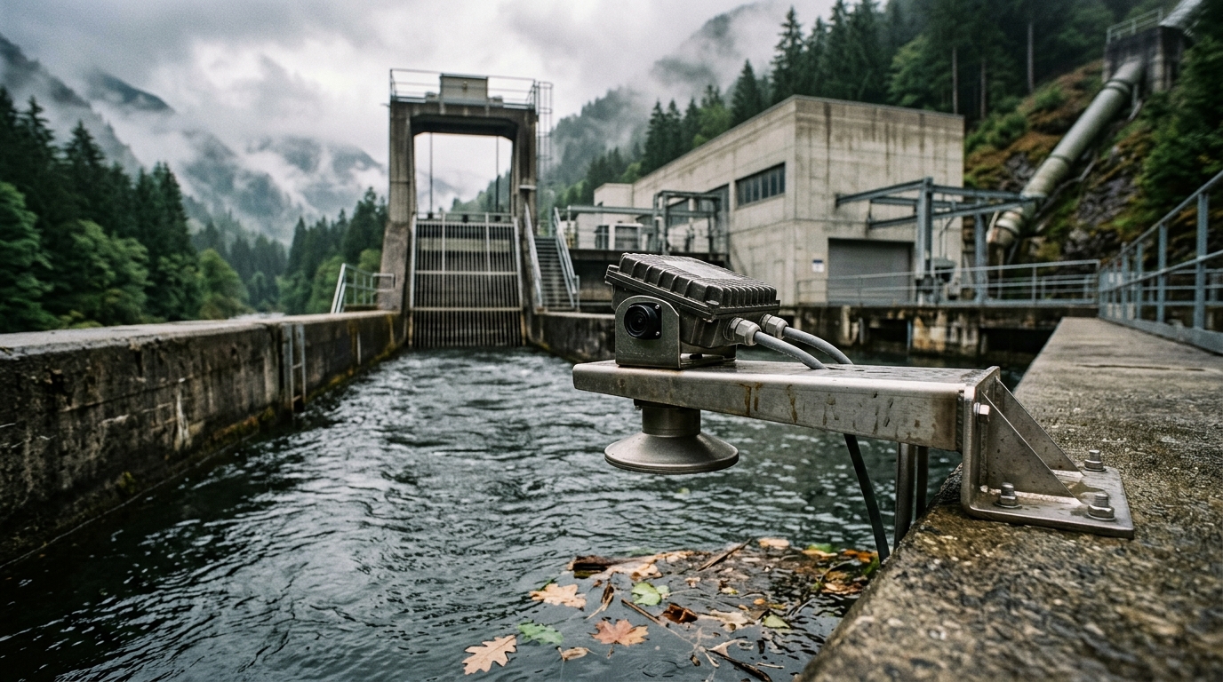
Visual Fusion Radar Water Level Gauge for Non-Contact Level Measurement in Hydropower Forebays and Tailraces
Addressing the pain points of hydropower forebay and tailrace level measurement - contact-type instruments damaged by floating debris, frequent electronics failures in condensation-heavy humid environments, conventional radar offering waveform data only with no way to verify actual surface conditions, and poor power and communication infrastructure at remote mountain sites - this solution is built around the visual fusion radar water level gauge: non-contact 76-81 GHz FMCW millimeter-wave radar with ±1 mm accuracy and a 0.1-40 m range, innovatively integrated with a 5-megapixel HD camera for scheduled and on-demand photography of the water surface. The dual 'radar sees data, vision sees the site' channels cross-verify each other and automatically reveal debris accumulation, icing and overtopping; IP68 protection and an ultra-low-power design deliver over 2 years of battery life with solar power for remote sites, while RS485 telemetry feeds RTUs and monitoring platforms for continuous forebay-to-tailrace level monitoring that supports unit output optimization, flood dispatch and ecological flow supervision.
Overview
Summary
Addressing the pain points of hydropower forebay and tailrace level measurement - contact-type instruments damaged by floating debris, frequent electronics failures in condensation-heavy humid environments, conventional radar offering waveform data only with no way to verify actual surface conditions, and poor power and communication infrastructure at remote mountain sites - this solution is built around the visual fusion radar water level gauge: non-contact 76-81 GHz FMCW millimeter-wave radar with ±1 mm accuracy and a 0.1-40 m range, innovatively integrated with a 5-megapixel HD camera for scheduled and on-demand photography of the water surface. The dual 'radar sees data, vision sees the site' channels cross-verify each other and automatically reveal debris accumulation, icing and overtopping; IP68 protection and an ultra-low-power design deliver over 2 years of battery life with solar power for remote sites, while RS485 telemetry feeds RTUs and monitoring platforms for continuous forebay-to-tailrace level monitoring that supports unit output optimization, flood dispatch and ecological flow supervision.
Key Advantages
Challenges
- Floating debris strikes and entangles instruments: branches, ice floes and trash are common on forebay and tailrace surfaces; submersible and float-type contact probes are easily damaged, entangled or jammed, distorting data and demanding frequent maintenance
- Humidity and condensation attack electronics: tunnel outlets, forebays and powerhouse tailrace areas are humidity-saturated year-round with condensation and spray, corroding circuit boards and connectors of ordinary instruments and driving high failure rates
- Data jumps with no way to verify real conditions: flood season brings surging levels, and radar echoes disturbed by waves and debris cause reading jumps - with waveforms but no imagery, operators cannot distinguish instrument faults, debris interference or genuine level changes
- Remote sites lack power and communication: most hydropower stations sit in mountains, with forebay and tailrace points far from the powerhouse; grid power and wired communication are unavailable, and traditional solutions require long power cables with high construction and O&M cost
- No level-output data linkage: correlation analysis among forebay level, tailrace level, unit discharge and output lacks continuous reliable measurements, while flood dispatch and ecological flow supervision rely on manual reporting with poor timeliness and accuracy
Results
- Non-contact measurement immune to debris: 76-81 GHz FMCW millimeter-wave radar measures from above the point without touching water - branches, ice and trash cannot damage the instrument, keeping measurement continuous and reliable
- Vision + radar dual-channel cross-verification: the 5-megapixel HD camera captures scheduled and on-demand water-surface photos, so any abnormal reading is checked against imagery from the same moment to identify debris accumulation, icing, wave disturbance or genuine level change - dramatically faster O&M judgment
- IP68 protection + corrosion-resistant enclosure for humid duty: the fully sealed IP68 device with a corrosion-, acid/alkali- and impact-resistant enclosure runs long-term in condensation and spray environments, virtually eliminating moisture-related failures
- Ultra-low power with over 2 years of battery life: low-power operation plus the 96 Ah expandable battery and solar supply enables long-term unattended operation at remote mountain sites without grid power, sharply cutting construction and O&M cost
- Telemetry supports refined dispatch: RS485 feeds hydrological RTUs, streaming forebay and tailrace levels to the monitoring platform for head-output correlation analysis, flood dispatch, ecological flow supervision and automatic overtopping alarms
Solution Details
Visual Fusion Radar Water Level Gauge: Non-Contact Level Measurement for Hydropower Forebays and Tailraces
The forebay (headrace surge basin) and tailrace channel are critical nodes of the hydraulic works at diversion-type and dam-toe hydropower stations: forebay level directly governs penstock intake conditions and unit discharge, while tailrace level affects unit output and downstream river safety. Yet level measurement at these two points has long faced multiple challenges. Floating debris - branches, ice floes, trash - is common on forebay and tailrace surfaces, so contact instruments such as submersible and float-type gauges are easily struck, damaged or entangled and jammed. Tunnel outlets and powerhouse tailrace areas stay humidity-saturated year-round with condensation and spray, causing frequent moisture failures of electronics. During flood season, levels surge and plunge amid heavy debris; when radar readings jump, O&M staff cannot tell whether it is instrument fault or real conditions. Most stations sit in remote mountains where grid power and wired communication are unavailable, keeping traditional solutions expensive to build and maintain.
How the Visual Fusion Radar Water Level Gauge Solves Forebay and Tailrace Measurement
This solution deploys the visual fusion radar water level gauge to solve forebay and tailrace level measurement. The device mounts on a bracket or wellhead above the measuring point and emits 76-81 GHz FMCW millimeter waves toward the water surface for non-contact measurement with ±1 mm accuracy, a 0.1-40 m range and a blind zone as low as 10 cm; the 14-degree horizontal / 10-degree vertical (-3 dB) beam effectively avoids reflections from channel walls and structures, while the 4 GHz operating bandwidth delivers higher resolution through a compact fiberglass antenna and integrated lens design.
Breakthrough: the gauge integrates a 5-megapixel HD camera that captures water-surface photos on schedule or on demand and uploads them - conventional radar shows waveforms only, while visual fusion radar shows the actual site. When level data jumps abnormally, operators pull up the photo from the same moment to intuitively determine whether debris accumulation, surface icing, wave disturbance or a genuine level change is behind it. Data and imagery cross-verify through dual channels, fundamentally solving the industry pain point of 'data only, never the site'.
The device is rated IP68 with a corrosion-, acid/alkali- and impact-resistant enclosure for sewage and humid duty, and alarms automatically when water reaches the device. Ultra-low-power operation exceeds 2 years of battery life; the 96 Ah expandable battery with solar panels enables long-term unattended operation at remote sites. RS485 communication feeds hydrological RTU telemetry terminals, with level and image data uploaded to the monitoring platform - supporting forebay-tailrace head and unit output correlation analysis, flood dispatch and ecological flow supervision as a trustworthy data foundation for refined hydropower station operation.
Key Technical Specifications of the Radar Water Level Gauge
Product Features of the Visual Fusion Radar Level Gauge
- Visual fusion dual channel: conventional radar shows waveforms only; this device integrates a 5-megapixel HD camera that shows the actual site, with scheduled and real-time well/point photography - level data and site imagery cross-verify, solving the industry pain point of 'data only, never the site'
- High-accuracy millimeter-wave radar: 76-81 GHz FMCW with ±1 mm accuracy, 0.1-40 m range and a blind zone as low as 10 cm; the 4 GHz operating bandwidth delivers higher resolution while the millimeter-wave RF chip provides a compact RF architecture with high SNR
- Interference-resistant beam design: (-3 dB) beam angle of 14 degrees horizontal / 10 degrees vertical minimizes interference from channel walls and structures for easy installation; fiberglass antenna and integrated lens design keep the unit compact and weatherproof
- Fully sealed high protection: IP68 rating with a corrosion-, acid/alkali- and impact-resistant enclosure suits humid, condensation, spray and sewage environments, and the device alarms automatically when water reaches it
- Ultra-low power, long life: low-power operation with battery life over 2 years; the 96 Ah (expandable) battery supports 9-28 VDC wide-range supply at -10 to 55 degC, fitting solar-powered remote unmanned sites
- No well entry + standard telemetry: bracket/thread mounting requires no well entry, greatly improving personnel and equipment safety and easing maintenance; one RS485 channel transmits level and water-quality data directly to RTUs and monitoring platforms
Application Scenarios for Hydropower Forebay and Tailrace Monitoring
The visual fusion radar water level gauge is engineered for the demanding conditions of diversion-type and dam-toe hydropower stations, where floating debris, year-round humidity, condensation and spray, flood-season surges and remote off-grid locations challenge conventional contact instruments. By combining non-contact 76-81 GHz FMCW millimeter-wave measurement with a 5-megapixel HD camera, the device delivers cross-verified level data and site imagery for forebay intake control, tailrace output and downstream safety monitoring, flood dispatch and ecological flow supervision - providing a trustworthy data foundation for refined hydropower station operation.
? 参考来源
- Original product description and feature list provided by the manufacturer
Approach
How we implement intelligence into your infrastructure step by step.
Site survey and installation design
Survey level fluctuation range, debris conditions, installation options (wellhead/bracket/cantilever) and power/communication resources at the forebay and tailrace; position the radar beam clear of wall and structure reflections, verify range coverage of the maximum flood level with overtopping-alarm margin, and document everything in a one-station-one-file ledger.
Device configuration and imaging strategy
Configure blind zone, filtering parameters and sampling rate; set the photography strategy - timed snapshots (e.g. hourly) plus event-triggered snapshots (on level jumps or threshold alarms) so every abnormal reading has imagery from the same moment for verification.
RTU networking and platform access
Connect the gauge to hydrological RTU telemetry terminals via RS485 Modbus and configure 4G/BeiDou transmission channels; upload level, image and alarm data to the monitoring platform and link them with unit output and discharge data on a forebay-to-tailrace monitoring view.
Data verification and dispatch application setup
During commissioning, verify radar readings against manual staff gauges or existing level stations; configure forebay-tailrace head vs unit output curves, flood-limit-level exceedance alarms, ecological flow supervision and overtopping alarm linkage on the platform to support flood dispatch and generation optimization.
O&M management and image review routine
Establish quarterly inspections to clean the lens and antenna cover, check bracket fastening and battery charge; use visual photos to remotely review site conditions and reduce site visits; historical level and image data accumulate as the station operation archive, underpinning flood-season dispatch and hydraulic structure safety assessment.
Recommended Hardware
Essential components for this solution.
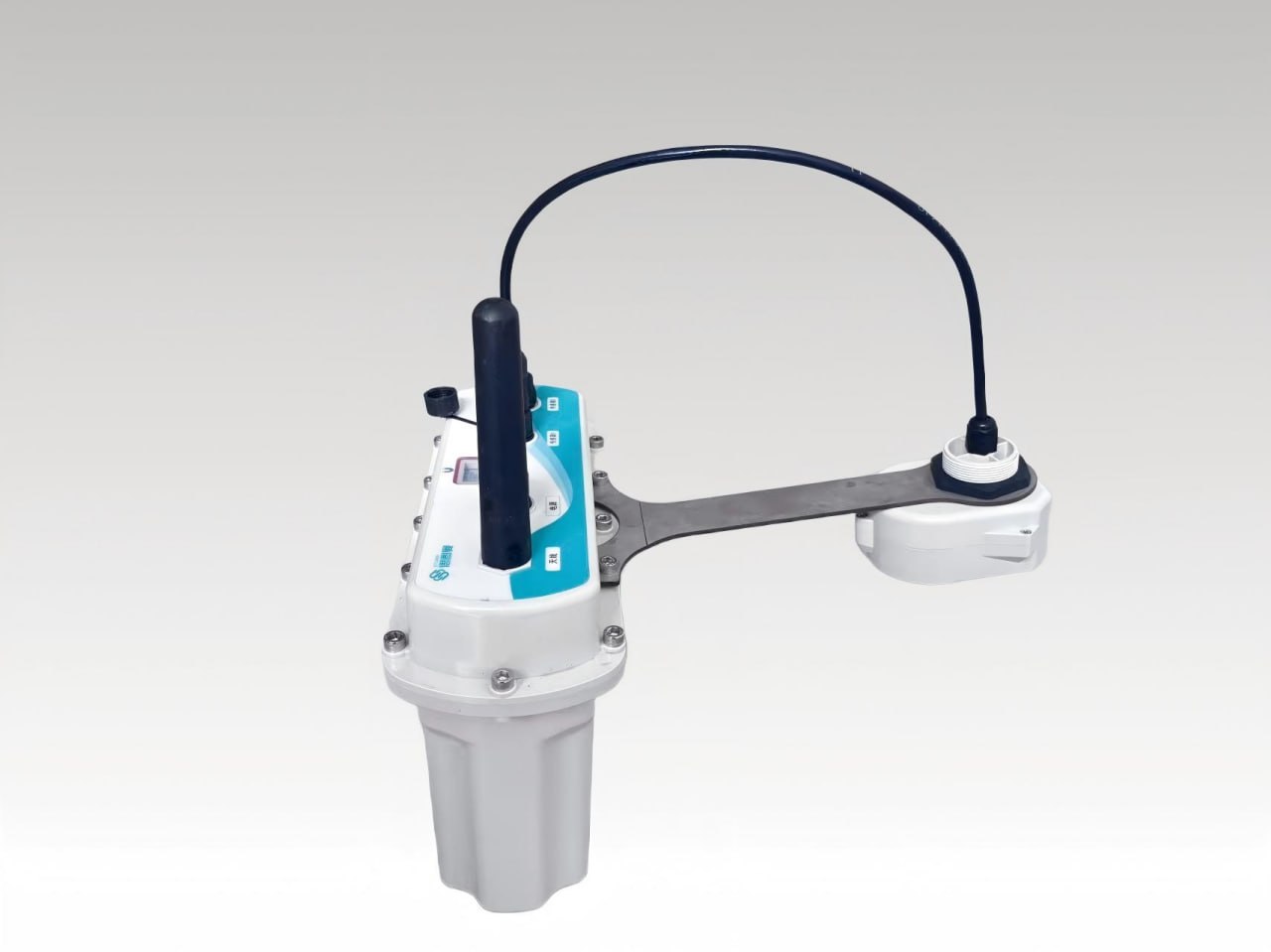
Visual Fusion Radar Water Level Gauge
The Visual Fusion Radar Water Level Gauge series is independently innovated and developed by Ecolor....
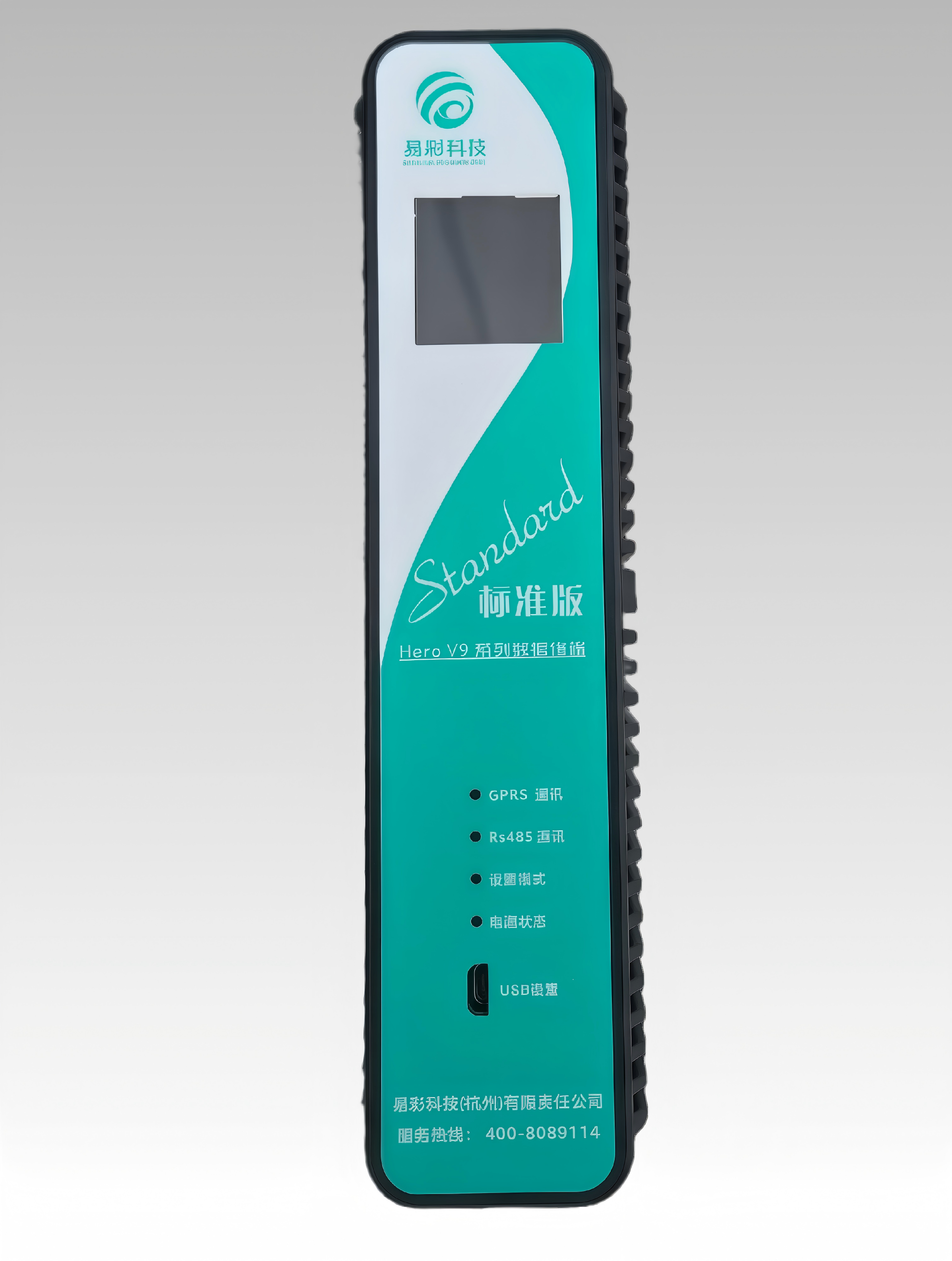
HERO V9-EC32 Hydrology RTU | Remote Terminal Unit
This product has the functions of remote data collection, control and communication. It can receive ...
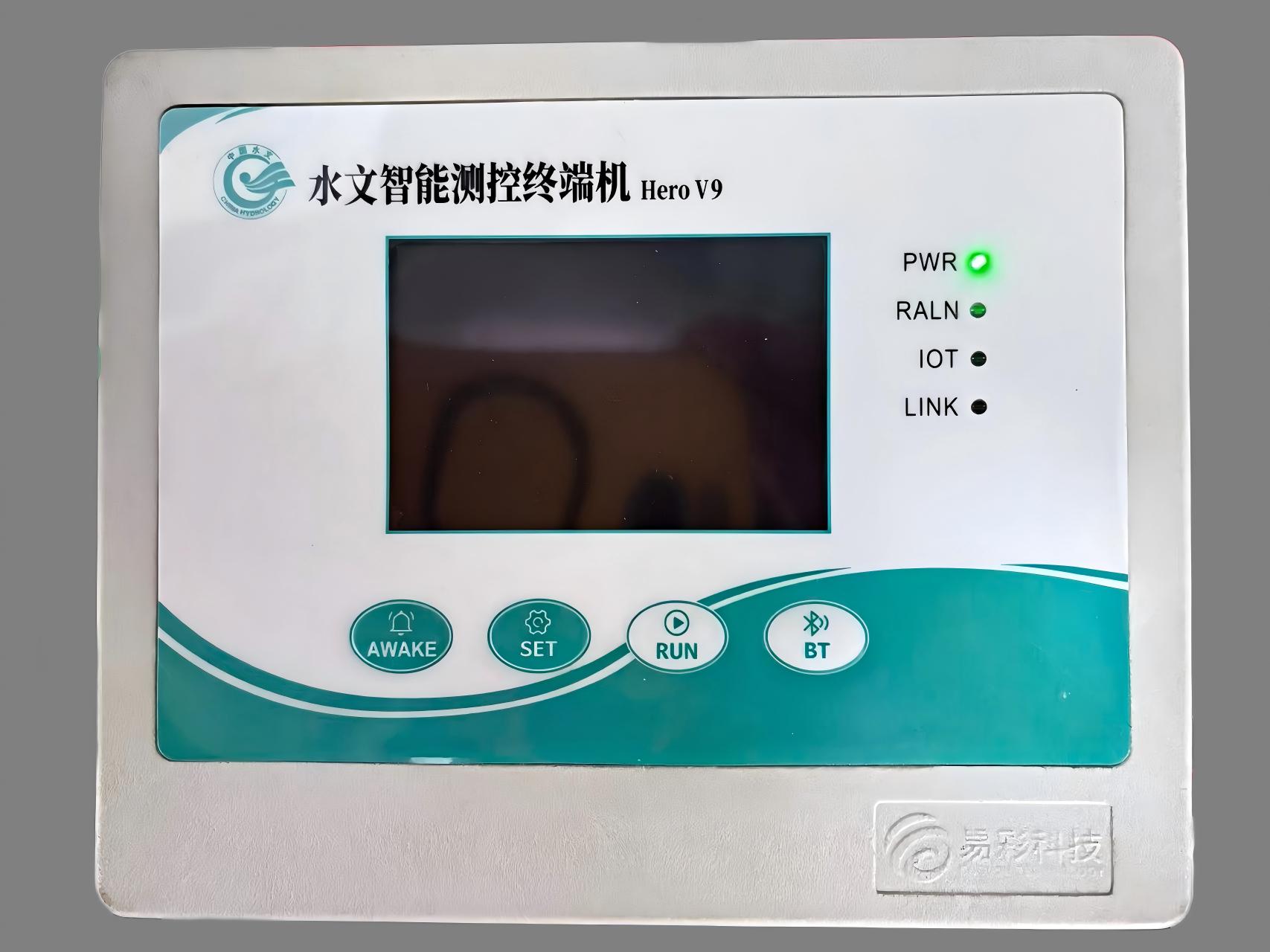
Hydrological Intelligent Monitoring and Control Terminal (Hero V9 Series - EC32)
The Hydrological Intelligent Monitoring and Control Terminal (Hero V9 Series - EC32), independently ...
❓ Related FAQs
Related Solutions
Radar Level Meter Solution for Level Safety Monitoring of Elevated Water Tanks and Pressure Vessels
Ultrasonic Level Meter Solution for Non-Contact Level Monitoring of Clean-Water and Balancing Basins in Water Treatment Plants
Submersible Level Transmitter Solution for Deep-Well Groundwater Dynamic Monitoring

Ready to Optimize Your Business?
Contact us, and our professional team will provide customized solutions to help your business achieve digital transformation.
Get In Touch